

The Life and Times of an Iron Age Wetland Settlement
![Artist reconstruction of the Episode 1 settlement]()

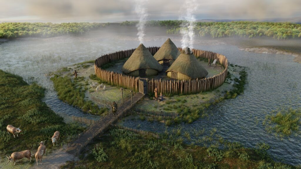
Buried within the peat of Black Loch of Myrton on the Machars peninsula, Galloway, archaeologists…
In Situ12 May 2026