


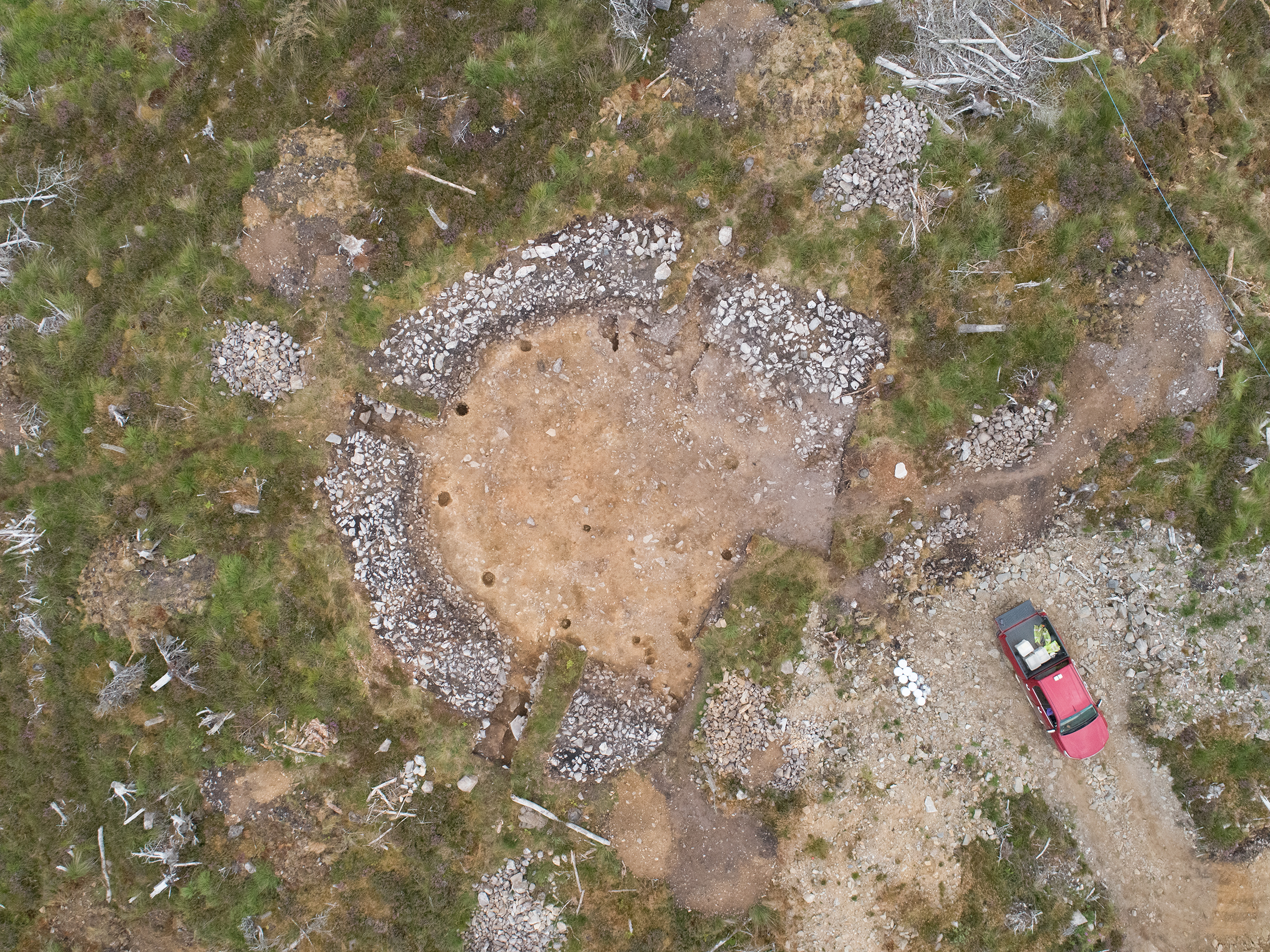
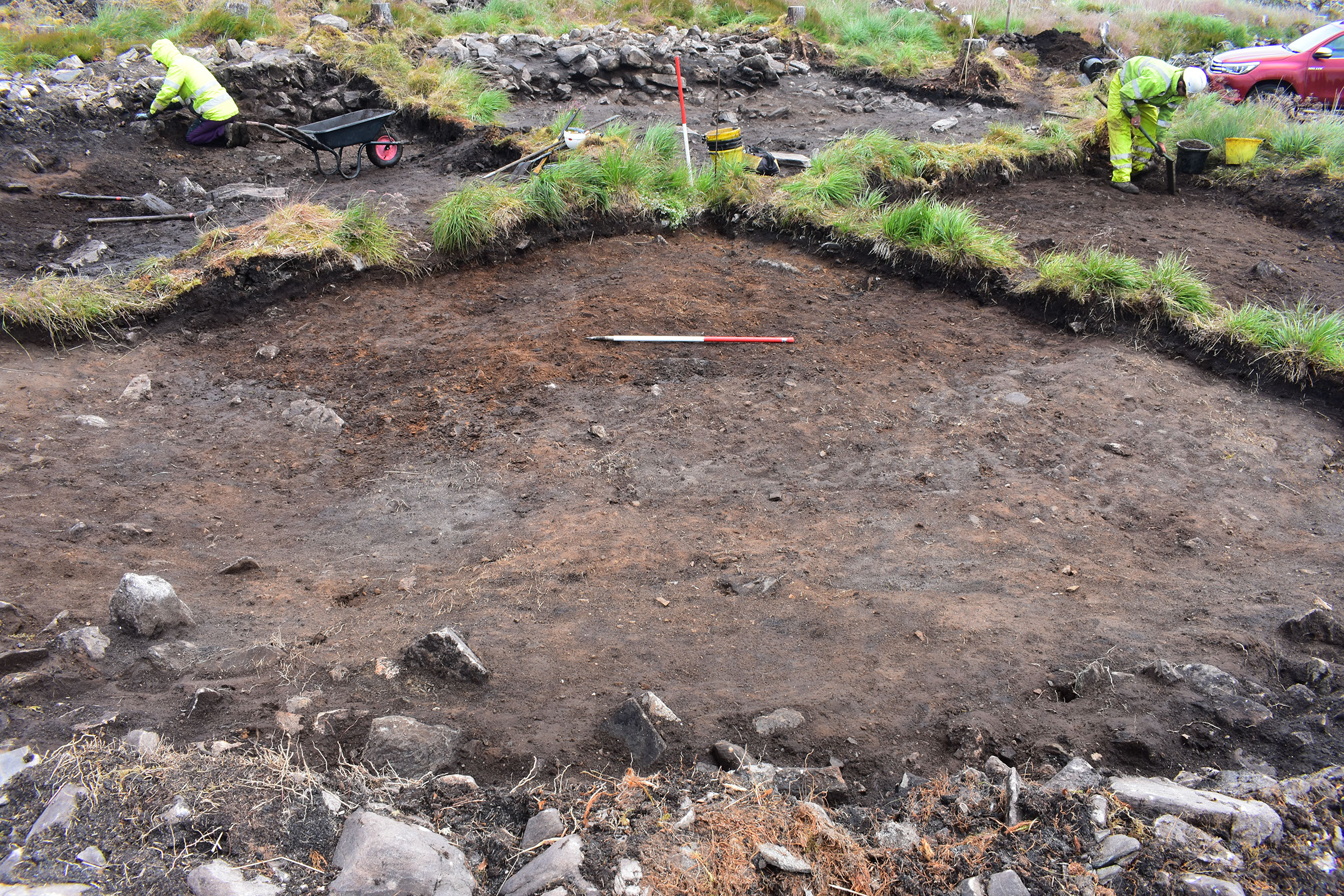
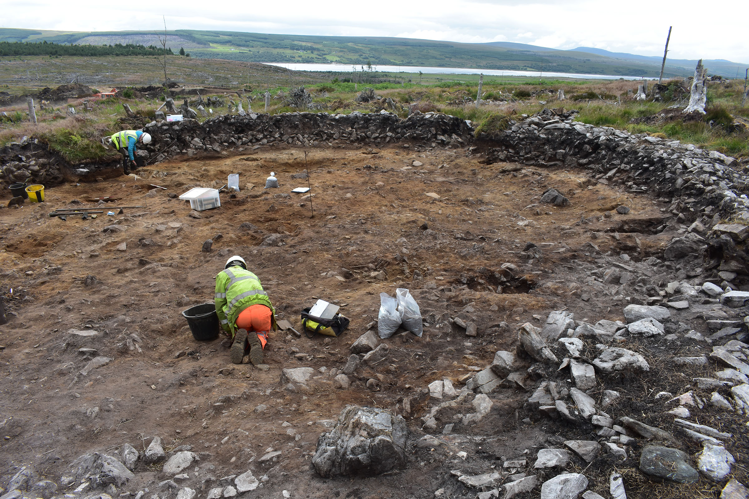
On the slopes of Dalchork Forest, near Lairg in the Scottish Highlands, a group of four roundhouses sat within an upland landscape which would have been part of a much wider area of prehistoric settlement.
In the summer of 2020, these four structures were fully excavated ahead of construction for a new electricity substation.
The excavation, undertaken by AOC on behalf of SSEN-Transmission, provided a rare opportunity to study a small prehistoric settlement in its entirety, shedding light on construction styles as well as the lives of the people who lived there.
The Settlement
The settlement contained four roundhouses, each with different characteristics, and a group of nearby stone clearance cairns, suggesting that the houses would have sat within an agricultural field system. Several other small groups of hut circles are known in the surrounding area so this settlement would not have been isolated but part of a wider community. Post-excavation analysis is still ongoing, but preliminary results indicate this was a Bronze Age or Iron Age settlement with several phases of occupation.
image: ©Tracks Ecology
image: ©Tracks Ecology
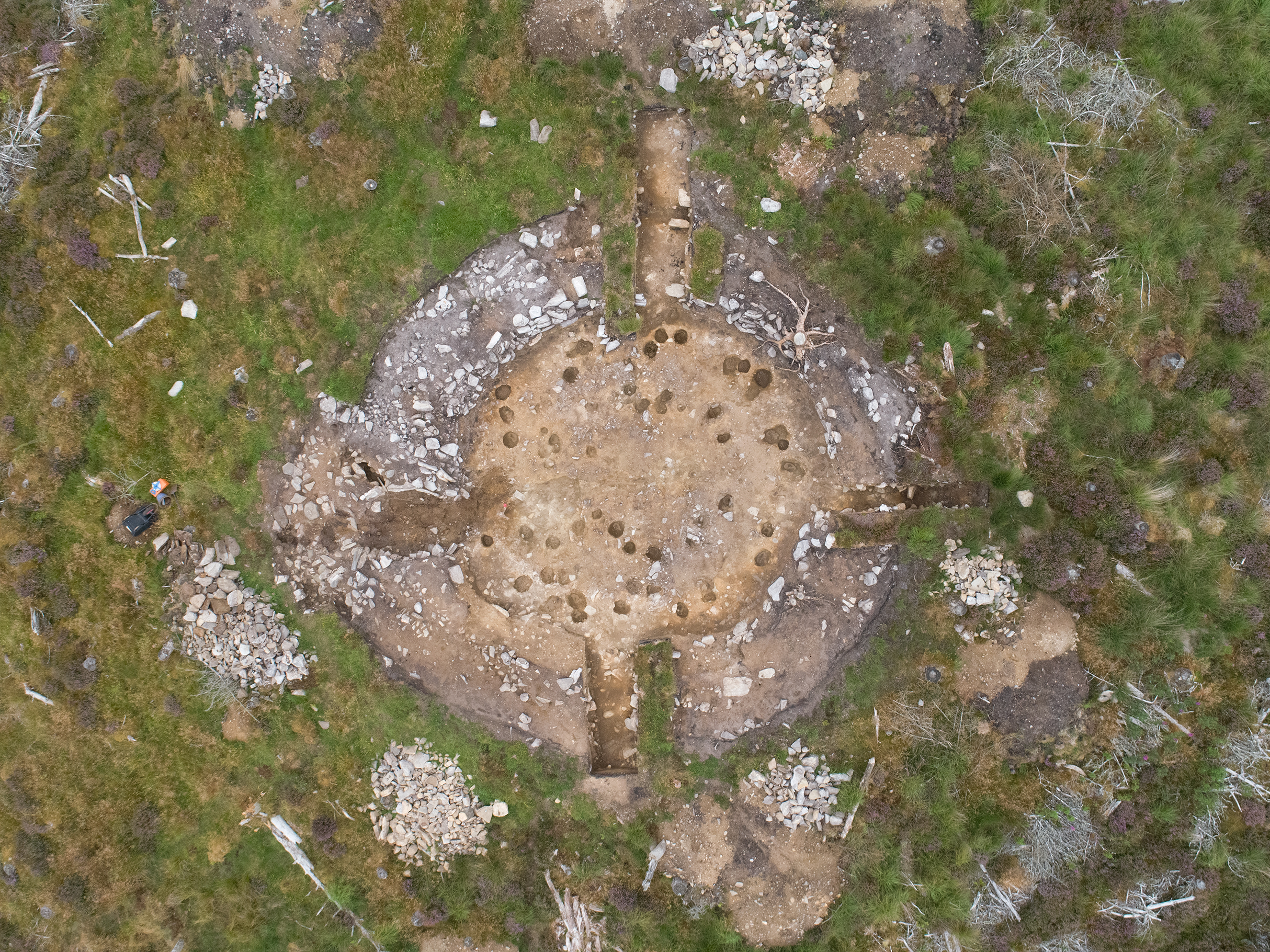
Roundhouse 1
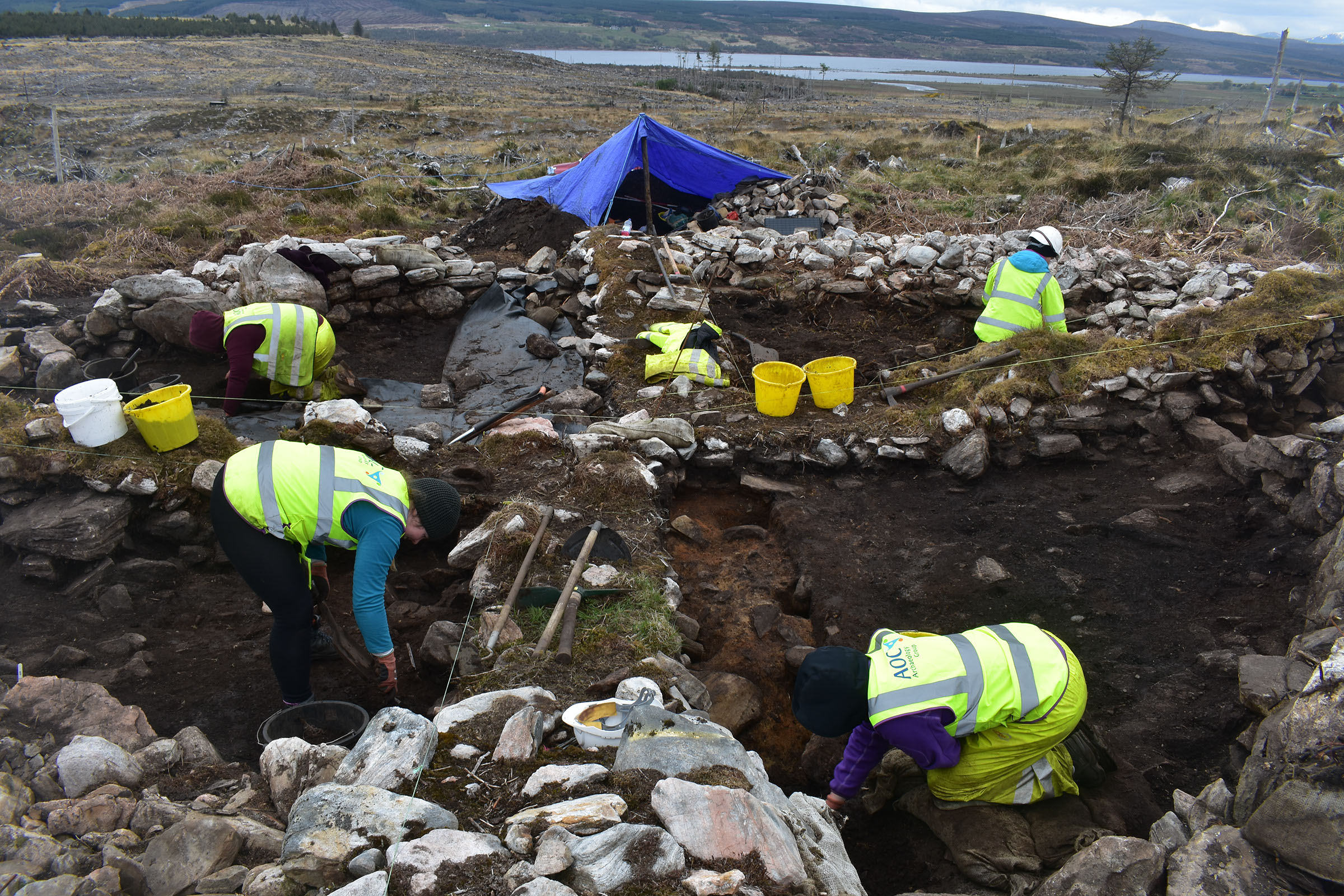
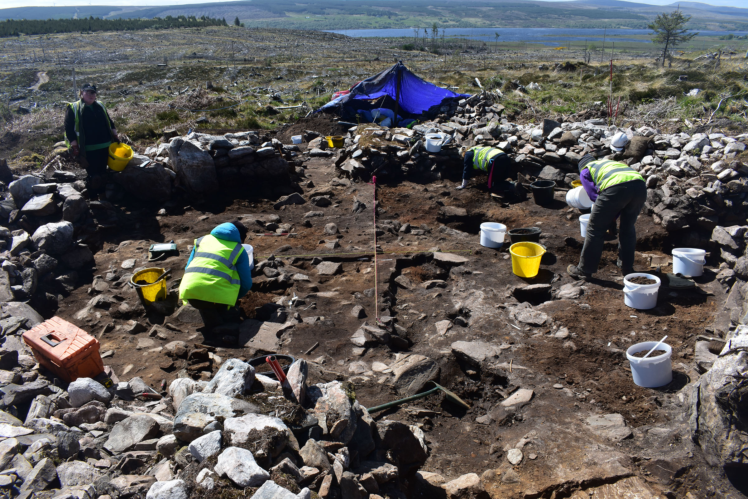
This roundhouse was built with a thick stone bank with large boulders or orthostats (upright stones) in the wall face. It had a single inner post ring to support the roof, a central slab hearth, and a simple entrance. Inside, the floor was made of a series of layers, most of which would have built up over time during the occupation of the house. One of these layers was very rich in charcoal, suggesting that the house may have been burnt down and later reinhabited. Other features, such as the widening of the wall, replacement postholes, and overlapping hearths, indicate that the house saw at least one phase of refurbishment.
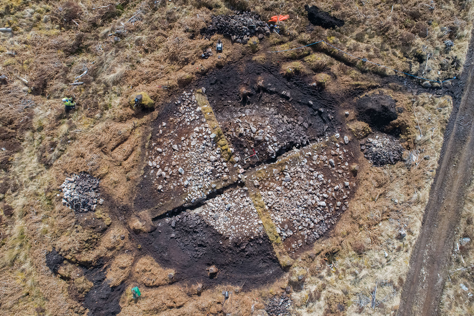
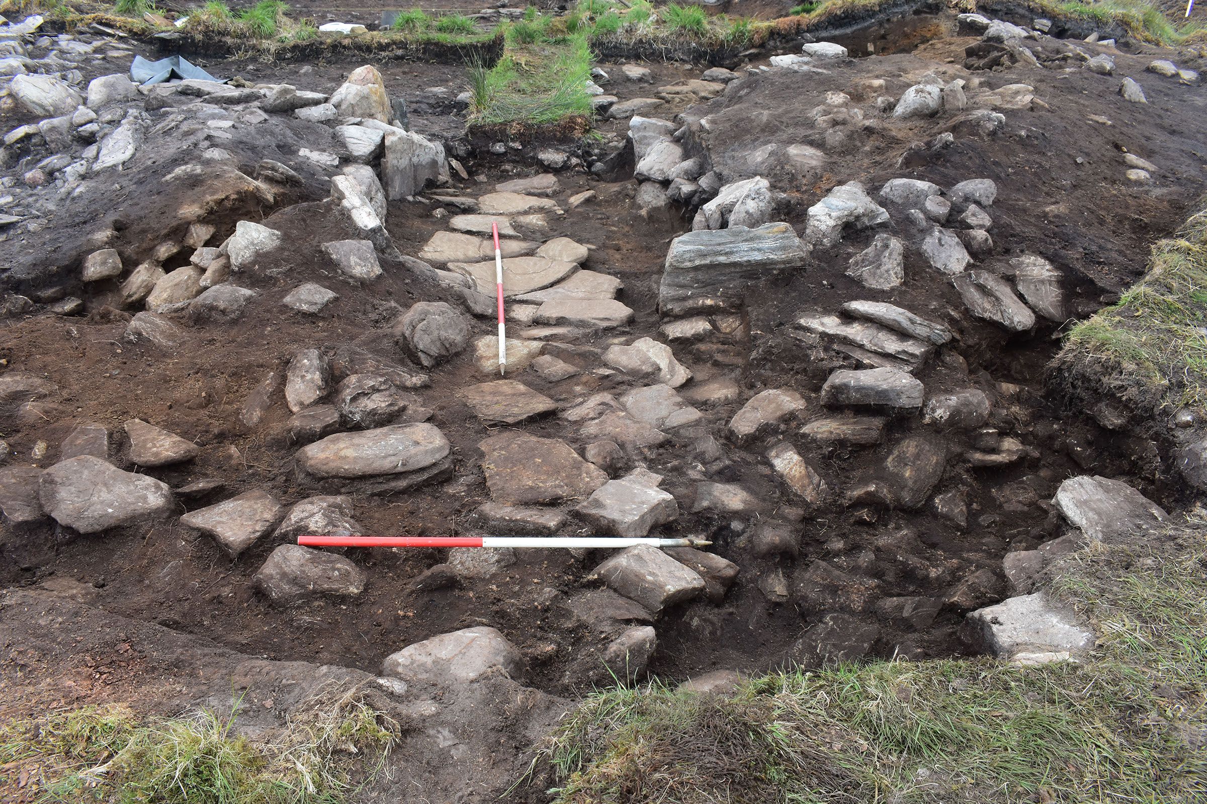
Roundhouse 2
This roundhouse was built with a mostly turf bank with rubble facing stones on the exterior and a low stone wall on the interior. It had two inner post rings, a drip gully around the outside, and a wide entrance passage with several layers of paving stones leading to the centre. From the re-setting and replacement of several postholes, it is likely that this building was used for a considerable period of time, though there was a scarcity of archaeological deposits over the floor. This lack of material, along with the double post rings, suggests that the building had a first floor timber structure below the roof which served as the main living area, while the ground floor was reserved for animals.
image: ©Tracks Ecology
image: ©Tracks Ecology
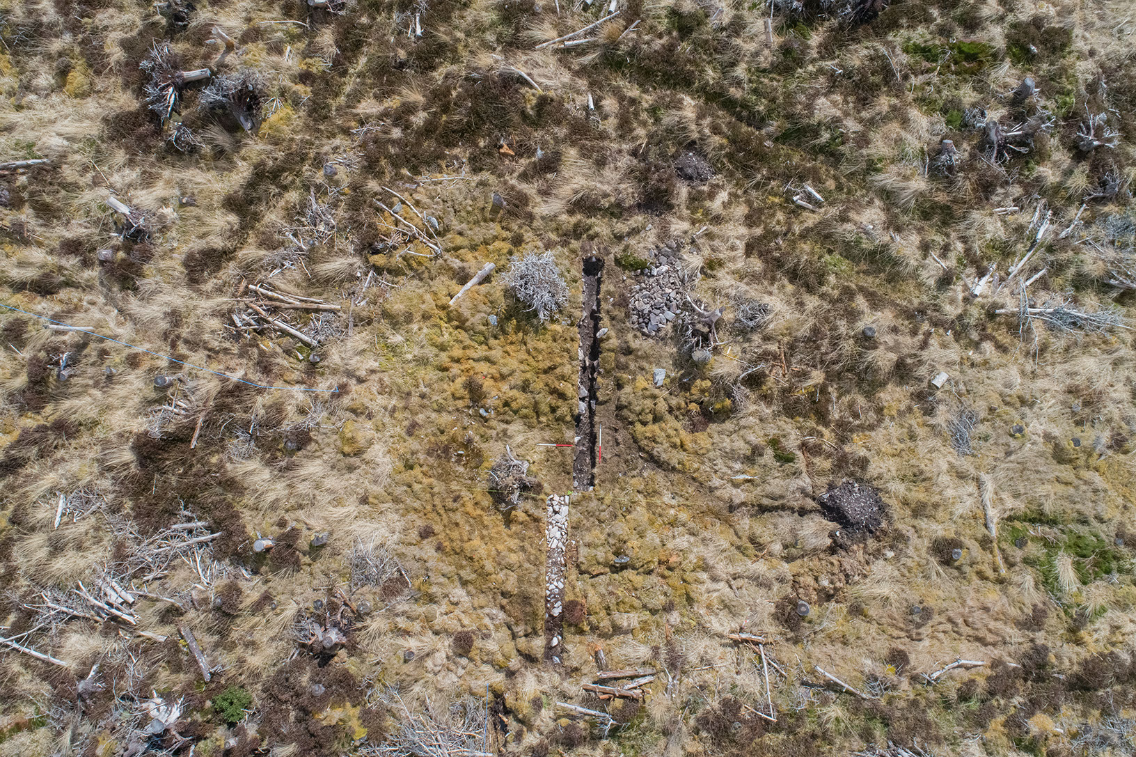
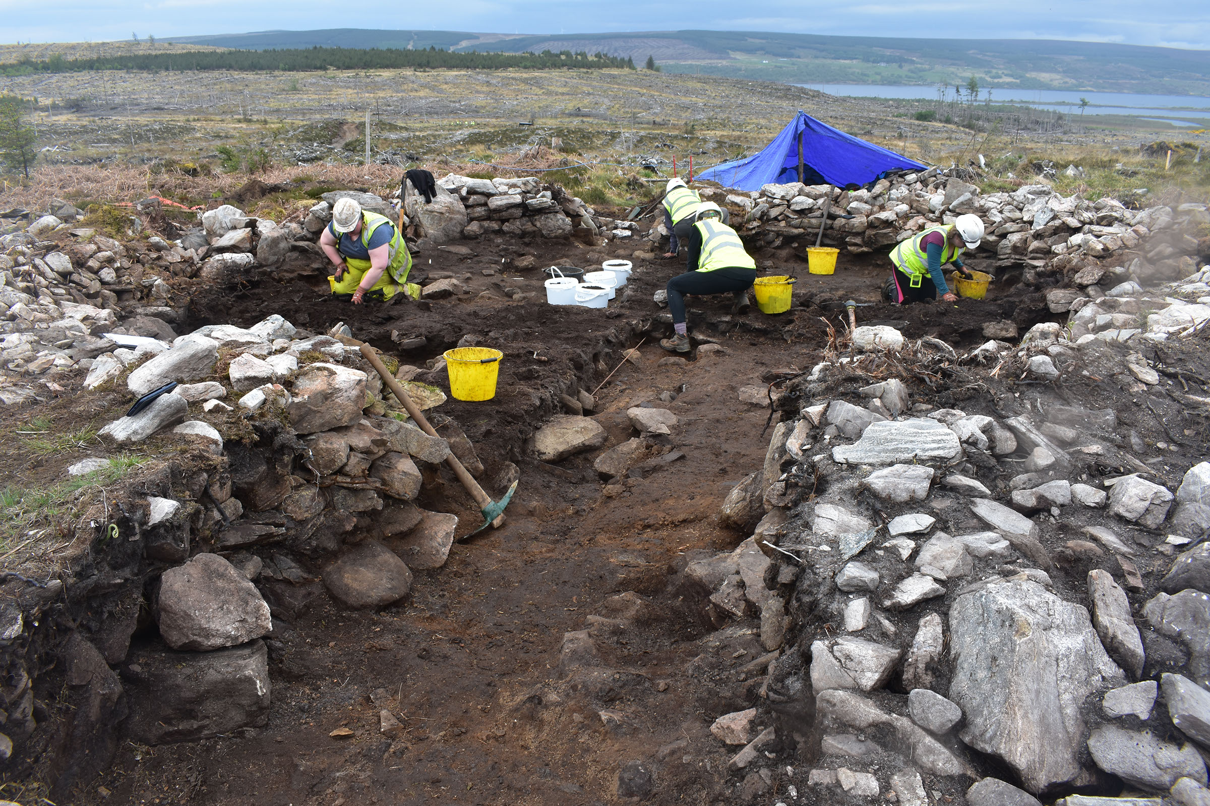
Roundhouse 3
This roundhouse was the smallest of the group and the most poorly preserved. Built with a very degraded rubble bank and edged with upright boulders, it contained an entrance to the south, the ephemeral remains of small internal postholes, and a central slab hearth. A slab-lined pit and ditch lay on the north side, apparently deliberately positioned in front of a distinct orthostat. The ditch was also clay-lined, suggesting it may have been used to contain water. These features were unique to this roundhouse and may have had a function related to a specialist activity or industry.
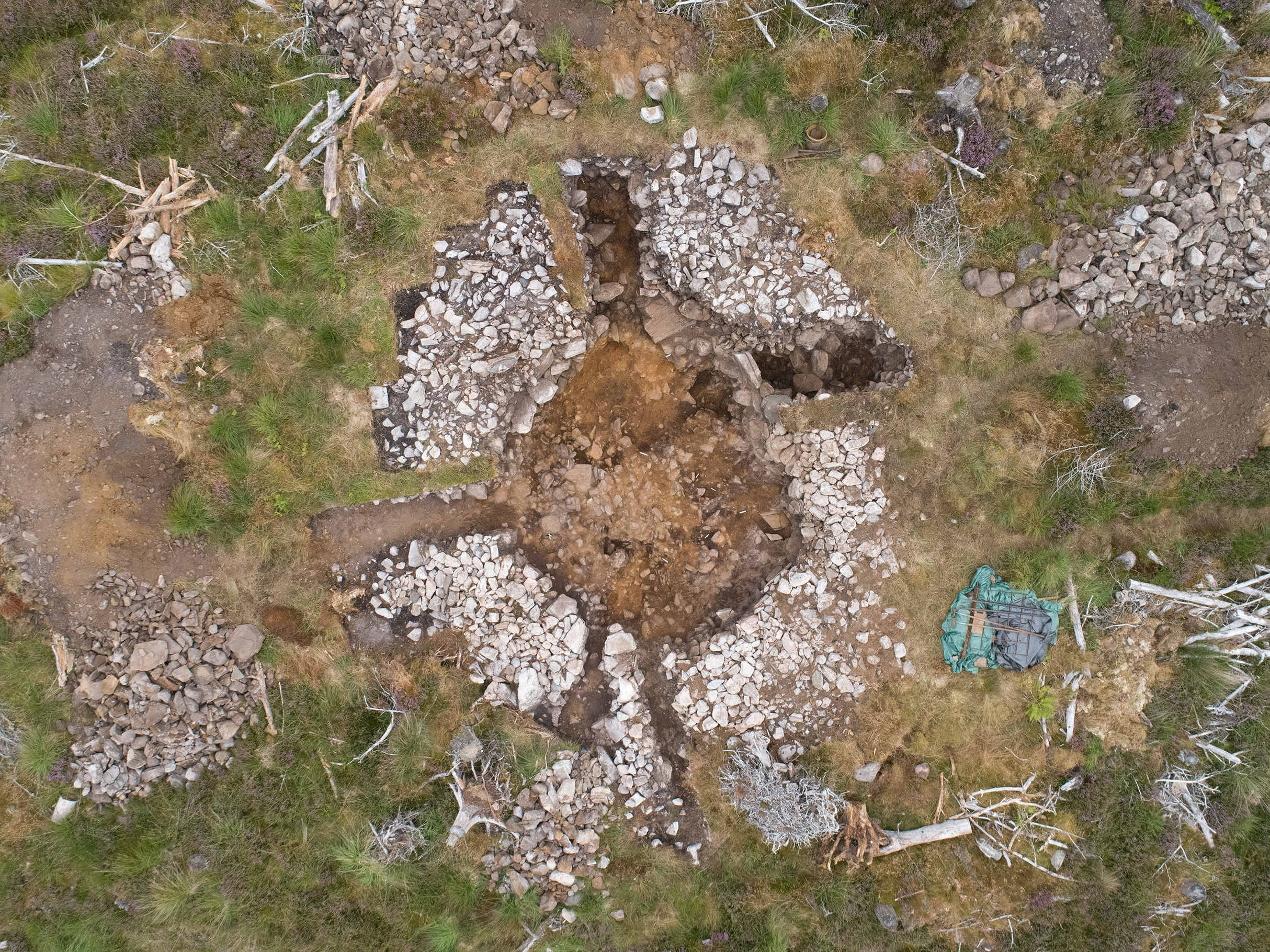
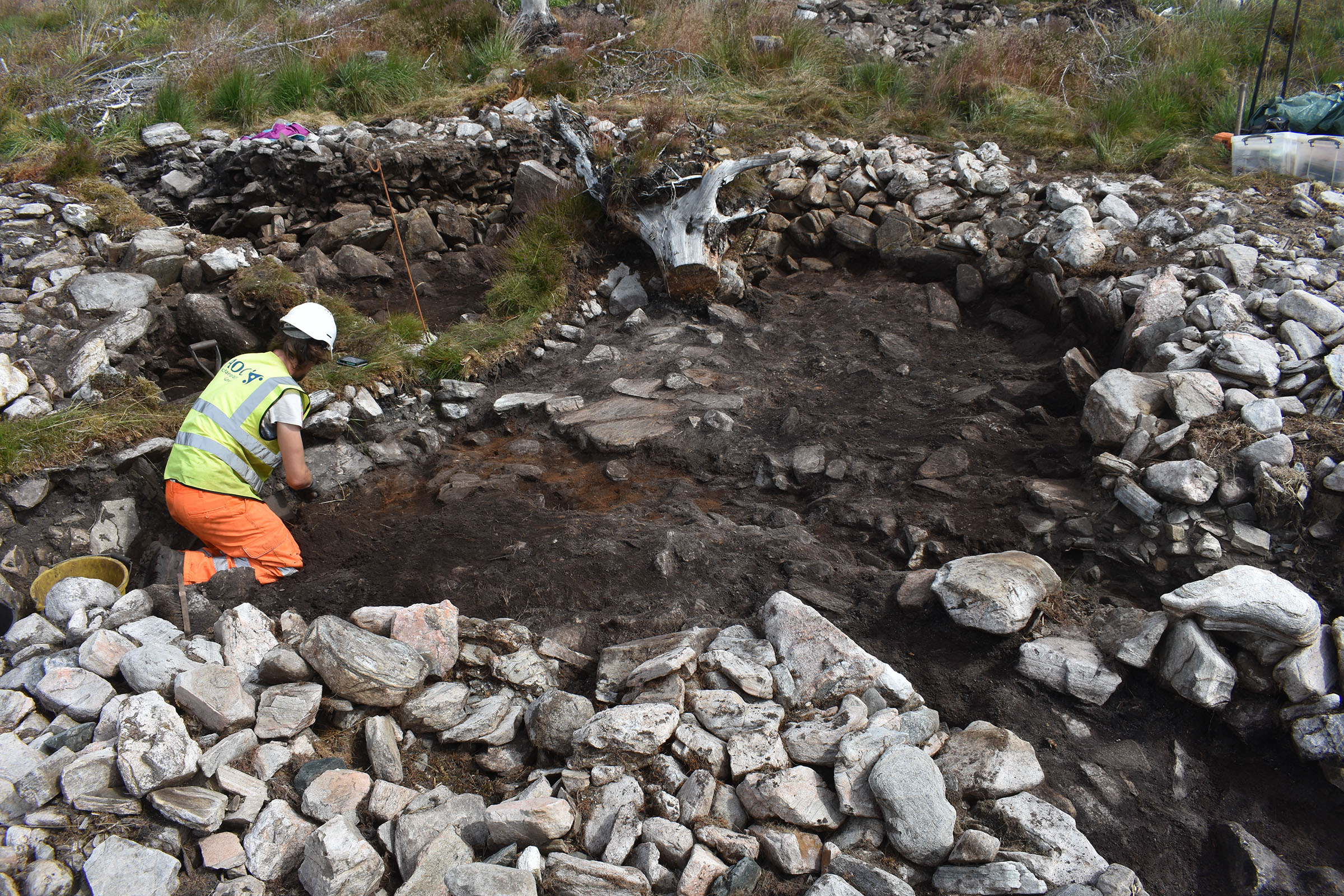
Roundhouse 4
This roundhouse was the largest, built with a rubble bank supported by boulder facing stones on the exterior, but it had been truncated on the southeast side by a previous forestry track. It contained a single inner post ring and a group of postholes on the south that likely formed a timber entrance passage structure. Minimal archaeological deposits survived across the floor, but in the centre was the remnant of a probable fire spot or hearth appearing as reddened or heat-affected soil.
image: ©Tracks Ecology


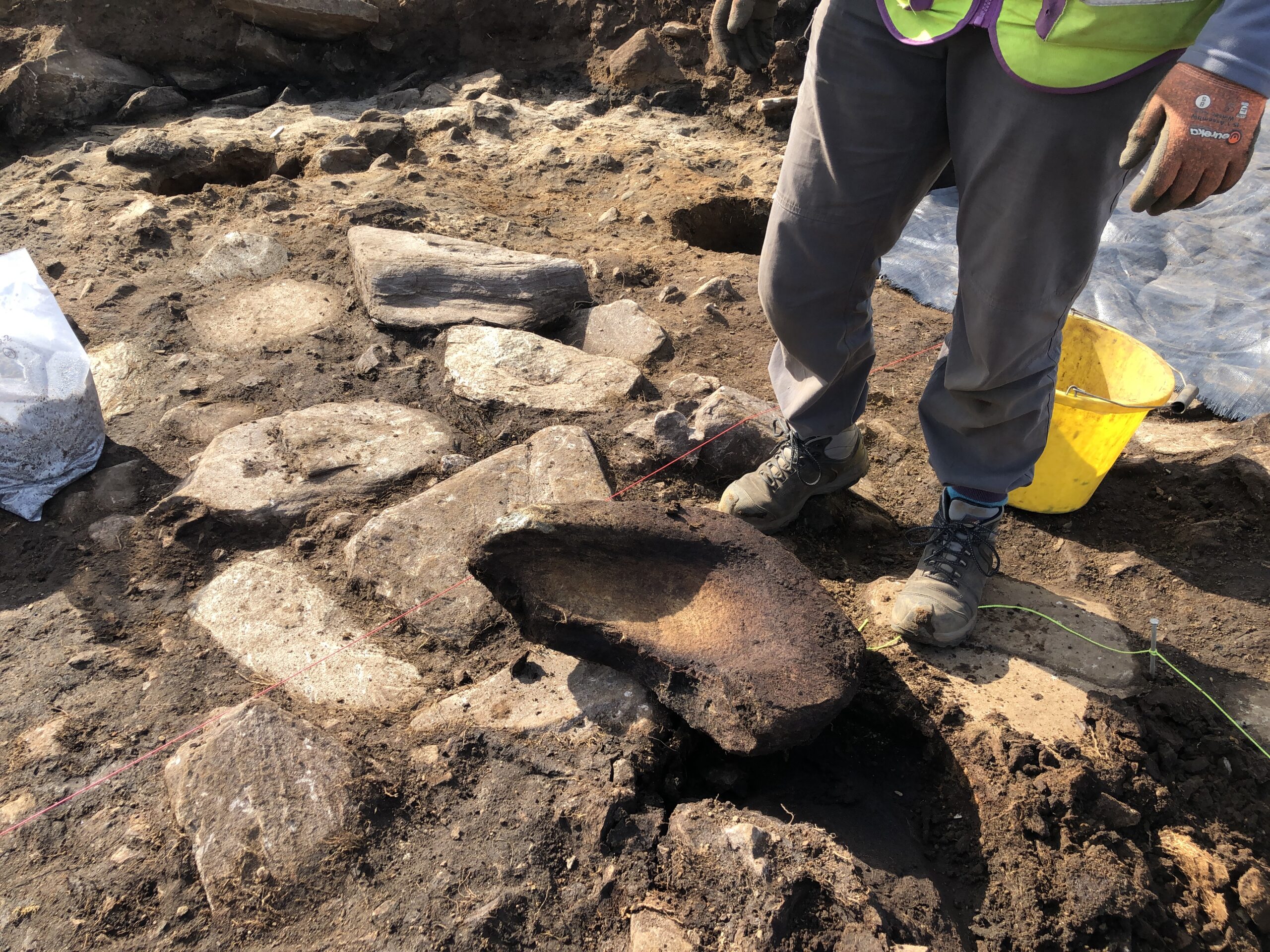
Roundhouse 2: Quernstone from paving
Quernstones – More than just a tool?
Quernstones were the most predominant artefact type found across the excavation with a total of 20 fragments recovered from across the settlement. Querns were used in the process of food preparation, specifically for grinding grain into flour. The type found on this site are known as saddle querns, which had a flat or dished surface onto which the grain would be placed. A second, smaller, rubbing stone would have been used to grind the grain. Their presence indicates that the people were likely growing crops and processing food on site.
Despite their apparent everyday uses, querns also appear to have a special significance. In Roundhouse 1, an upturned quern was utilised as part of the central slab hearth, while in Roundhouse 2, an upturned quern was used in the entrance paving. In both cases the querns were broken, but it is unclear if they were deliberately broken to be used as a ritual deposition within the houses or if their reuse was simply a convenient means of recycling.
Shale Bracelet – A Hint of Wealth
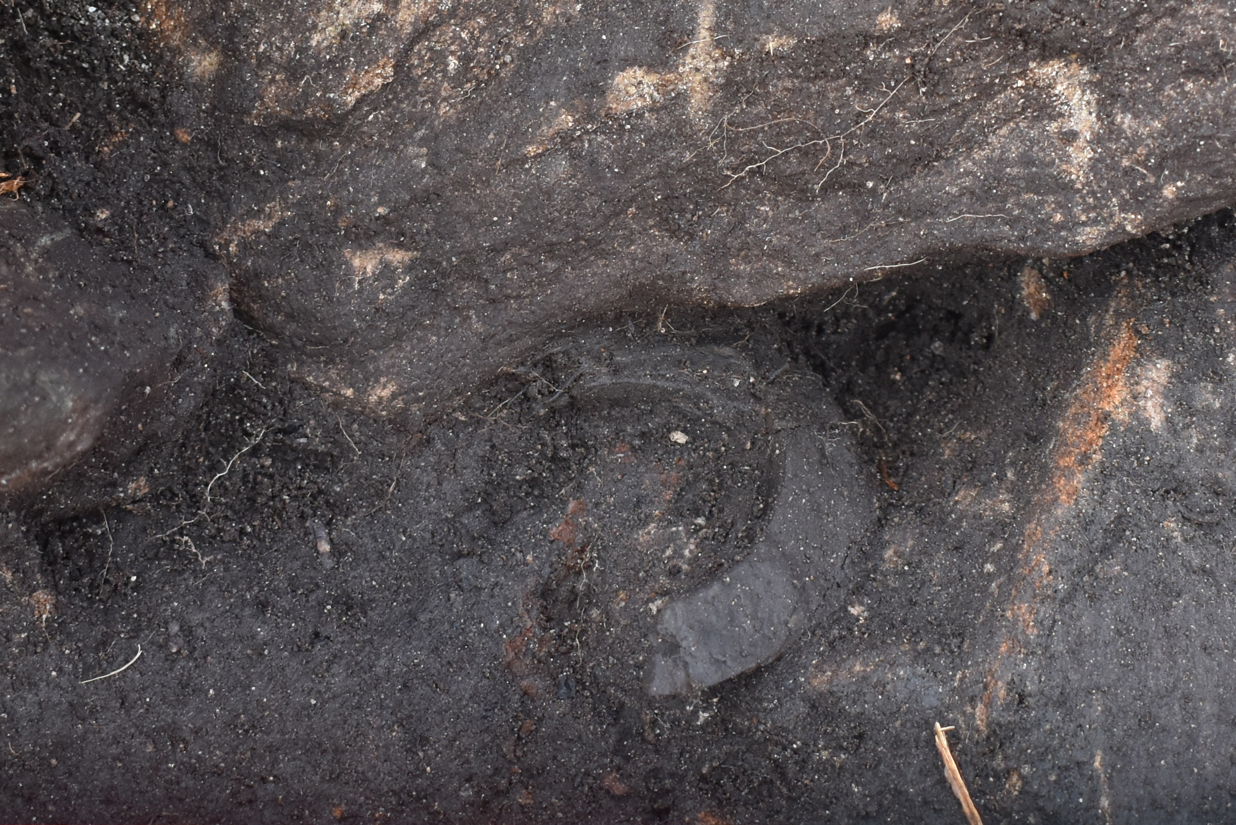
From within the burning layer in Roundhouse 1, a fragment of a possible shale bracelet was found, though it was heavily cracked by the effects of fire. Bracelets such as these were used throughout the Bronze Age and Iron Age and were made for children and adults alike as pieces of decorative jewellery. They are generally thought to be items of the elite, and the presence of one at Dalchork hints at the potential wealth or status of the people living here.
Roundhouse 1: Shale Bracelet
Roundhouse 2 : cup-marked stone
Cup-marked Stone – Incorporating the Past
A cup-marked stone was discovered built into the outer wall face of Roundhouse 2, near the entrance. Cup-marks are one of the oldest and most widespread types of early prehistoric rock art, though their meaning is enigmatic and highly debated. It is common to find cup-marked stones reused within later prehistoric sites such as roundhouses, souterrains, and burials. The reason for this is unknown but suggests that there was a symbolic meaning attached to cup-marks, either as part of religious or ritual beliefs, or as a link to past ancestors or places.


