


Buried within the peat of Black Loch of Myrton on the Machars peninsula, Galloway, archaeologists have uncovered the remains of an Iron Age wetland settlement. Waterlogged conditions on the site allowed the incredible preservation of at least six timber roundhouses, defensive palisade structures and other organic materials. The settlement was occupied intermittently over the course of two centuries during the Iron Age between the mid-5th and late-3rd centuries BC (circa 437 – 223 BC). Dendrochronological analysis of surviving oak timbers meant it was possible to match construction events to specific calendar years, providing a detailed picture of the changing settlement over its lifetime.
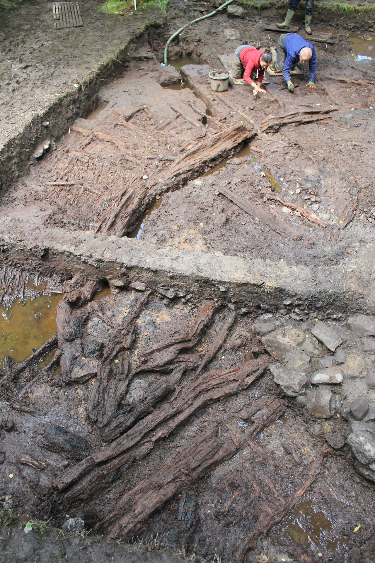
Excavations at Black Loch of Myrton were carried out by AOC Archaeology between 2013 and 2019, assisted by a team of enthusiastic volunteers. The works were made possible with the support of the landowners, Dourrie Farming, and funding from Historic Environment Scotland and the UK Arts and Humanities Research Council.
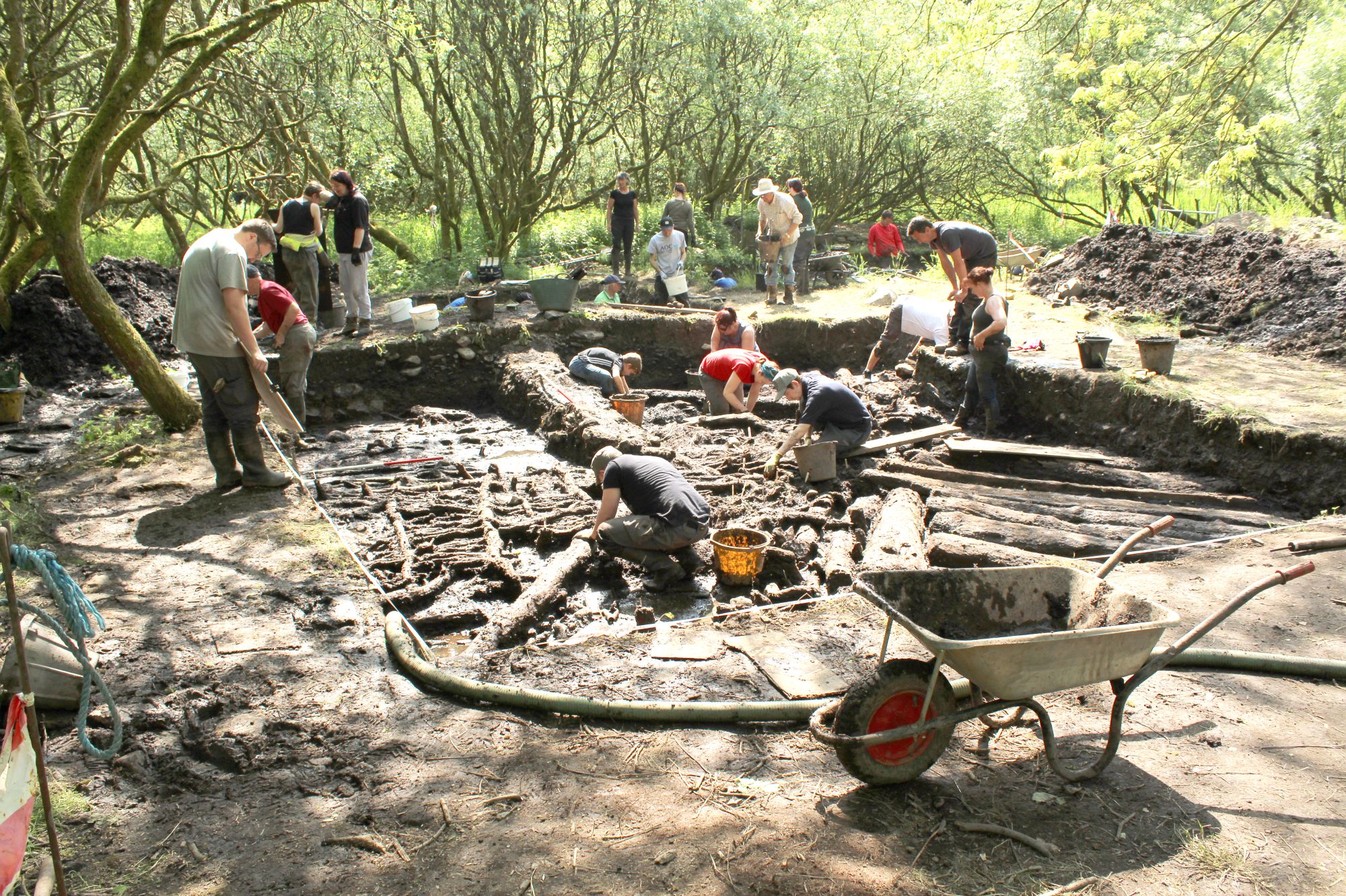
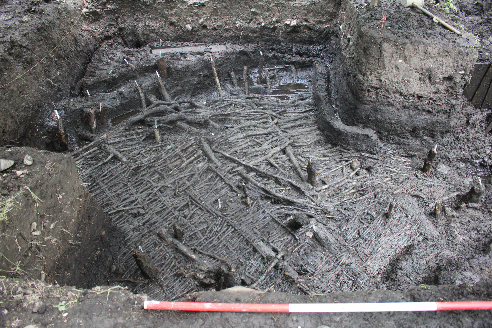
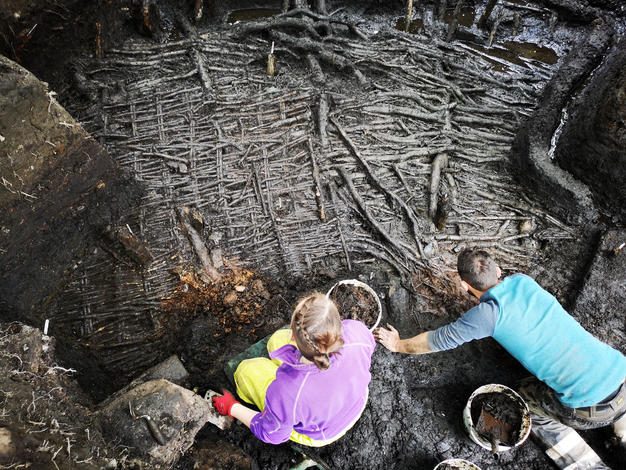
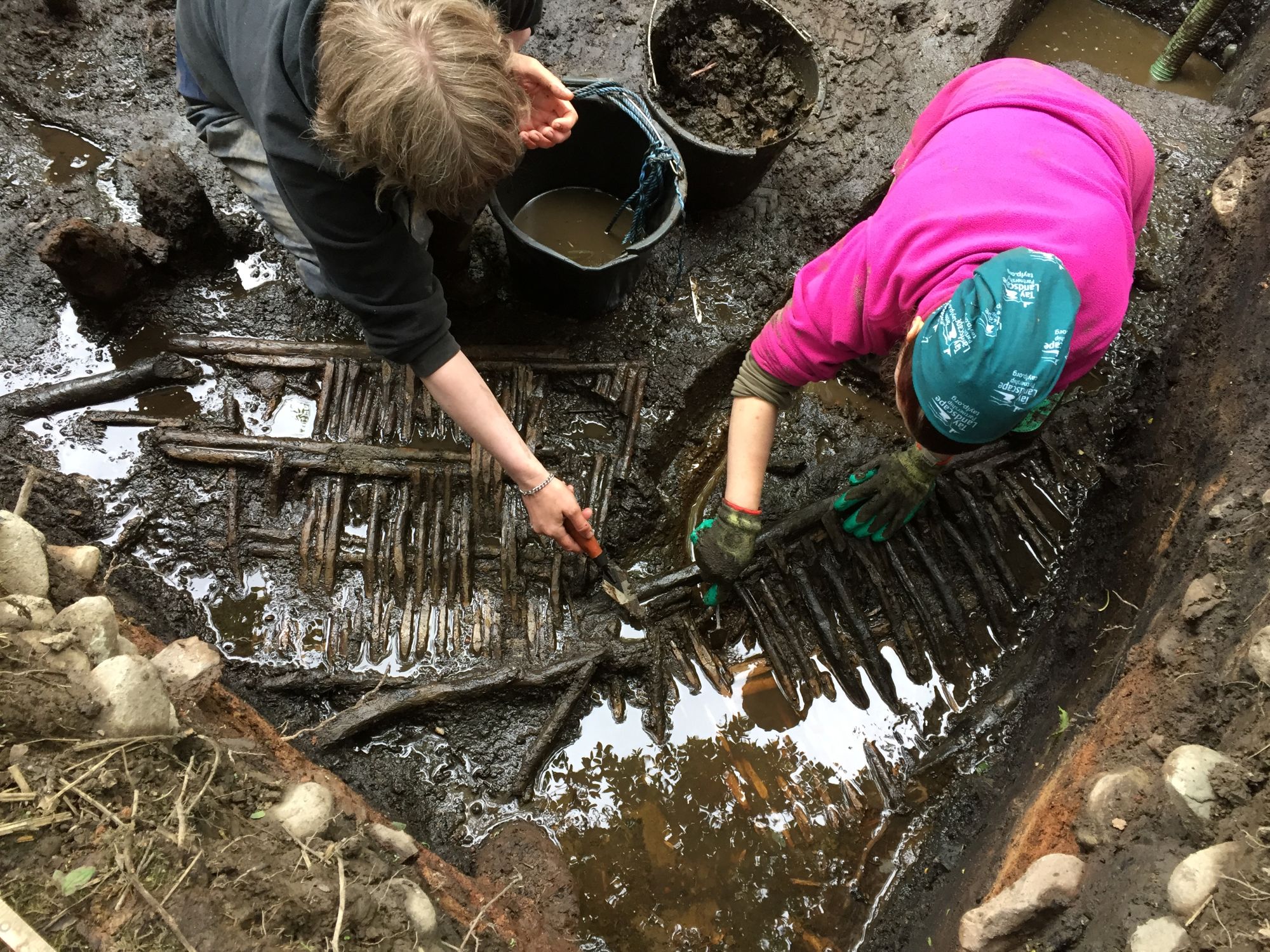
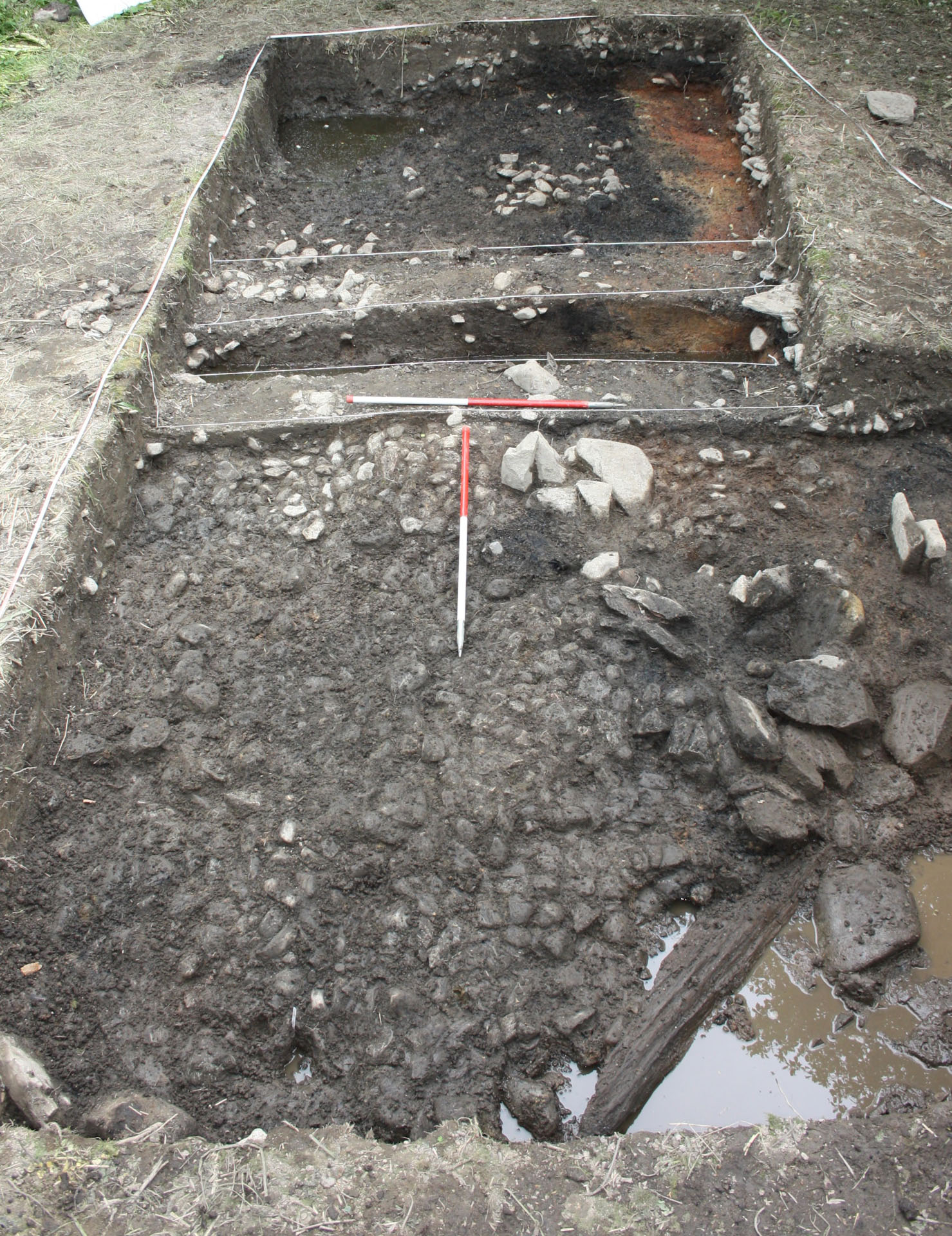
Archaeologists and volunteers excavating at Black Loch of Myrton
The Island
The Iron Age settlement at Black Loch of Myrton was built onto the peaty surface of a small, natural island on the edge of the loch. While 19th century antiquarians referred to the site as a crannog, there are no artificial foundations to the settlement, meaning it is more correctly described as a wetland settlement. Crannogs and wetland settlements were a major component of settlement patterns in this area of Galloway.
It was first discovered in the late 19th century by Sir Herbert Maxwell, the landowner of the Monreith Estate and an antiquarian with an interest in crannogs. Maxwell’s investigations of the site identified the tops of several oak posts from the palisade structures, the mounds of the roundhouse structures with stone slab hearths, and some coarse stone tools.
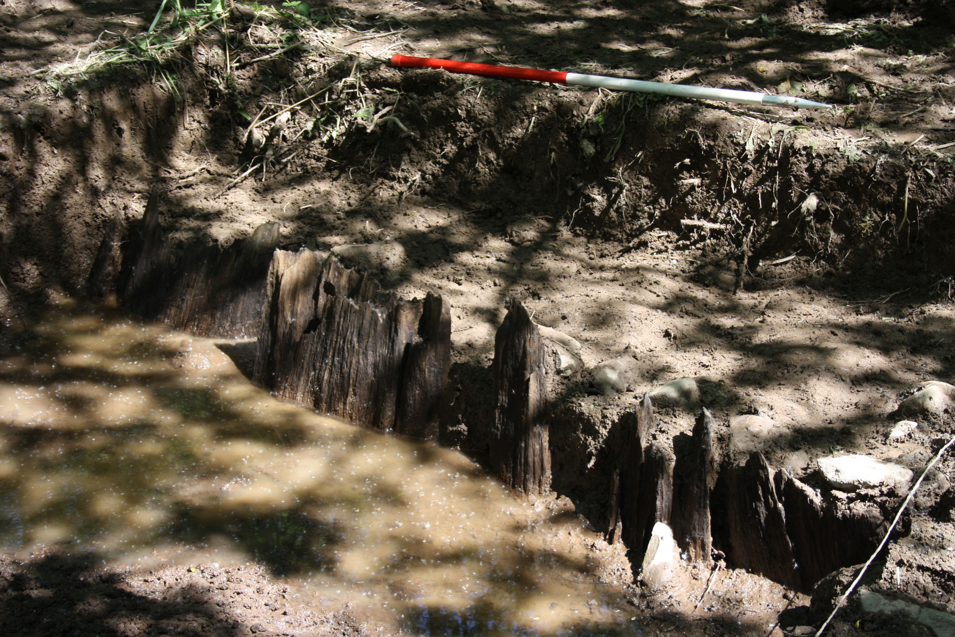
Black Loch was artificially drained in the early 19th century, leaving behind an area of peaty wetlands, which are now under woodland and still regularly flooded. The amazing preservation of the site is likely due to the rapid burial of the structures after their abandonment, caused by the weight of the structures sinking them into the peat and a rise in water levels.
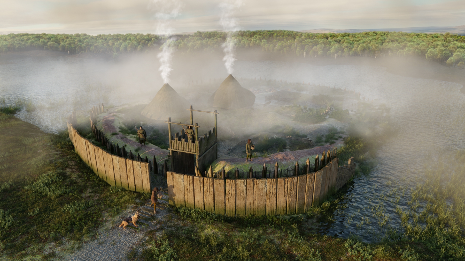
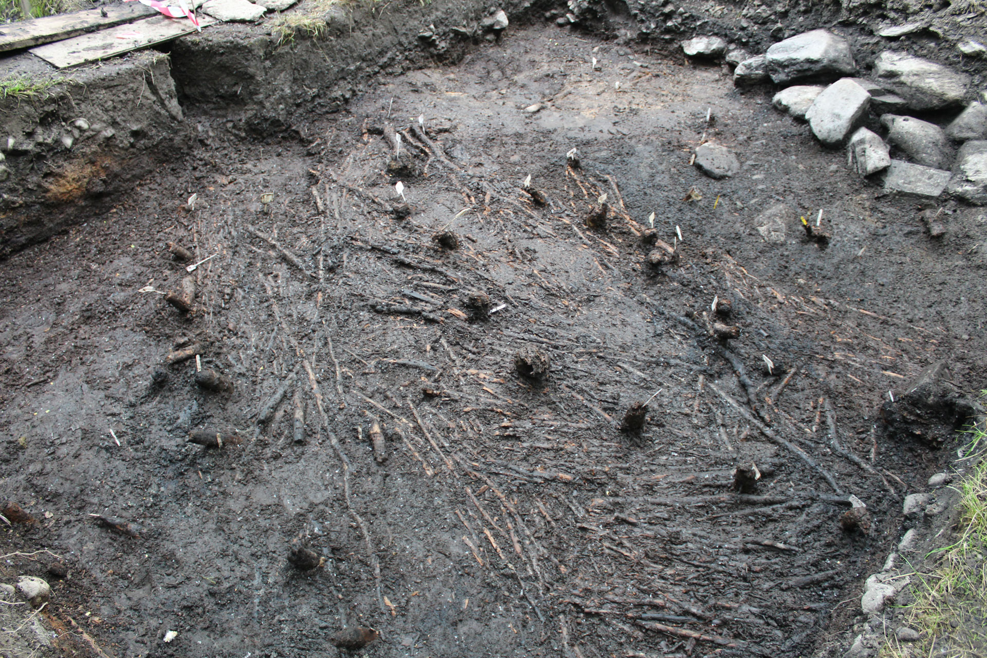
Episode 1: A New Settlement
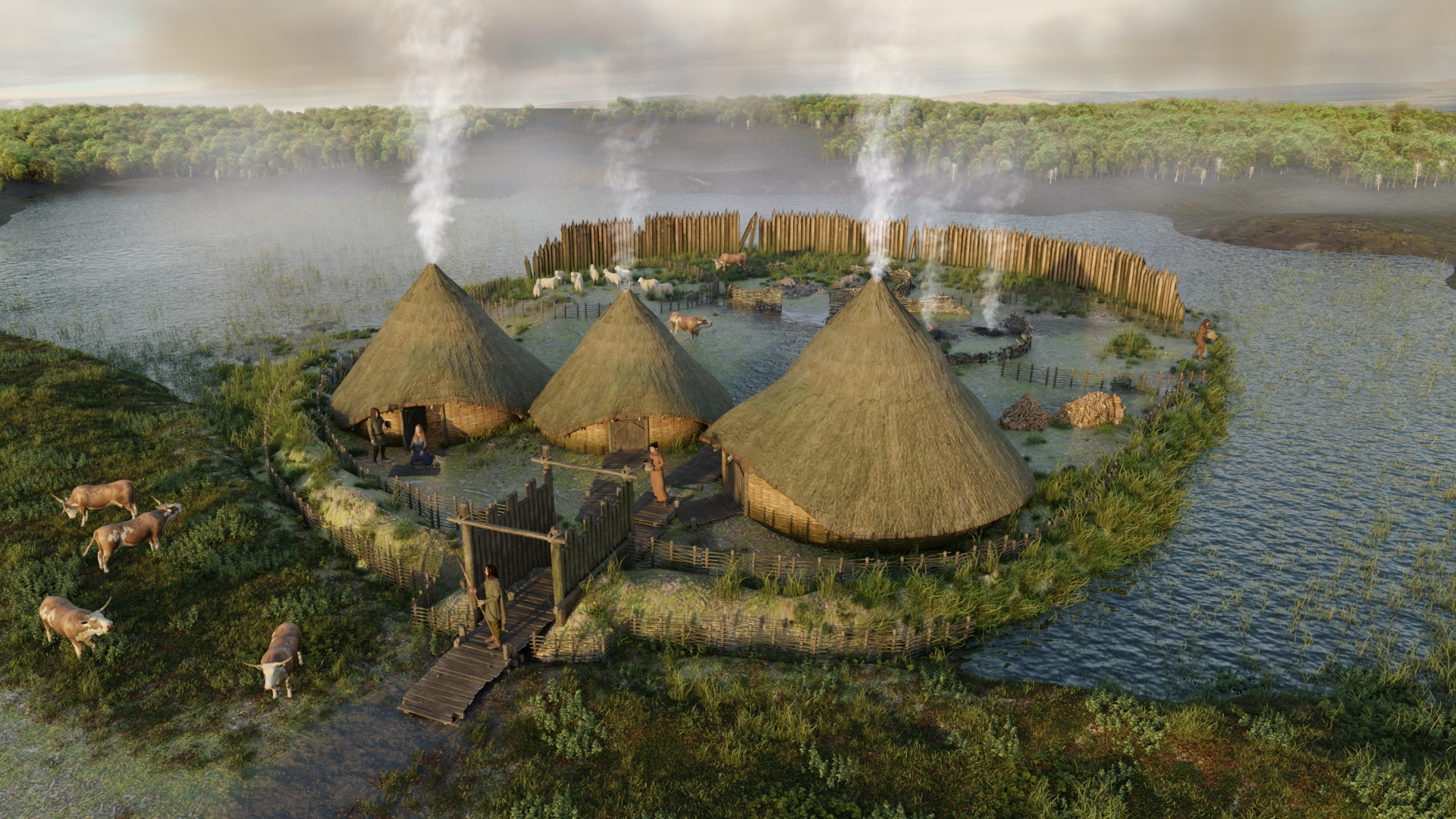
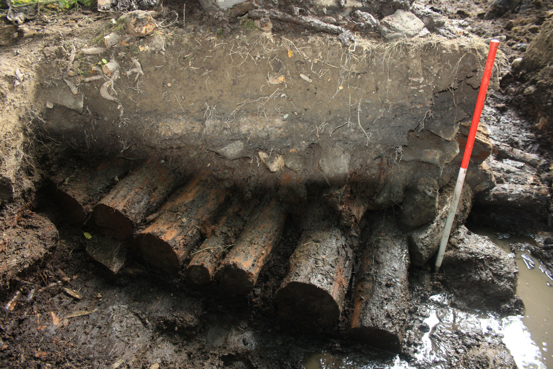
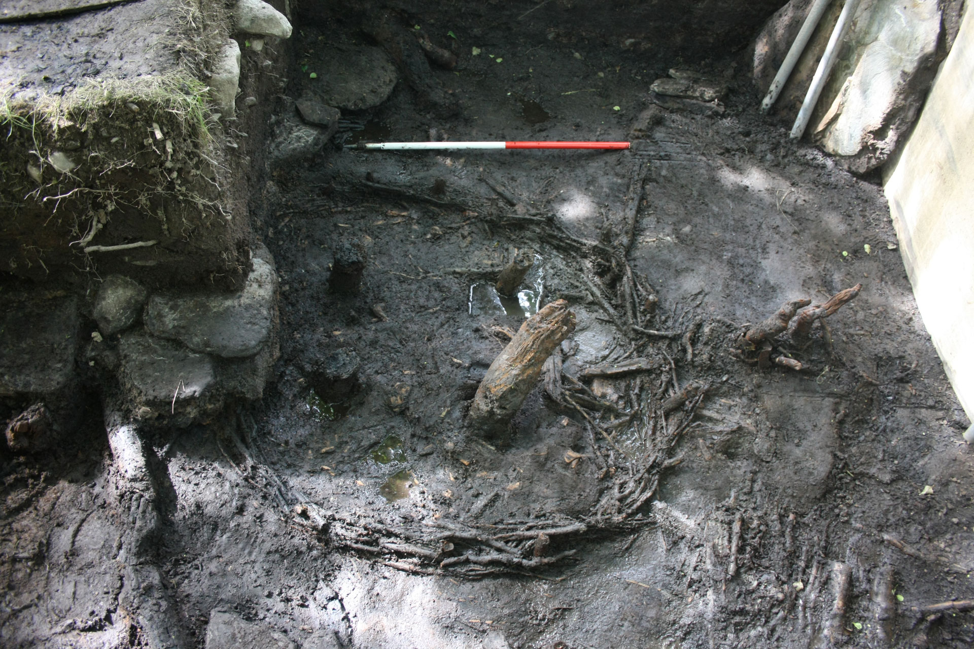
The first settlement on the island was built over a period of 2-3 years starting with the construction of a log trackway leading from the shore to the island in the year 437 BC. This was followed by the construction of a timber palisade (defensive fence) around the island in 436-5 BC and three roundhouses built in the spring or summer of 435 BC. The houses may have been lived in for up to 40 years before being abandoned or replaced by later structures.
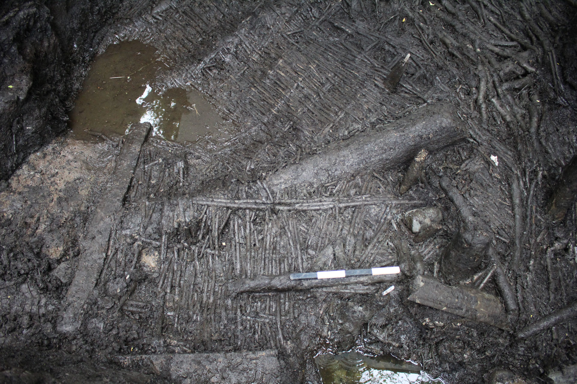
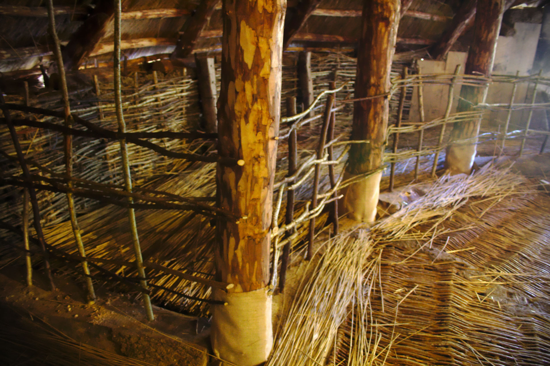
The houses were built with wickerwork walls woven around small stakes set into the ground with concentric rings of oak posts inside the house to support the roof. At the centre of each house was a large hearth or fireplace built with large stone slabs and lined with clay. The house floors were also wickerwork and overlaid with layers of branches and bracken that were likely regularly resurfaced and would have helped to keep the floors dry.
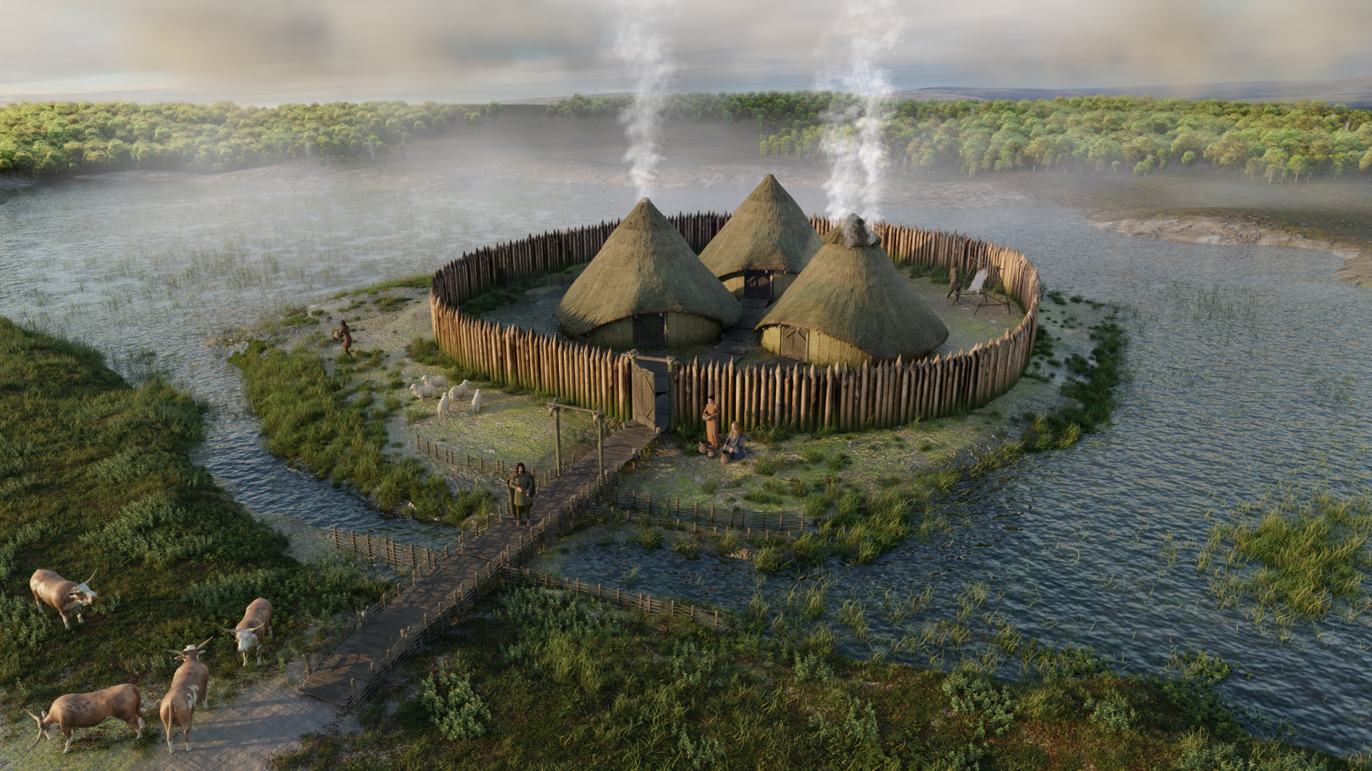
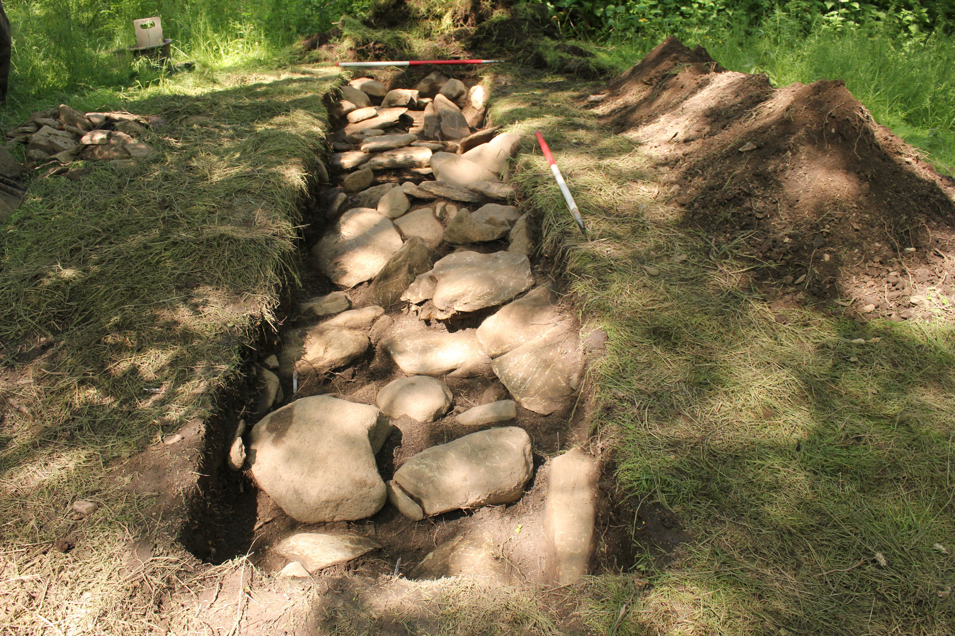
 People accessed the island via a narrow log trackway.
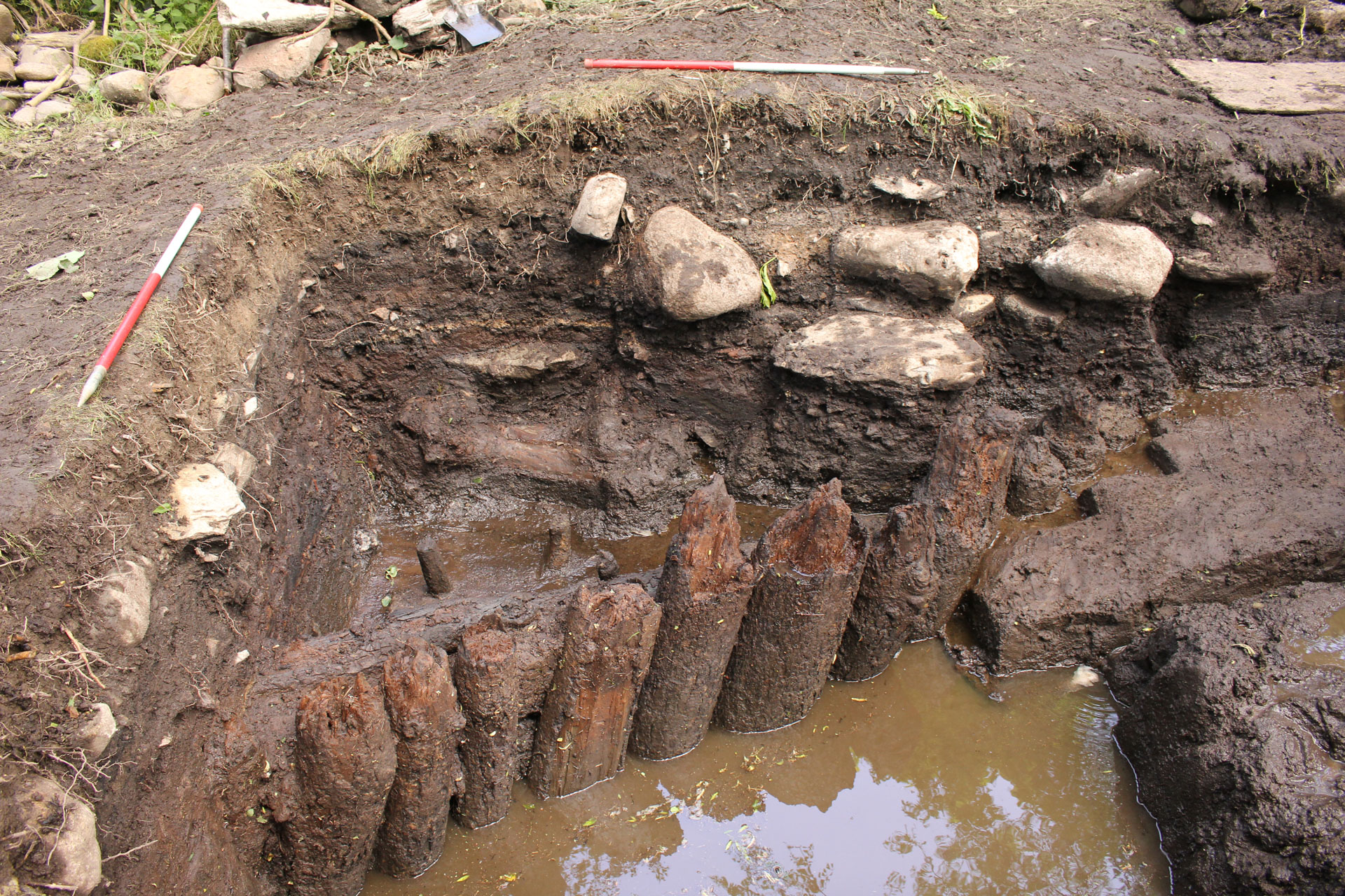 A defensive log palisade fence surrounded the settlement.
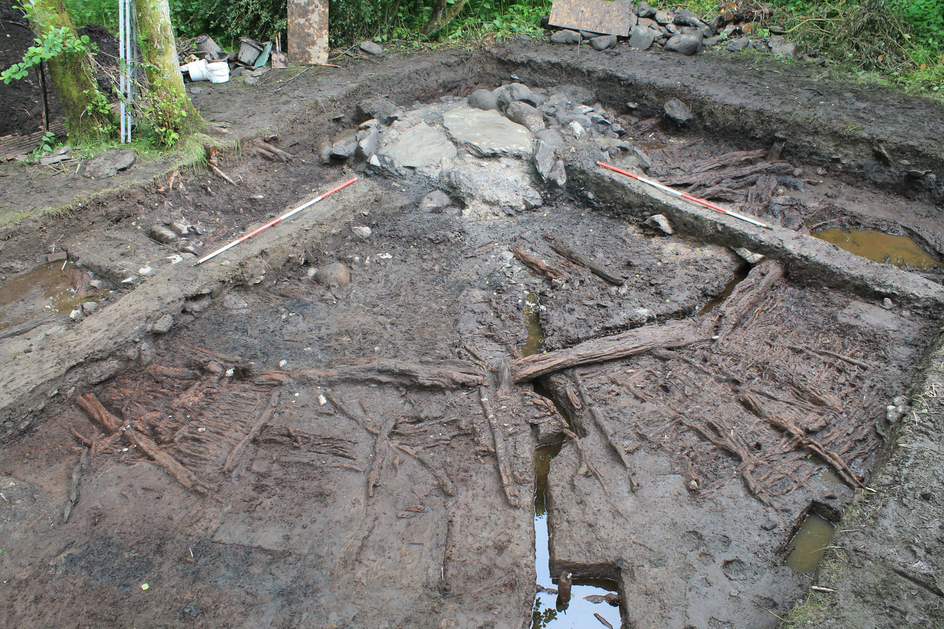
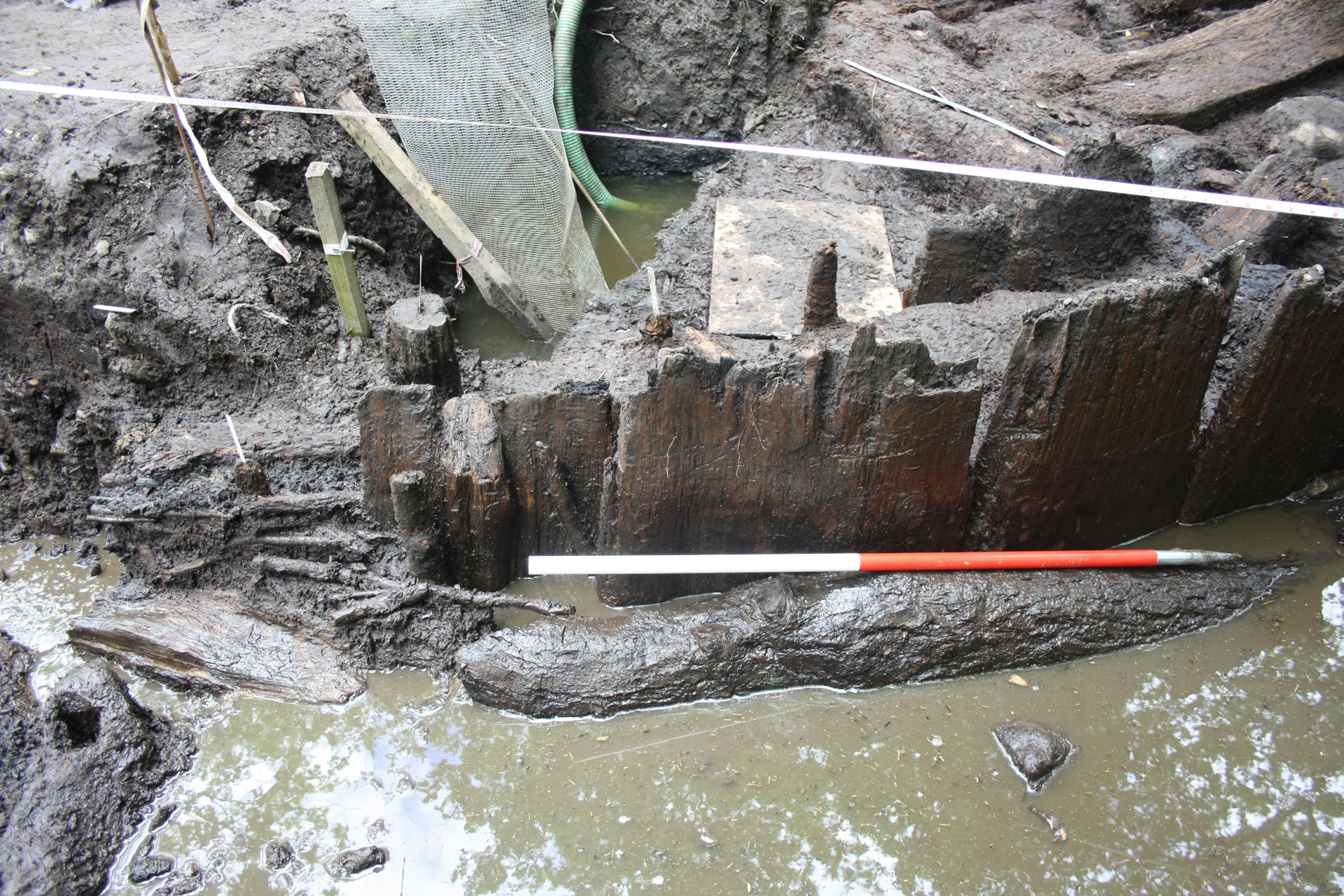 The house walls were built with double rows of upright planks. Inside, rings of posts would have supported the roof structure.
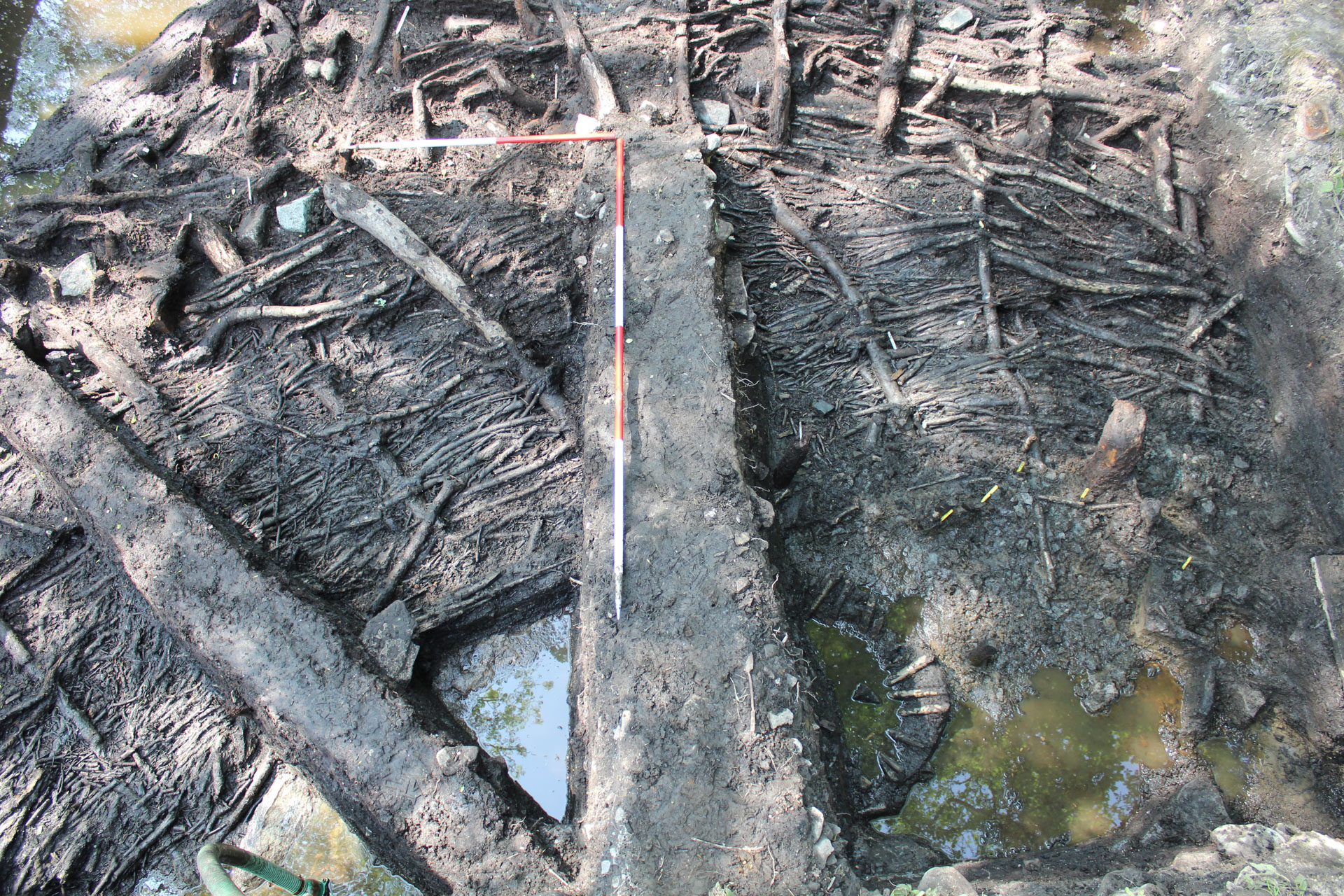
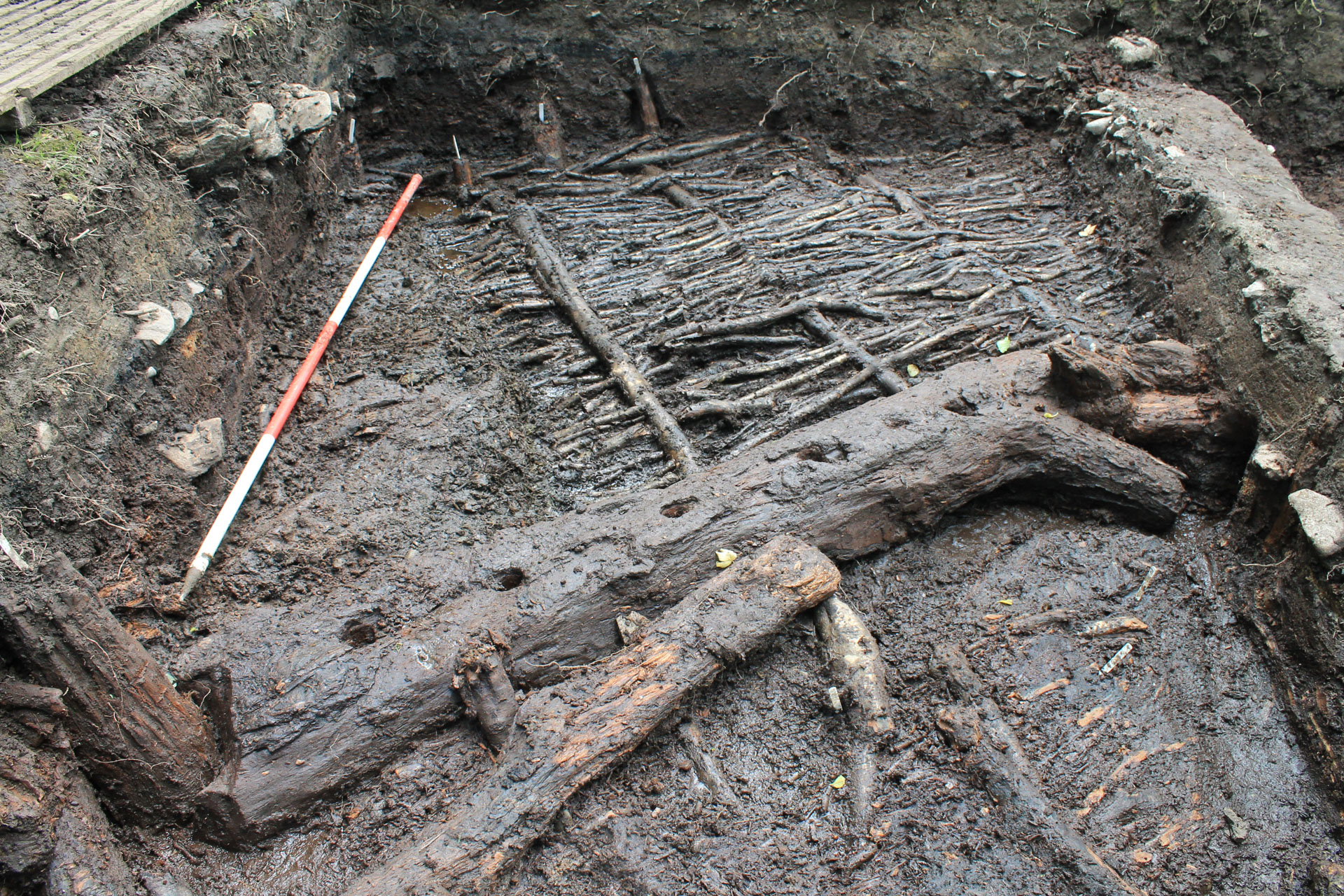 The roundhouse floors were built with wicker and brushwood surfaces covered by organic layers of bracken. Internal wicker screens were supported by sill beams.
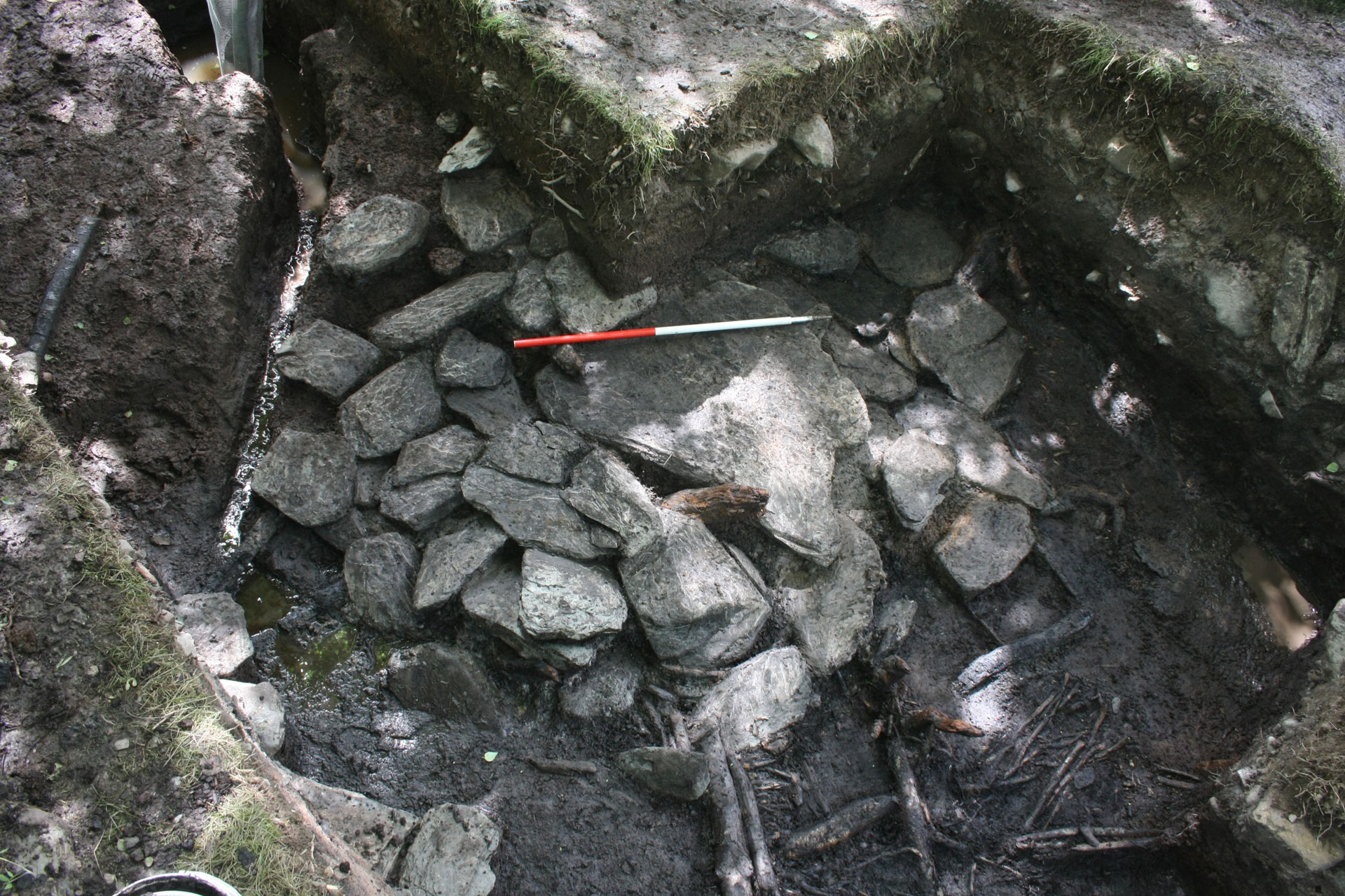
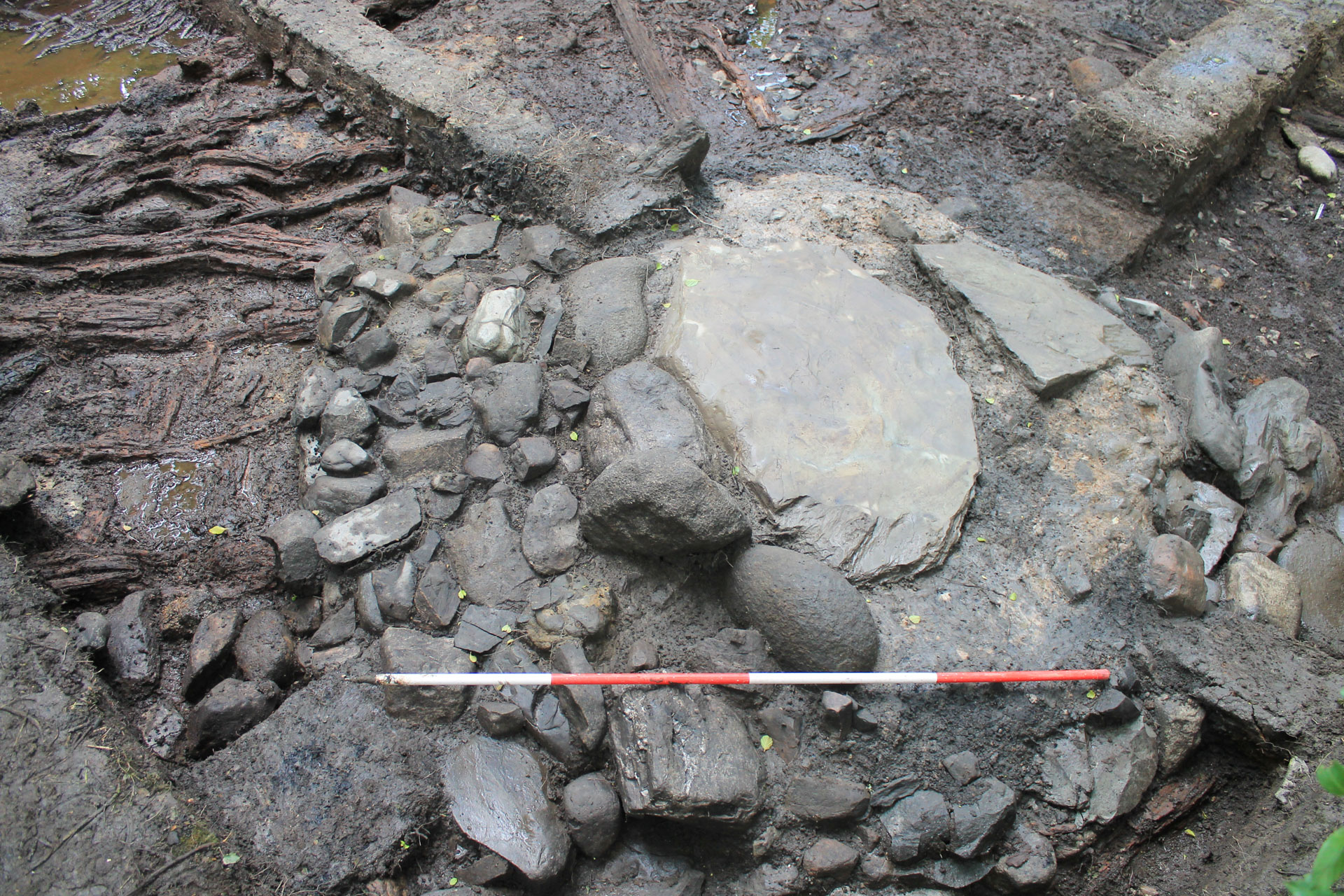 Each roundhouse contained a large stone slab hearth at its centre.
 Site plans and dendrochronology data were used to build specific features of the reconstruction image.
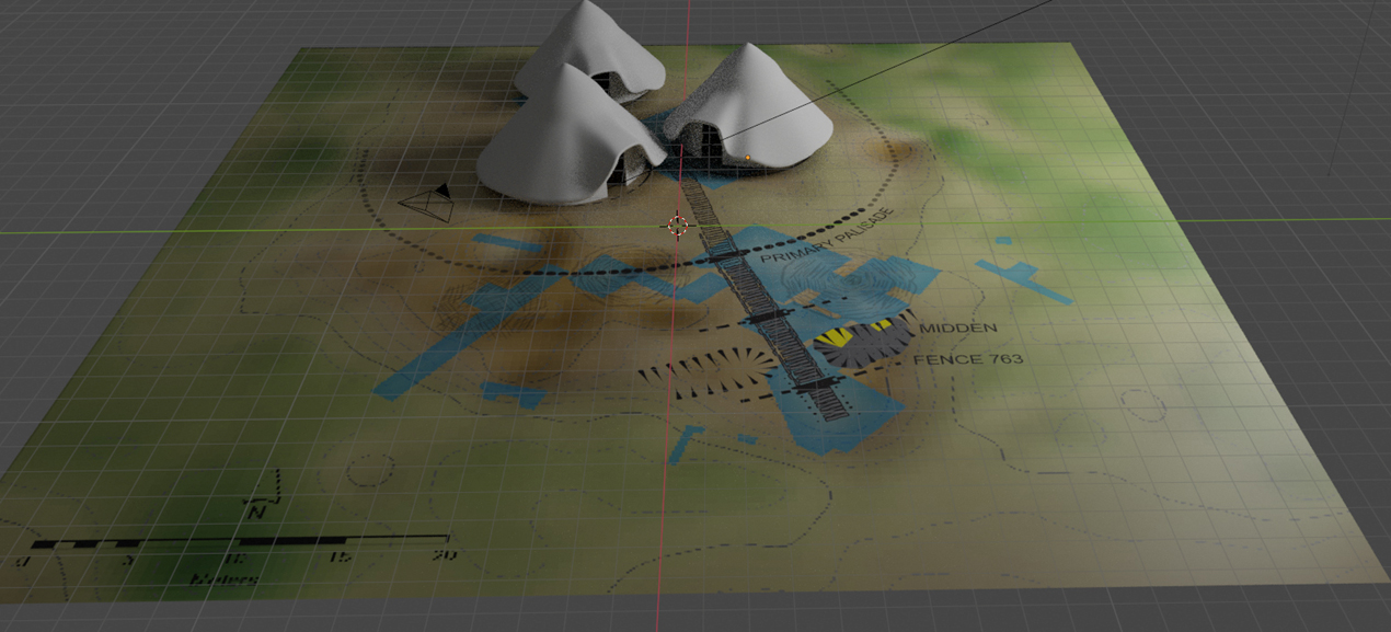 Site plans were used to create the layout of the reconstruction image.
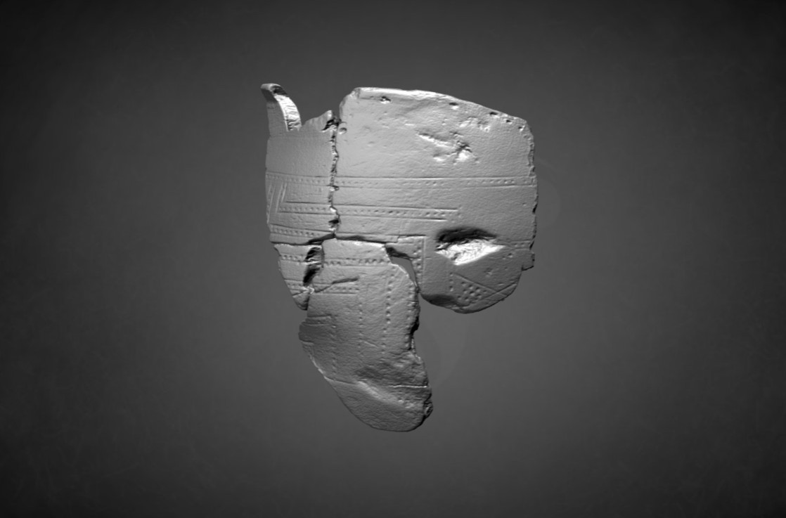 These people in the reconstruction image are holding bowls that would have looked like the decorated wooden bowl found on site.


Episode 2: Expansion and Rebuilding
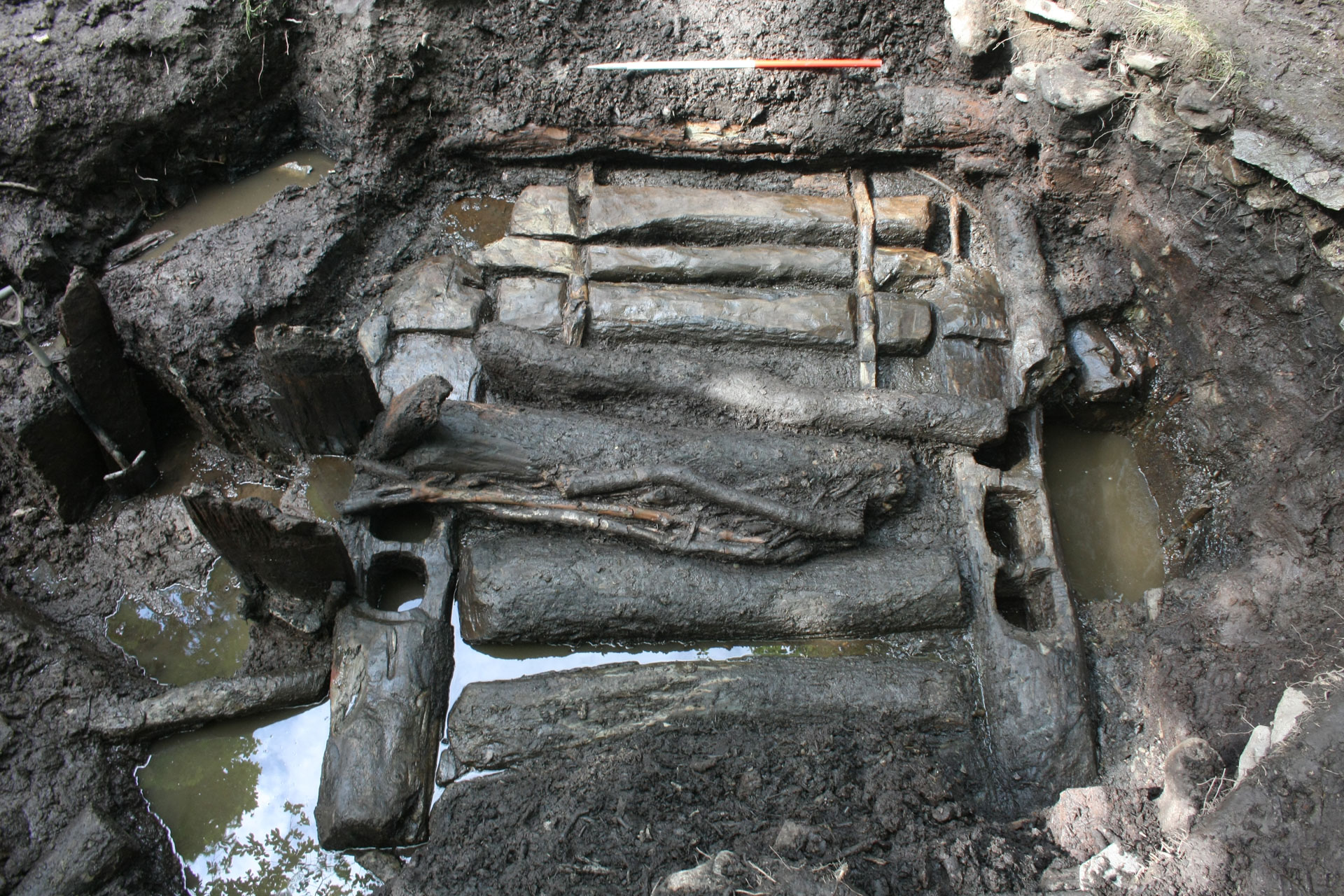
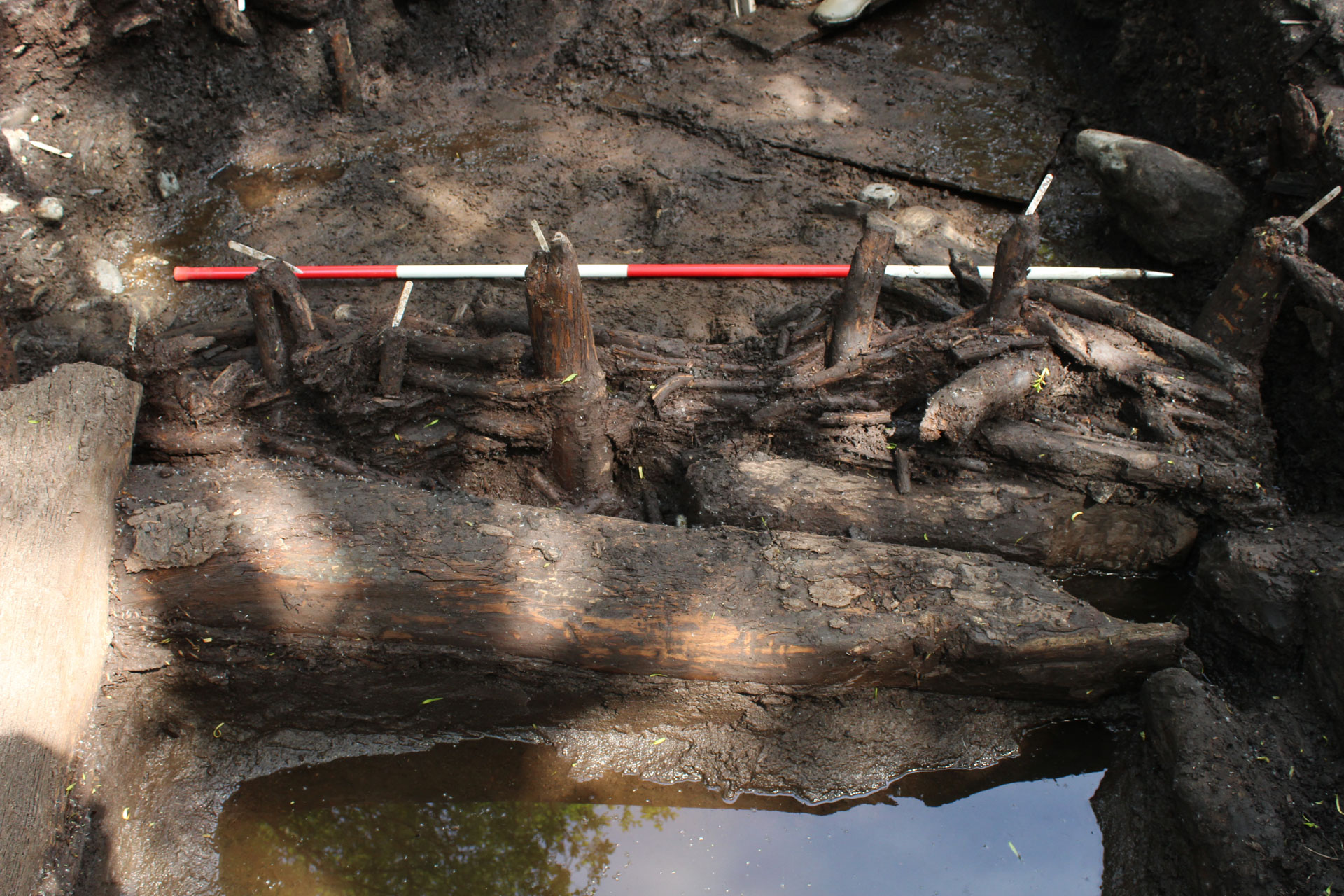
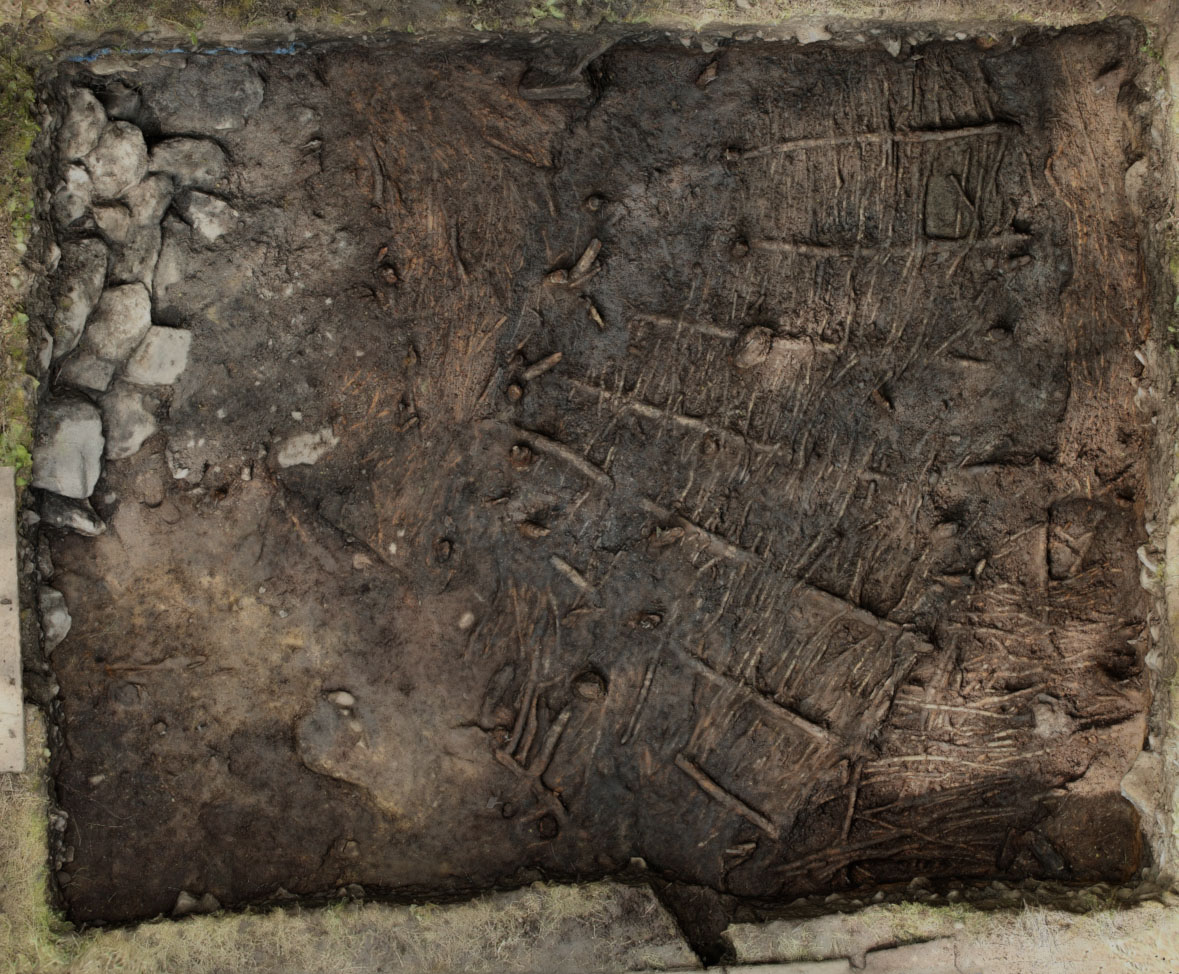
Settlement on the island expanded over the south half of the island with the construction of three new roundhouses around 400 BC. Smaller or more flimsy structures may also have been built on top of the Episode 1 houses. Access to the island was tightly controlled with a defensive turf rampart and alder palisade built around the perimeter and fenced entrance passage along the trackway.
These houses were built in a similar style to the earlier buildings, with wickerwork walls, rings of posts and large central hearths. One of the structures had evidence for at least eight phases of activity, each represented by a new hearth and refurbished floors and internal partition walls. This Episode was less precisely dated, but the houses could have been in use for between 45-110 years and were likely abandoned between 375-310 BC.
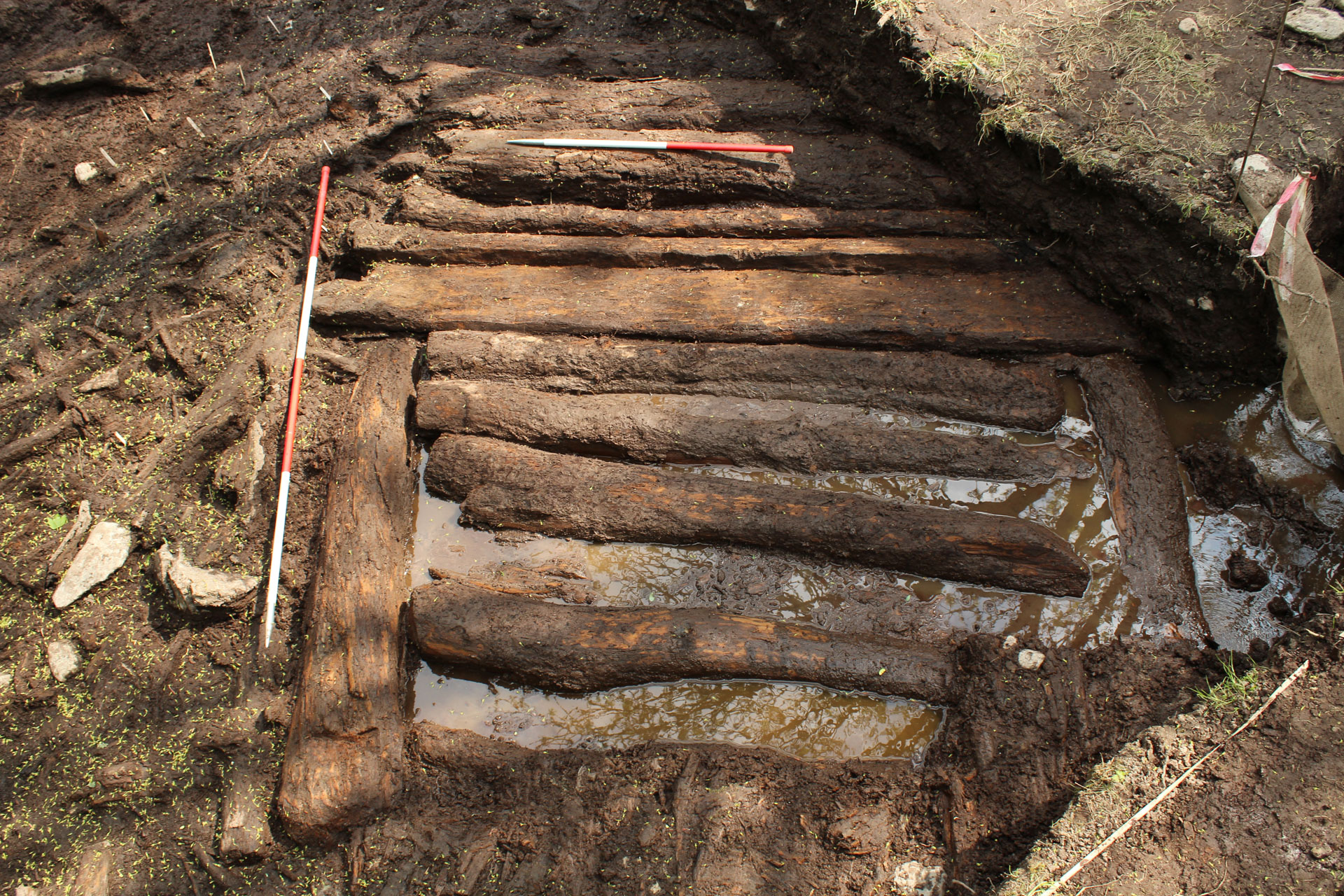
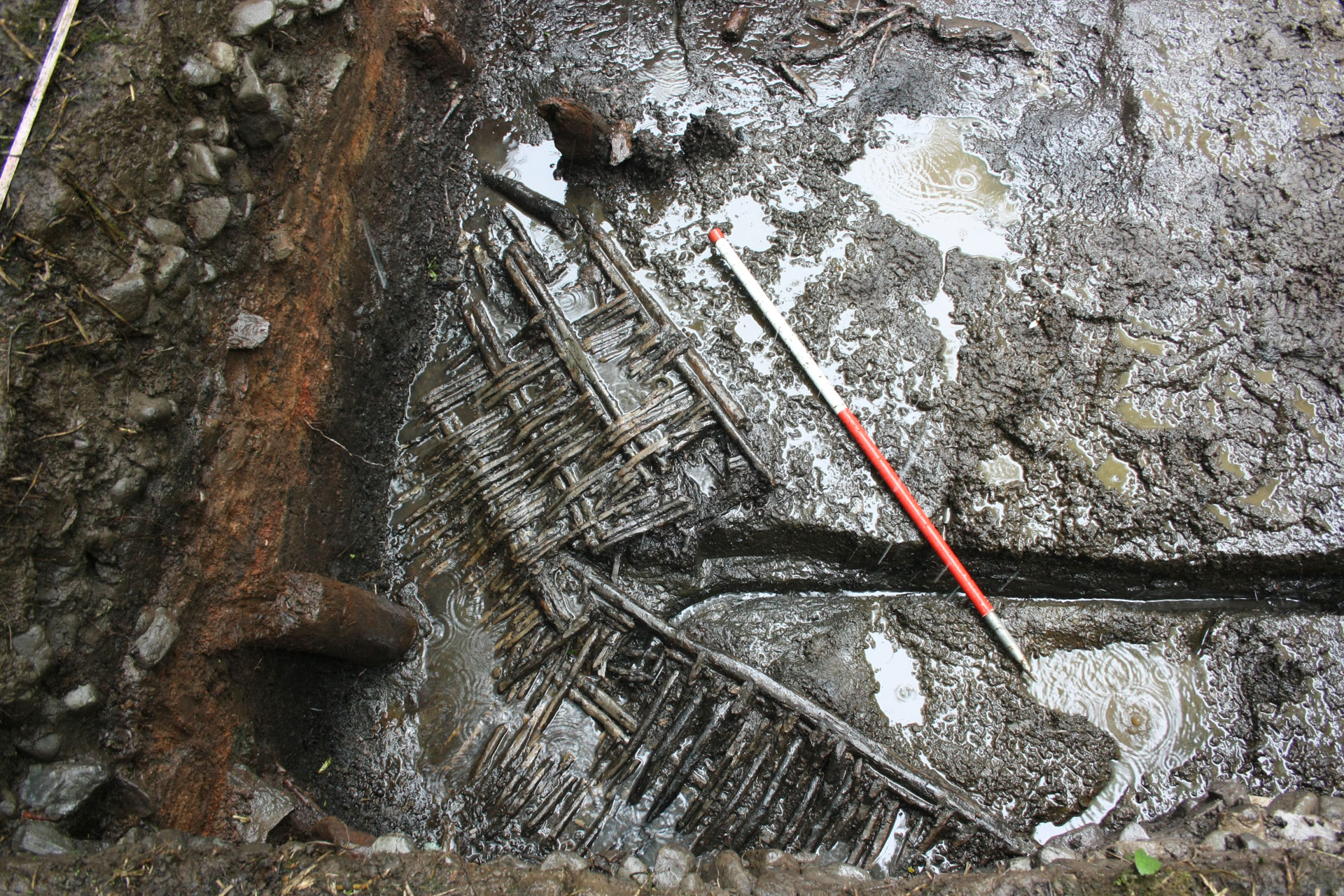
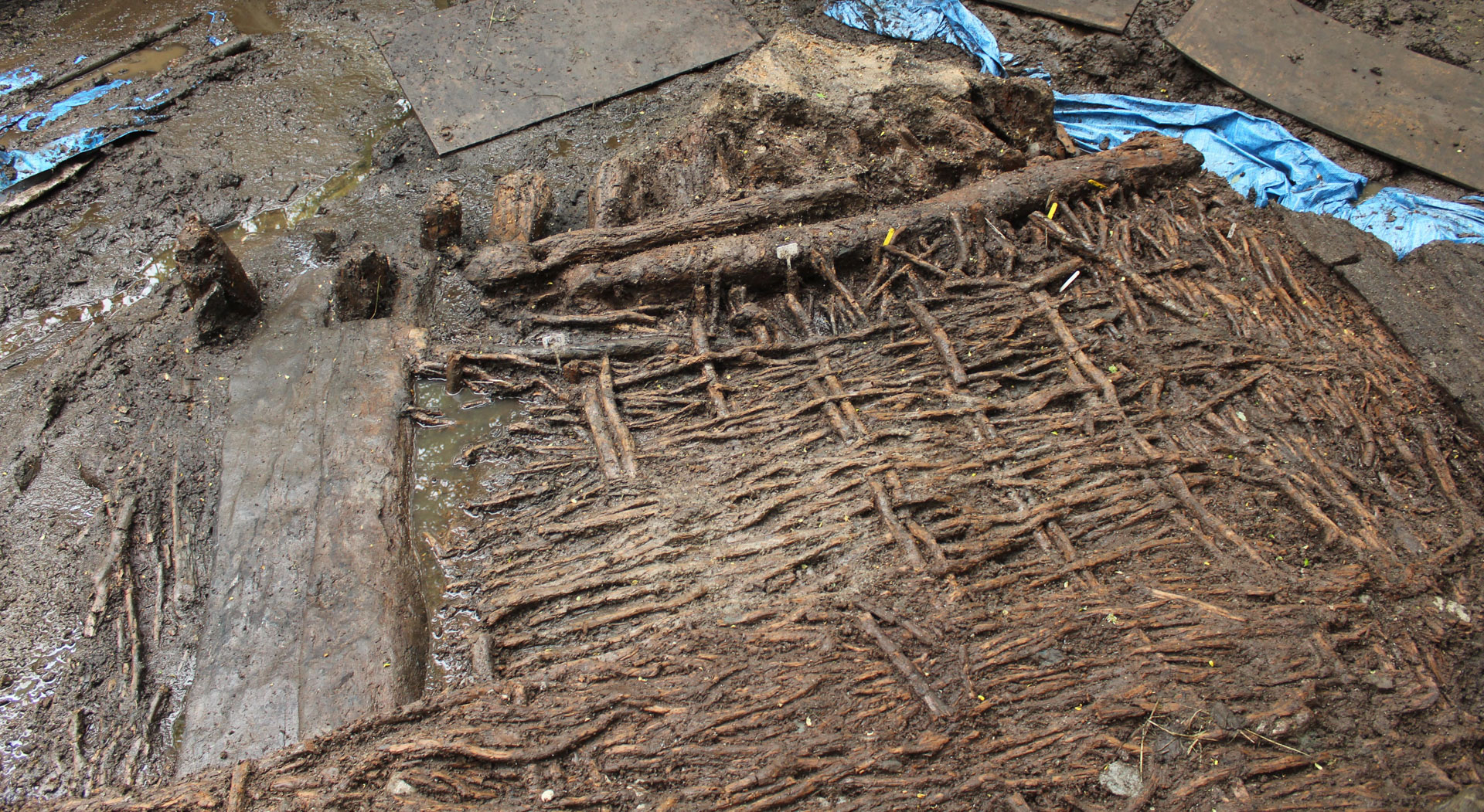 The trackway remained in use and was resurfaced many times, particularly in the entrance area.
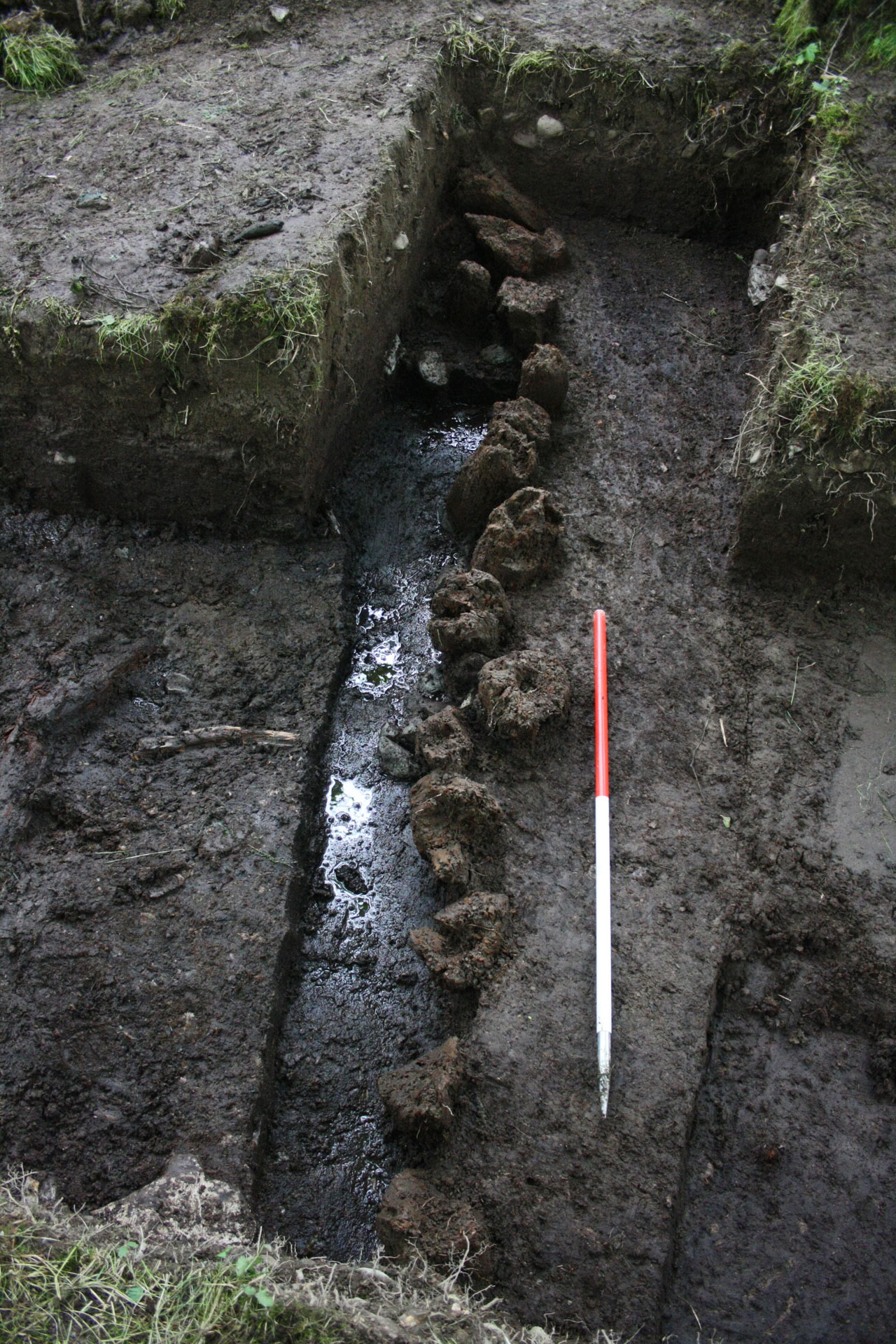 The settlement was surrounded by a defensive earthen rampart and timber palisade.
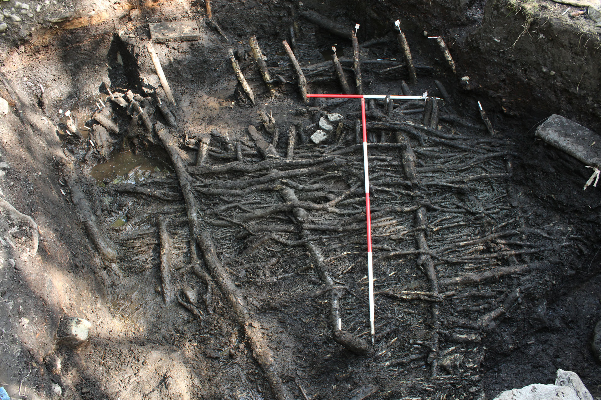 The house walls were built with wickerwork around a ring of slender stakes.
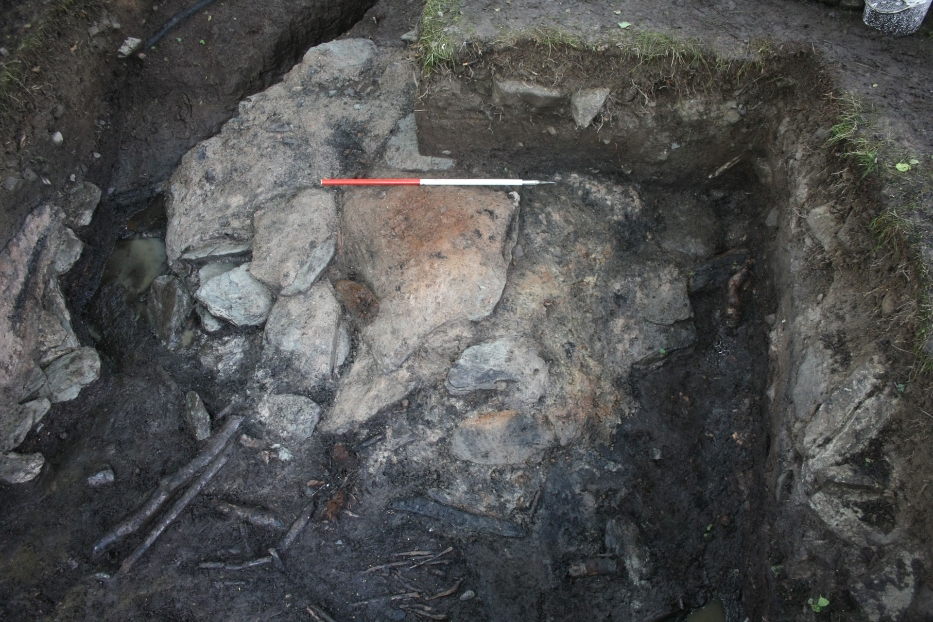
 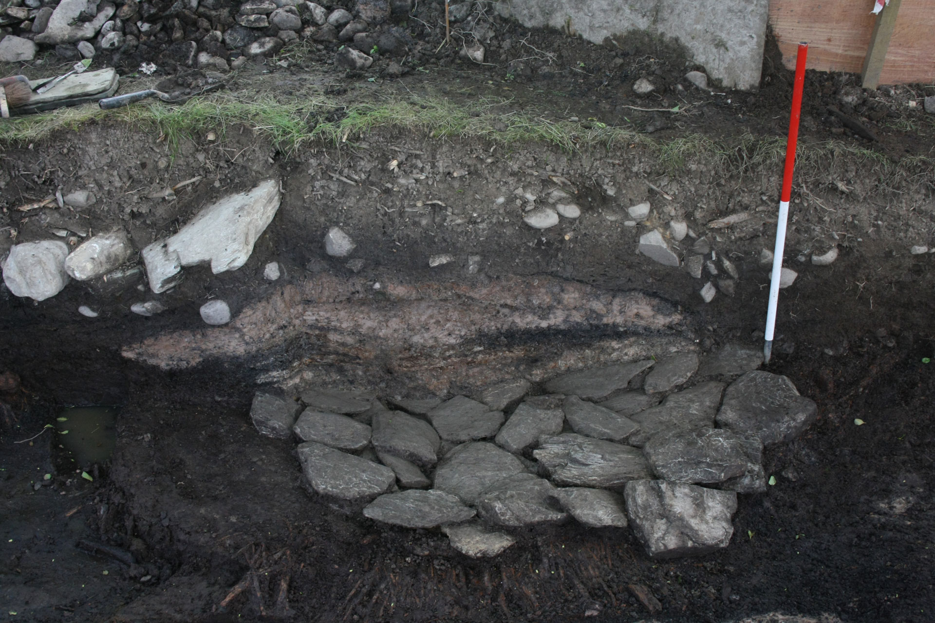 Two clay ovens used for food production were found within this roundhouse.
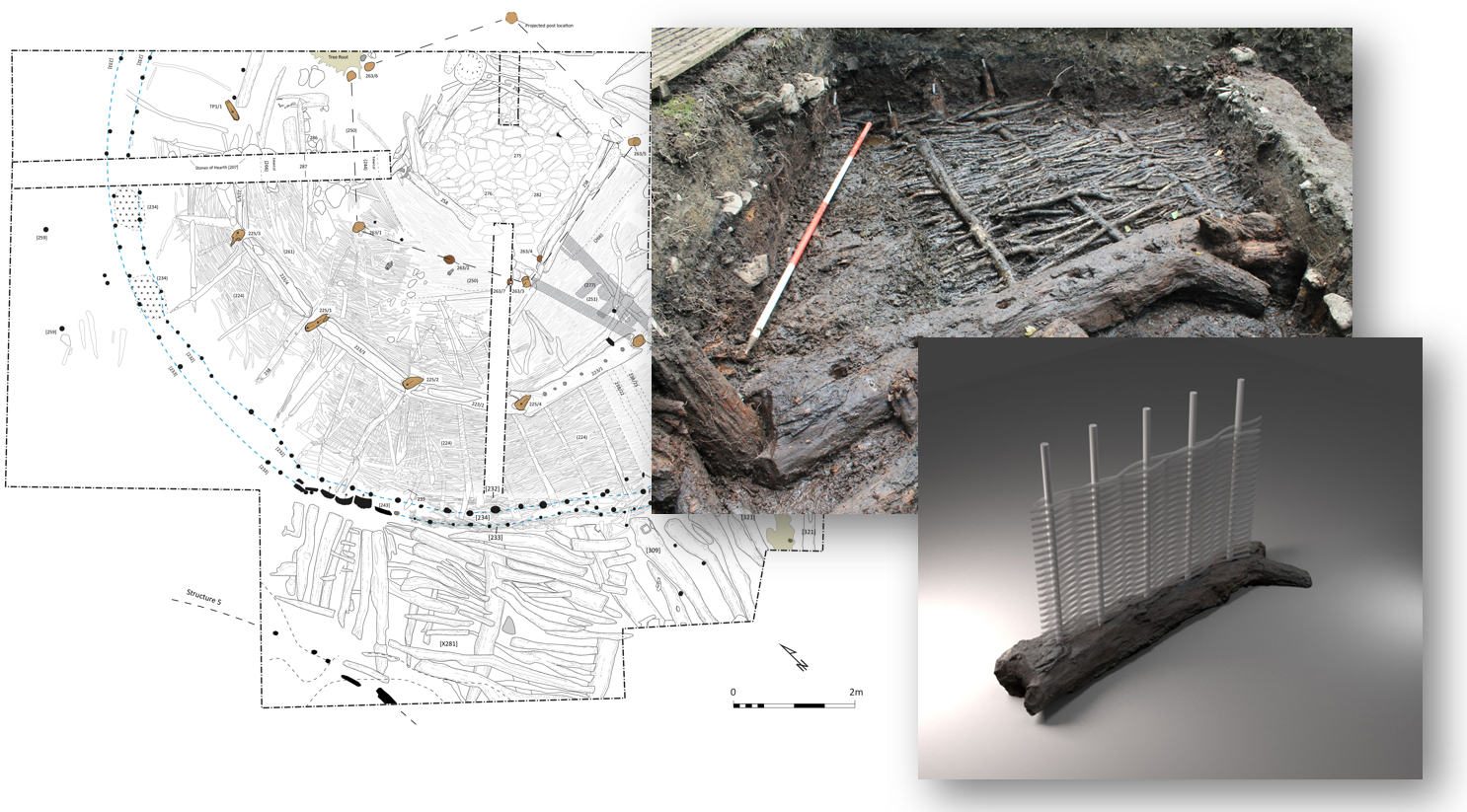 Site plans and photographs were used to create the features shown in the reconstruction images.


Episode 3: Defending the Island
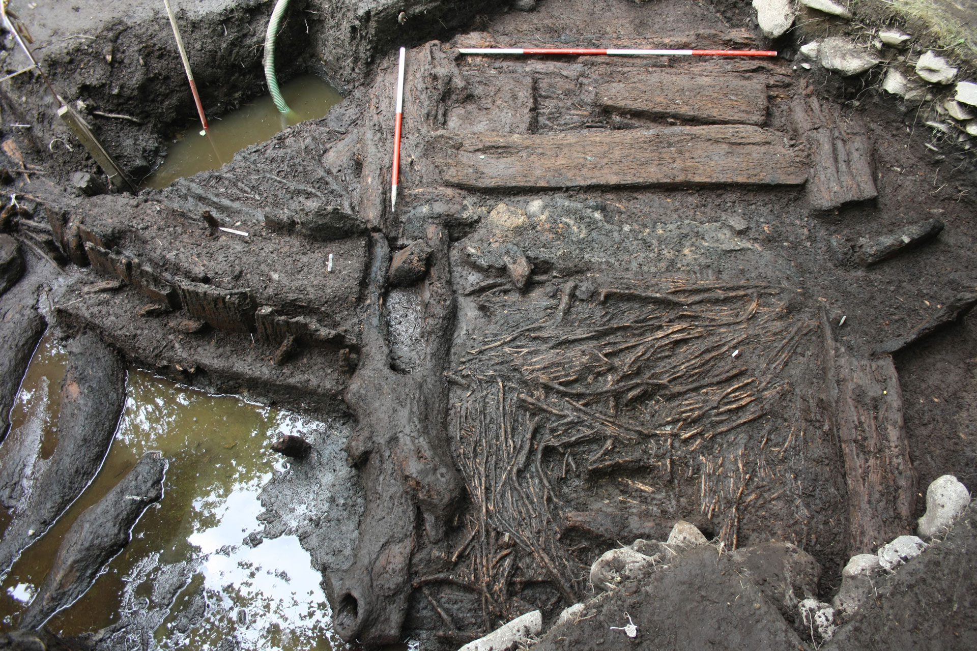
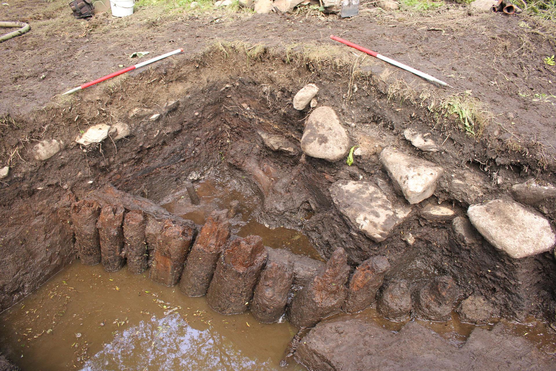
Little evidence remains for the occupation of the island during the final Episode other than in the form of defensive structures around the entrance. There was frequent rebuilding of these structures over a period of 55 years from 278-6 BC to 223 BC. The defensive perimeter consisted of an earthen bank with an exterior palisade of posts and a barrier of posts on either side of the trackway at the island’s entrance.
Later, the perimeter was significantly strengthened and the entrance realigned. The main earthen rampart and external palisade were still used, but a second palisade of massive oak planks was also built in the littoral zone in 243 BC. There is no evidence for activity on the island after this period and it is thought that the settlement was finally abandoned in the early 2nd century BC.
 A palisade of large oak planks set vertically into the peat surrounded the island.
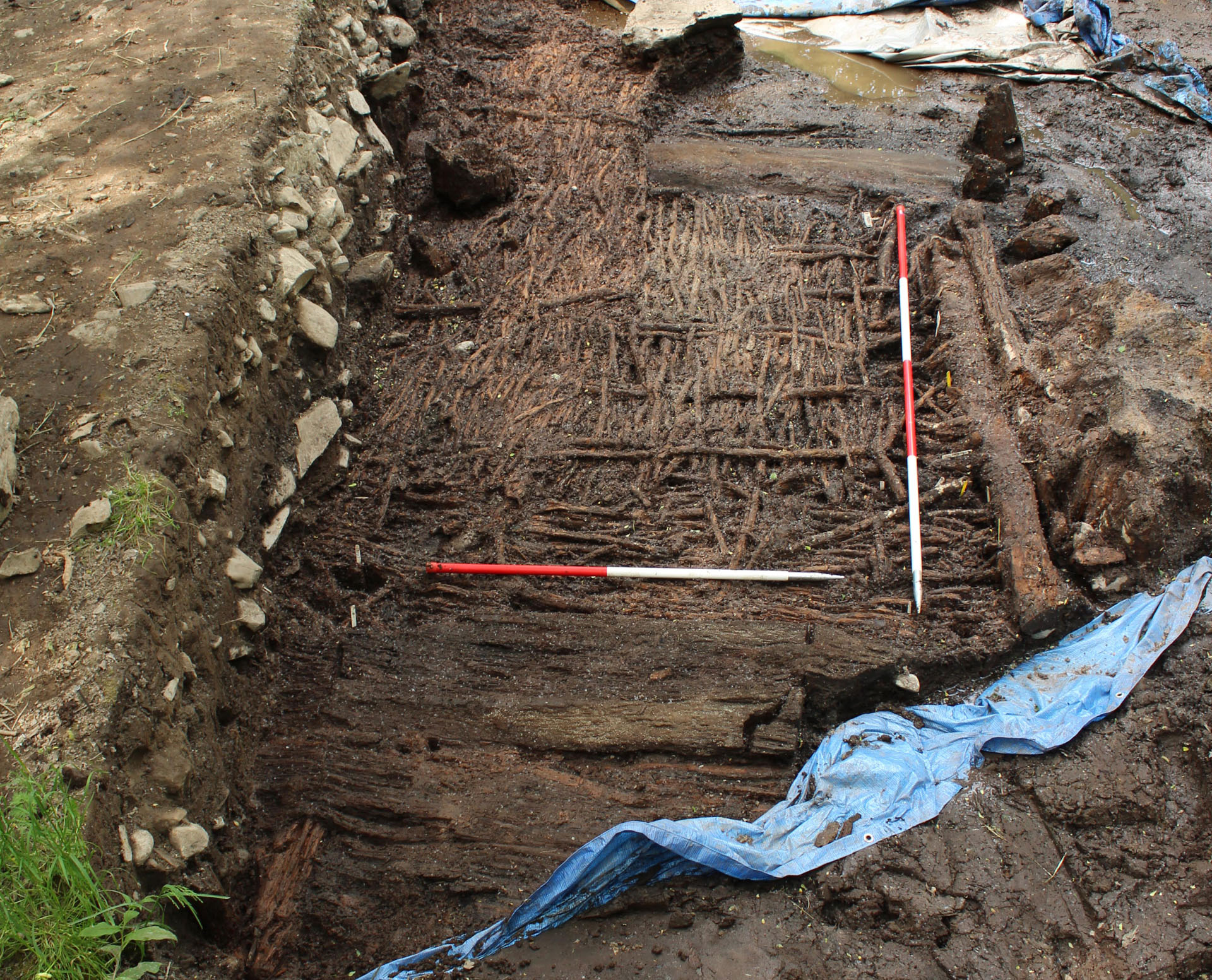 A plank mat appears to have been built over the Episode 2 trackway.
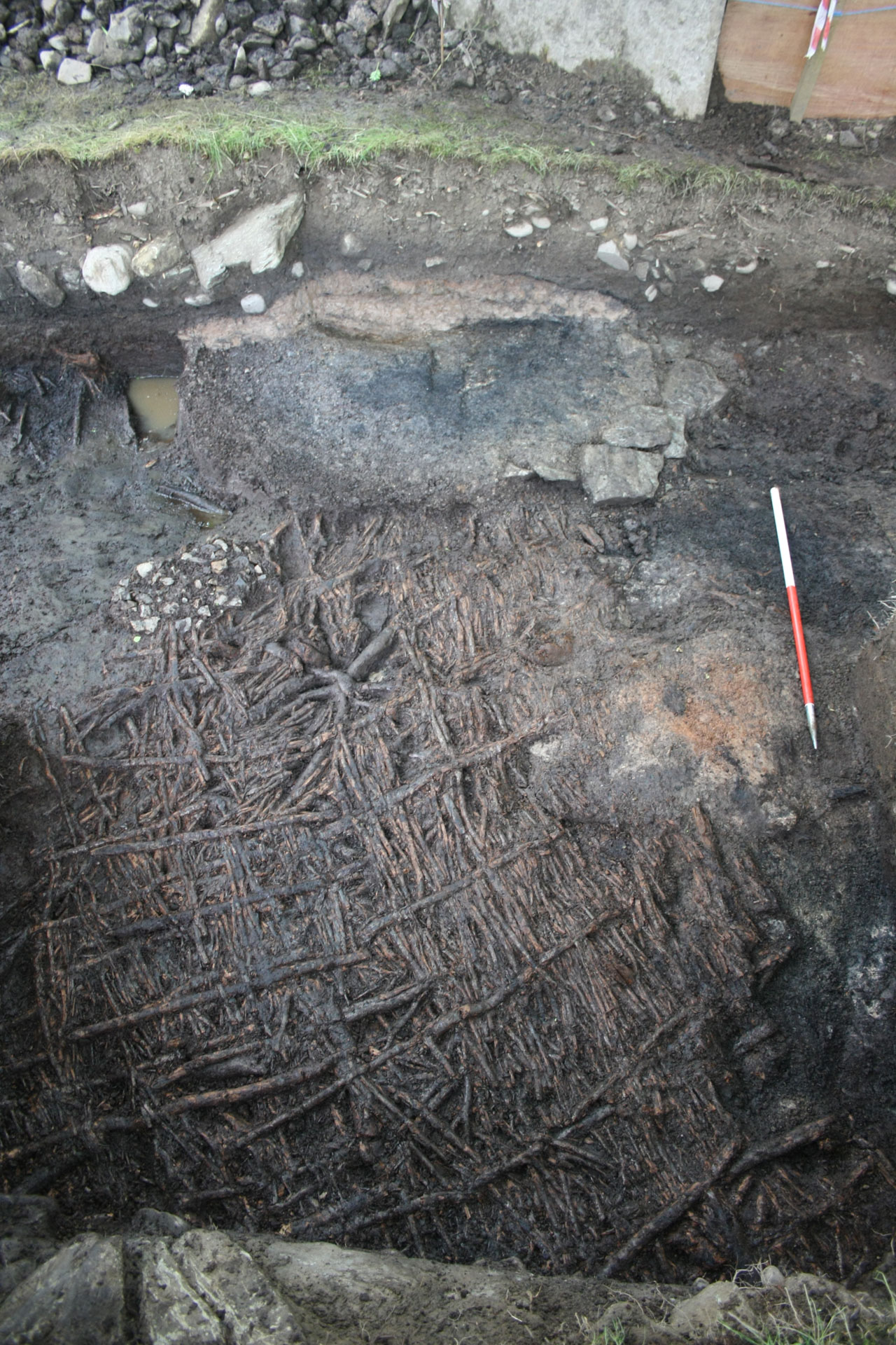
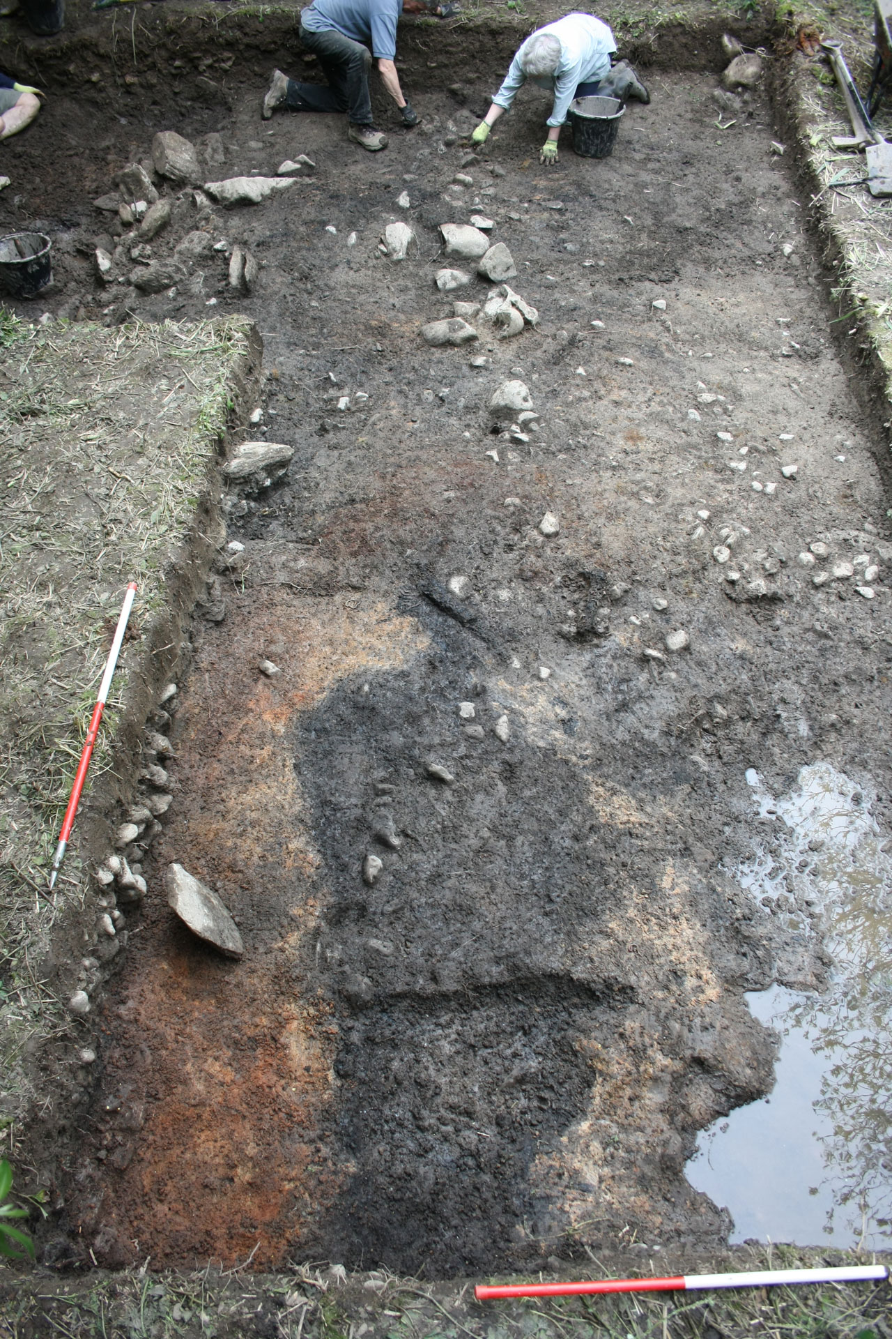 An earthen rampart was built behind the palisades enclosing the south of the island.
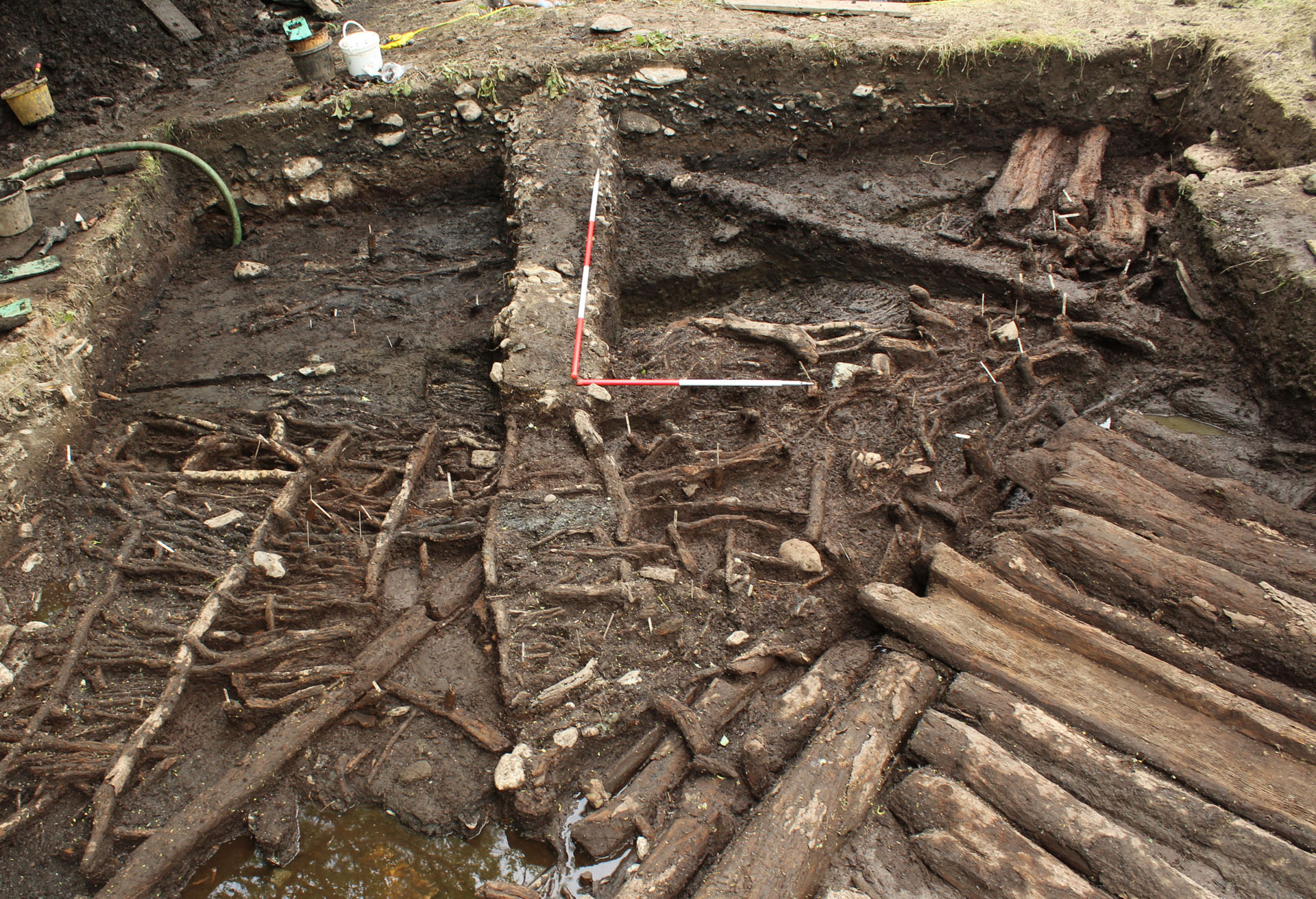
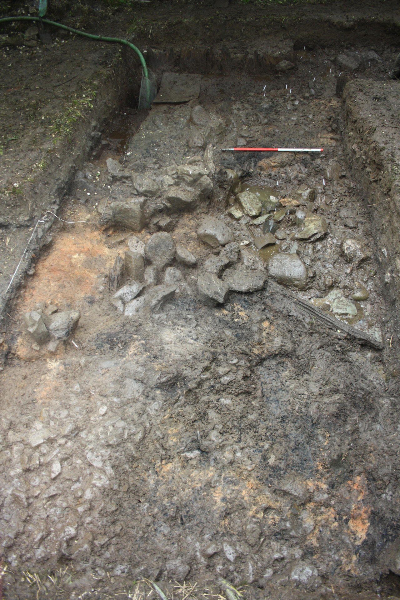
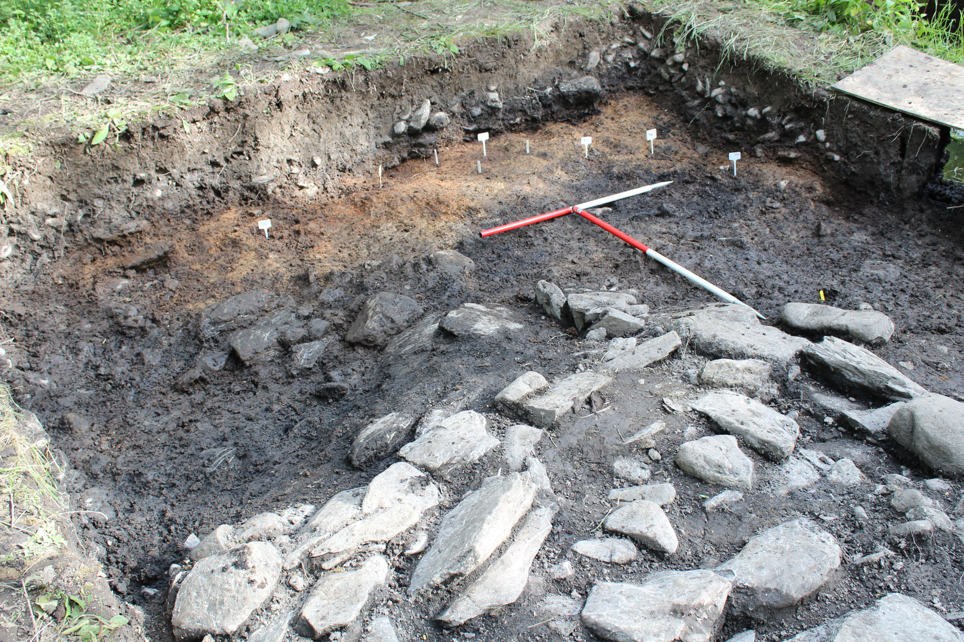
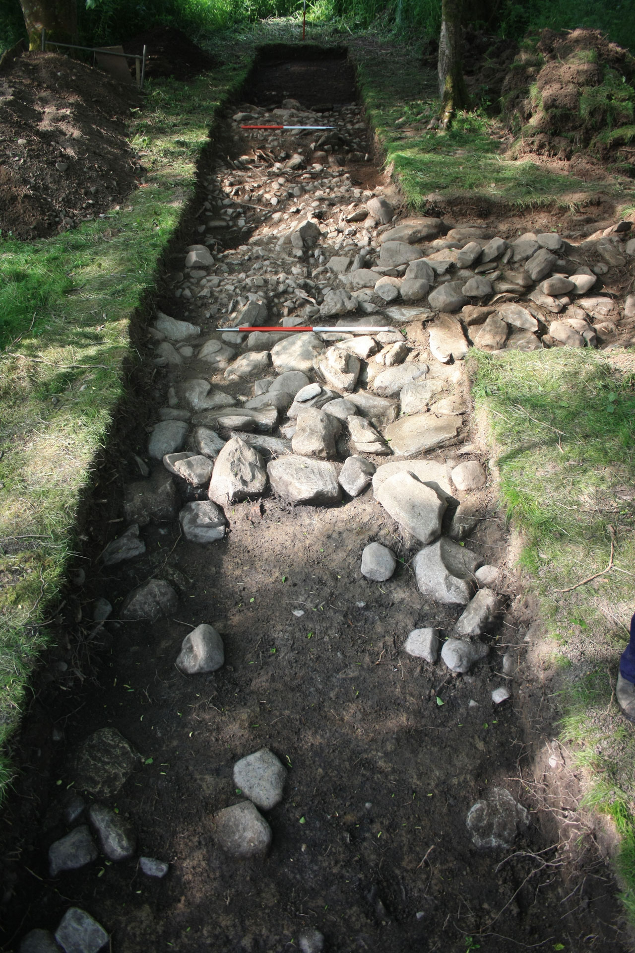 Limited evidence was found for the nature of the settlement during this Episode, though large stone surfaces and walls were uncovered.


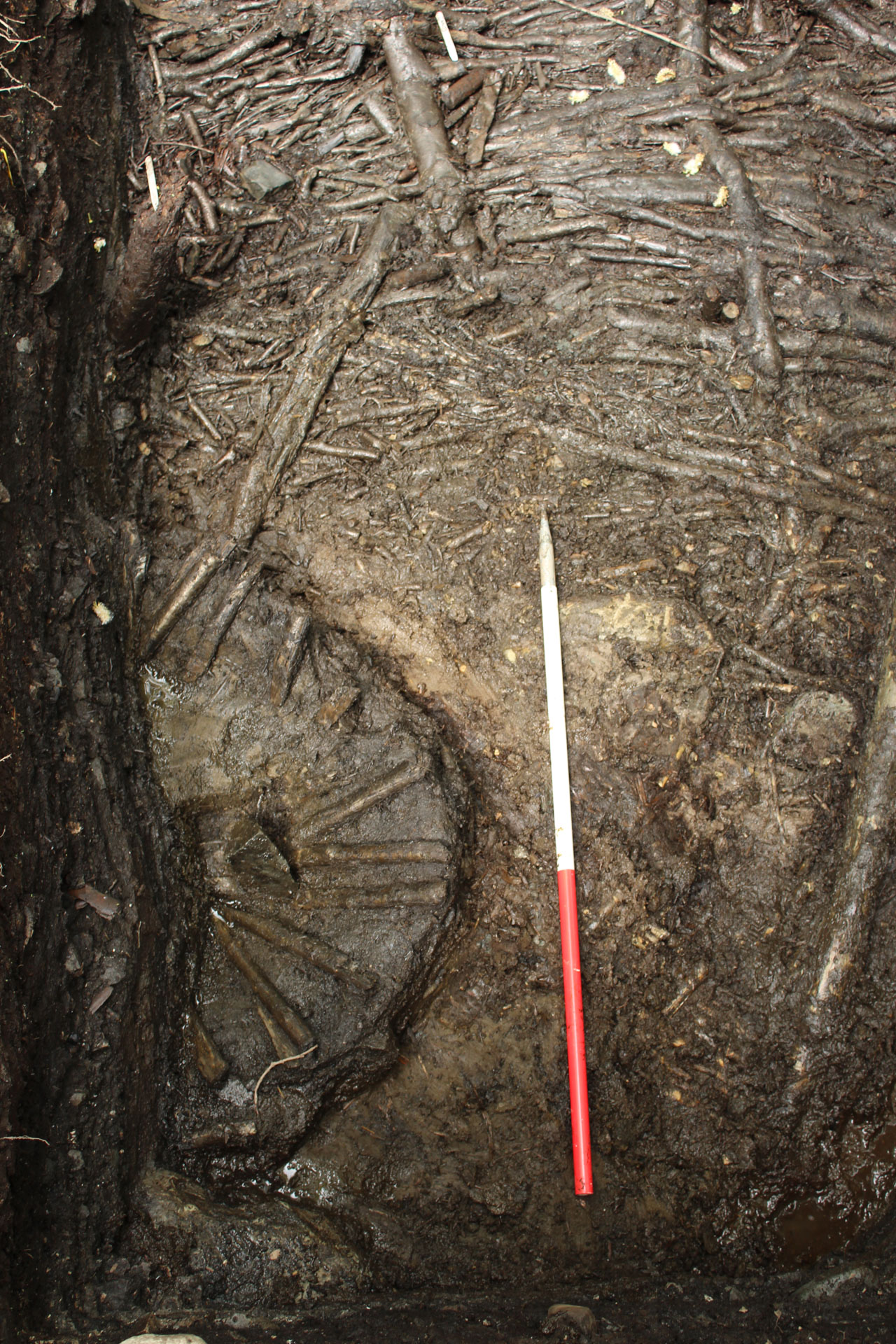
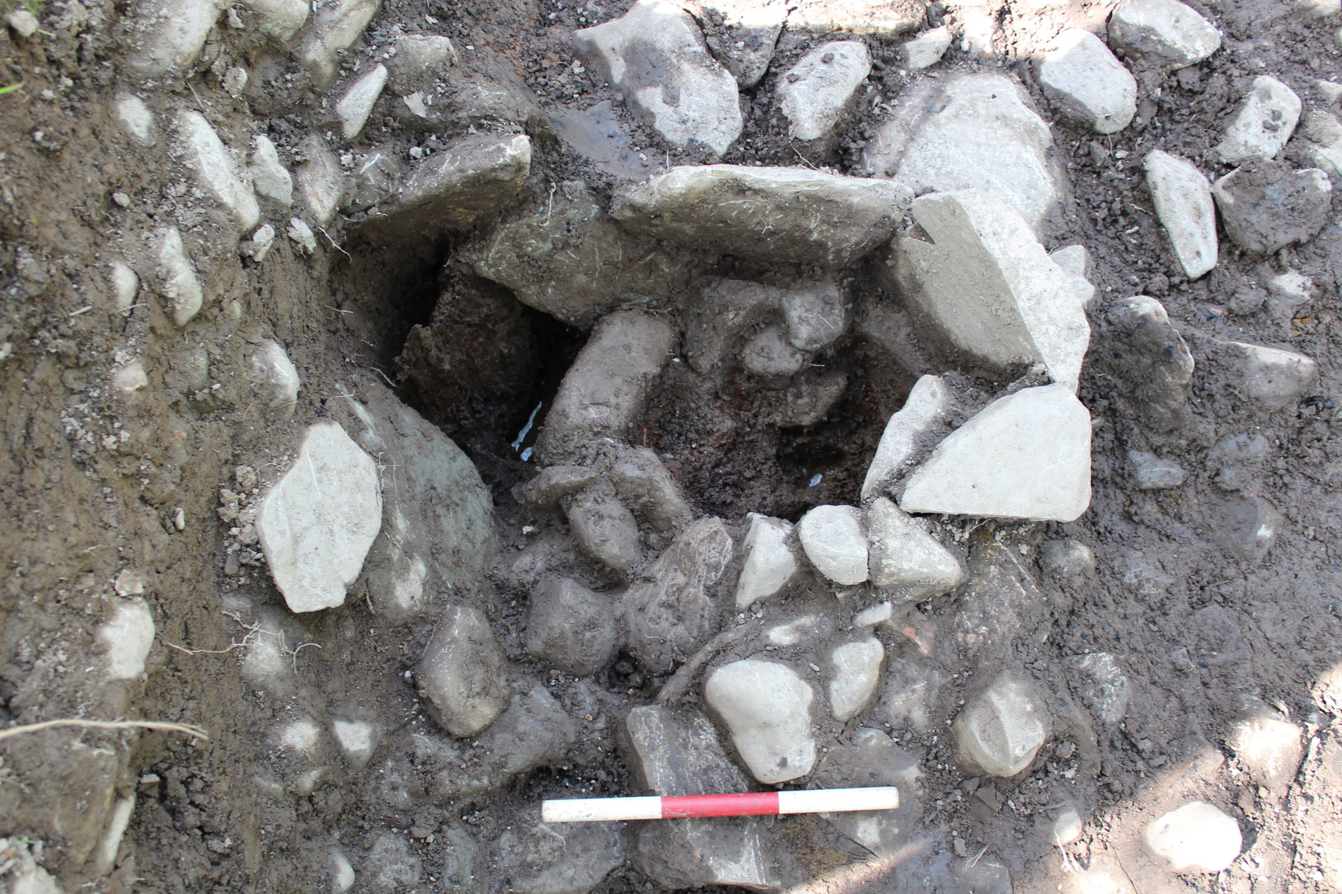
 with the stones of Hearth 8 in the foreground")


Explore by Map
Scroll through the map below to view the layout of the settlement during each Episode. Use the controls in the map to zoom in and out and view the trenches in more detail.
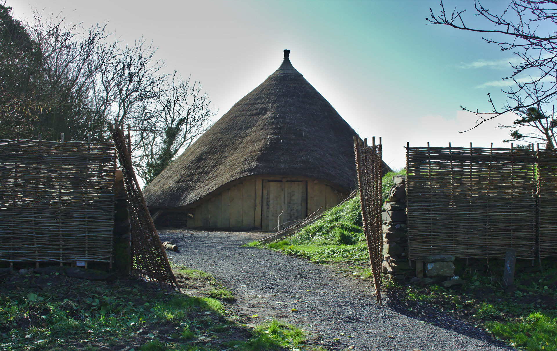
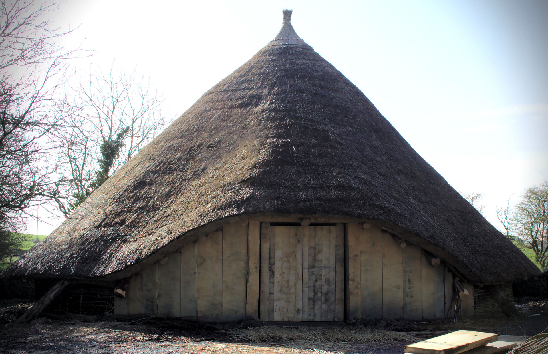
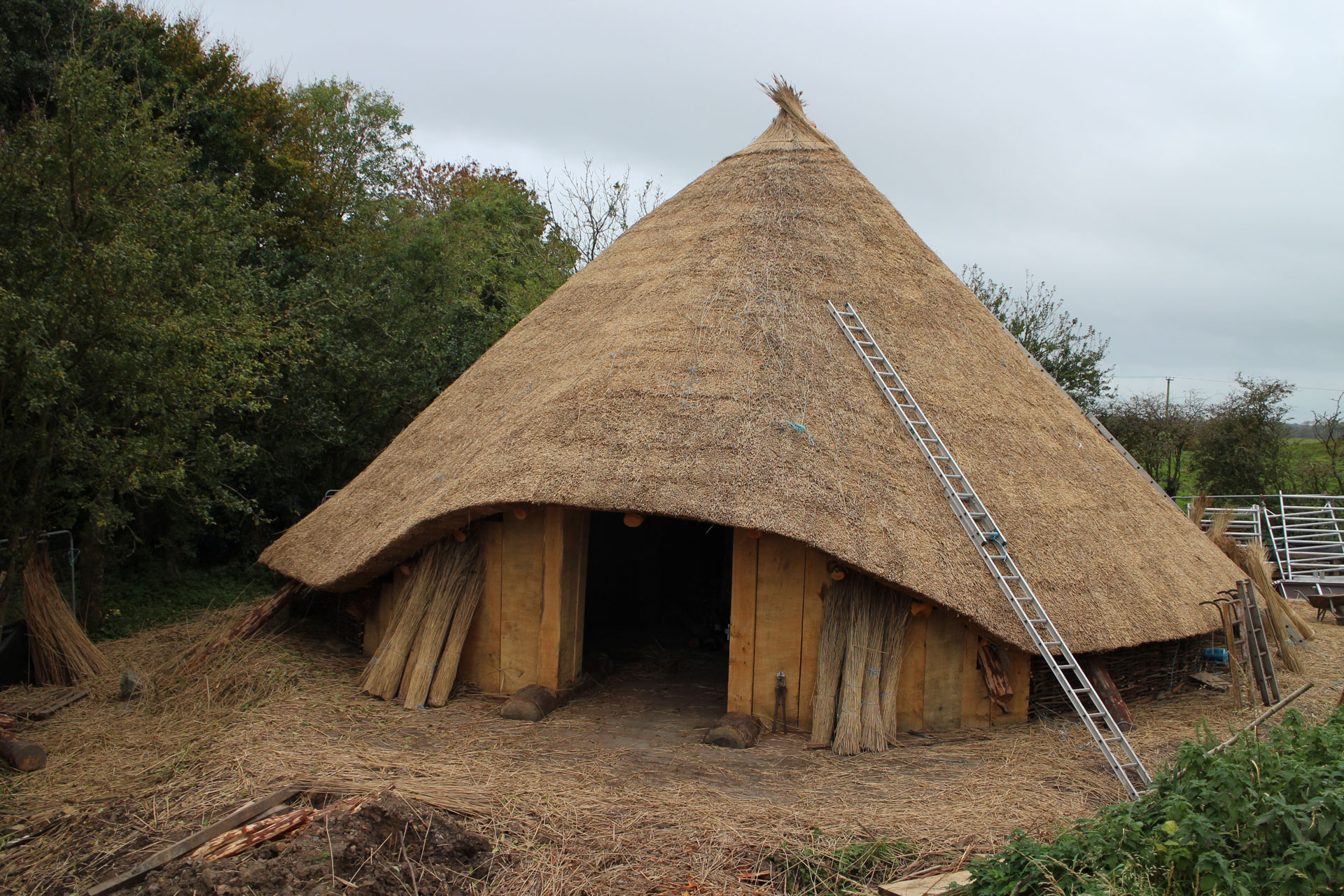
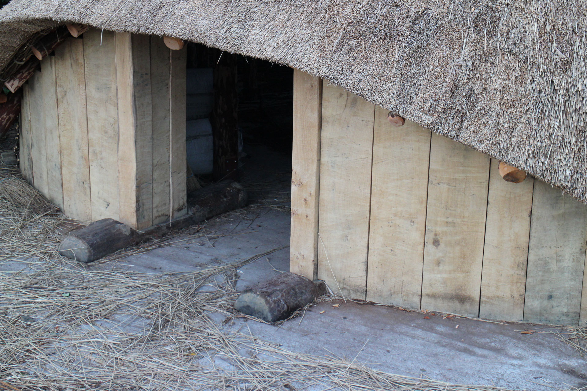
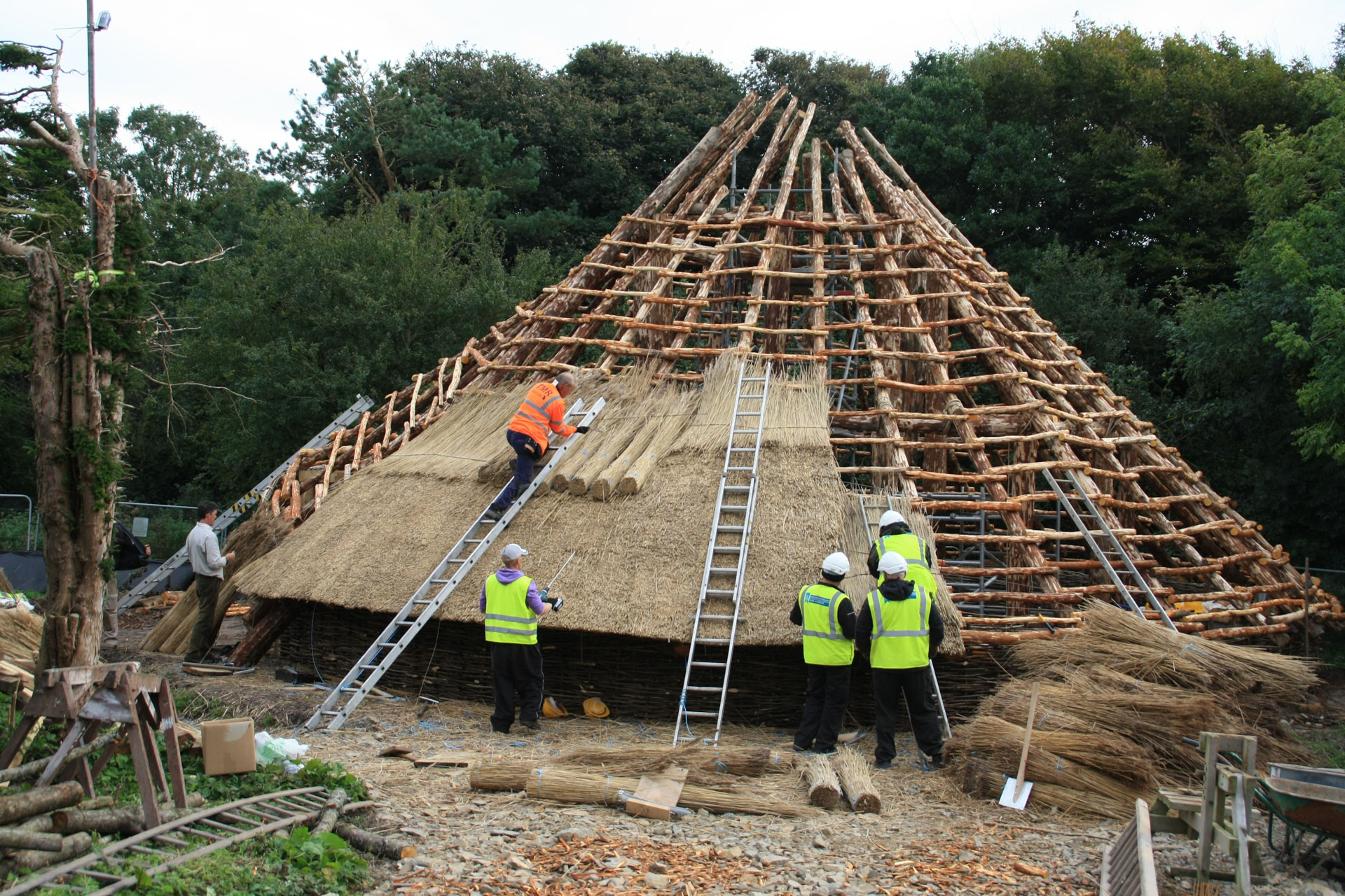
Reconstructing the Roundhouse
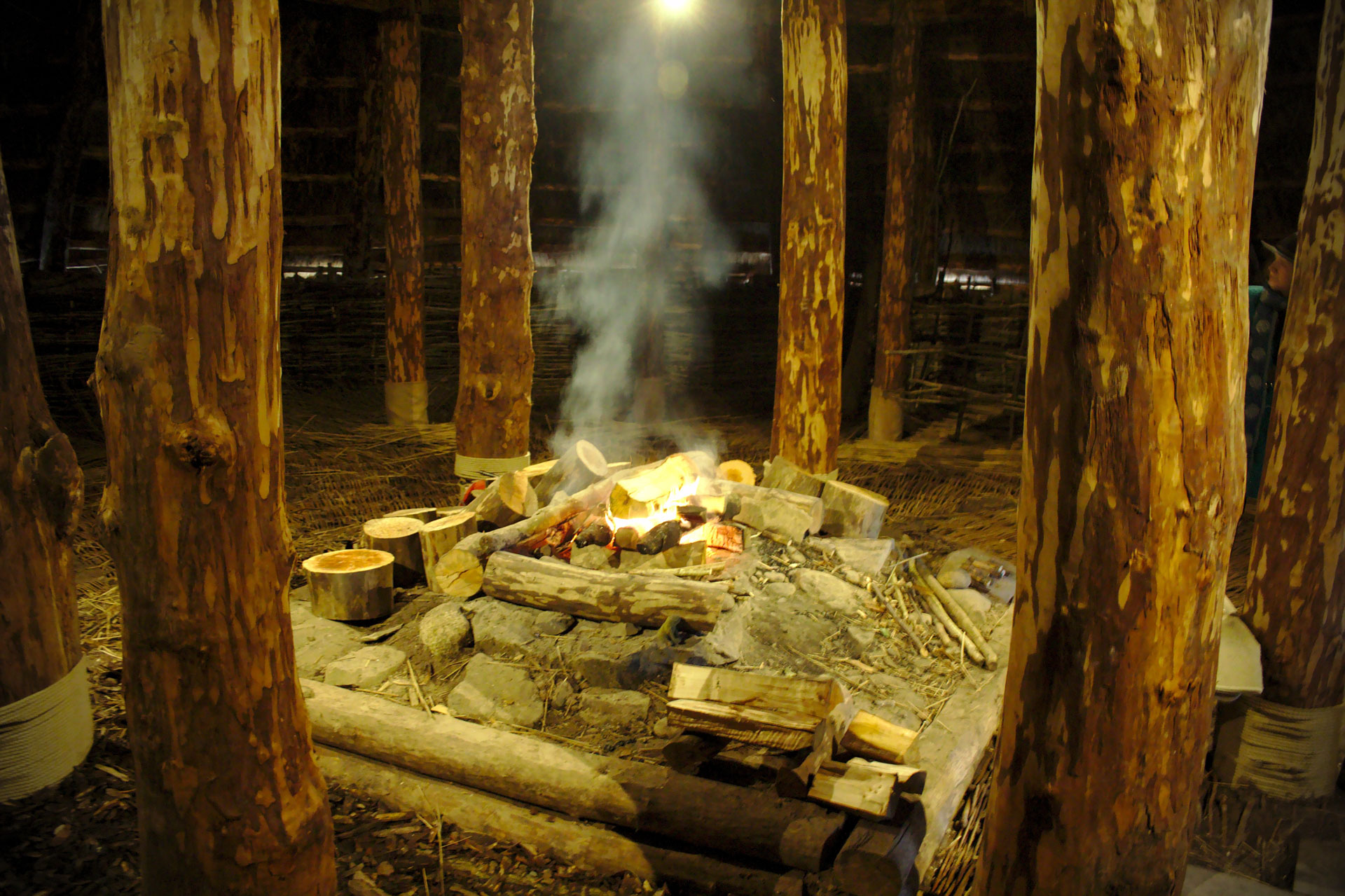
In 2016, the Whithorn Trust reconstructed a life-size replica of the Black Loch roundhouse using as many details as possible from the original to inform the construction. Members of the public, students and school pupils joined with craftspeople on the site as they wove wattle, thatched with reeds, and worked with oak, hazel, willow and alder.
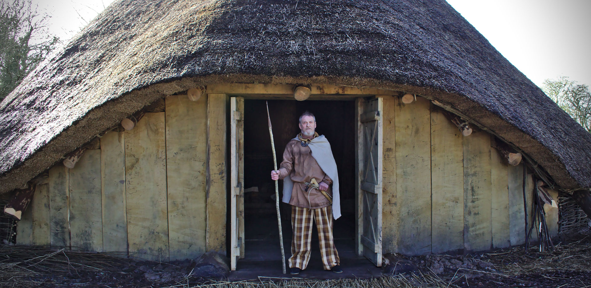
A reenactor stands in the entrance of the reconstructed roundhouse


Dendrochronology
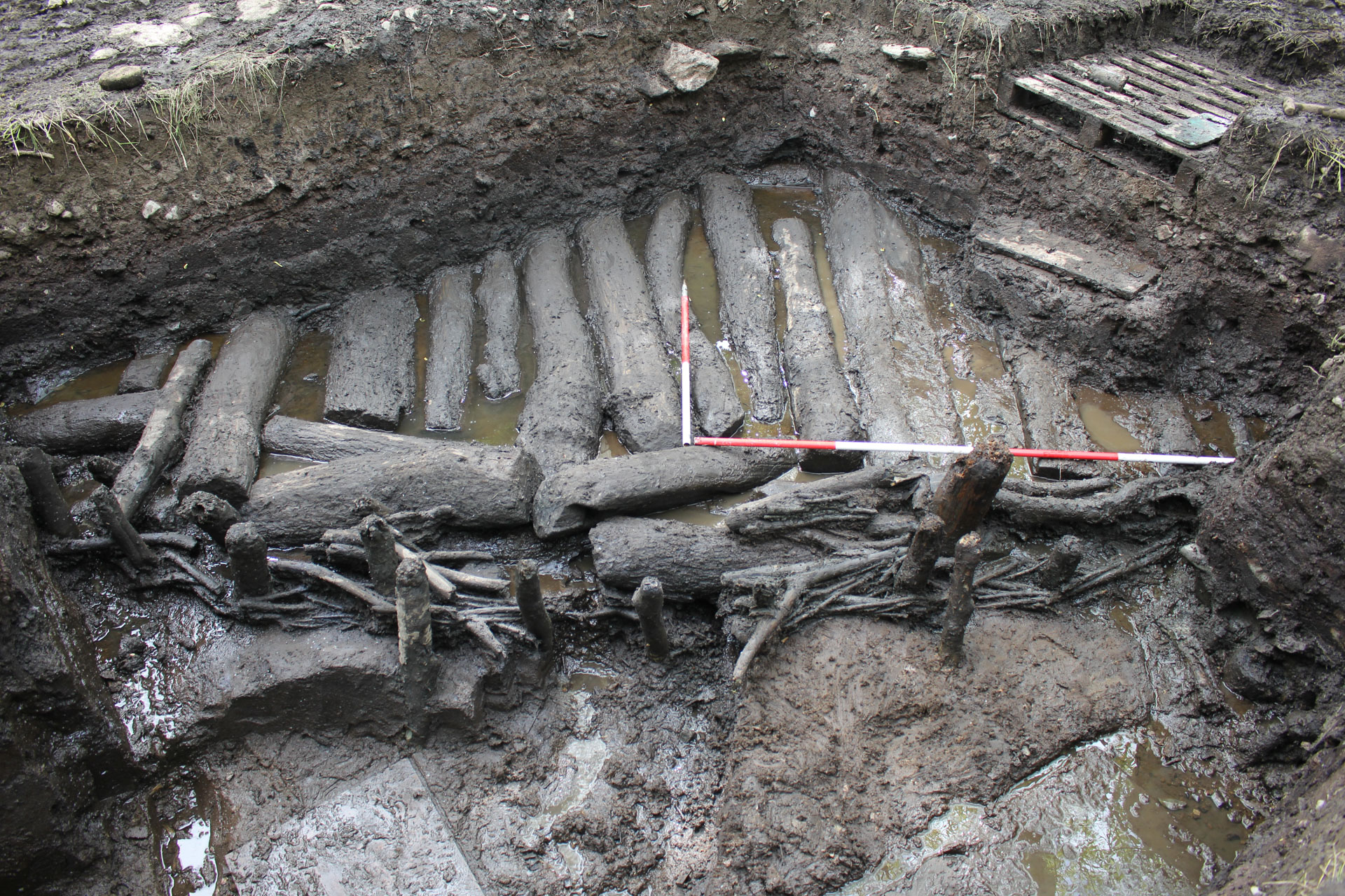
The use of Dendrochronology allowed archaeologists to get precise calendar dates for the activity at Black Loch of Myrton. Dendrochronology is the analysis of tree growth rings, which can be linked to sequences of tree rings with known calendar dates. A lot of wood samples were analysed after the excavations, with dendrochronology used to indicate the felling dates of trees used in the construction of timber features, such as the palisades, trackways and roundhouses. These dates were corroborated by radiocarbon dating of organic materials, such as charcoal and plant seeds or grains.
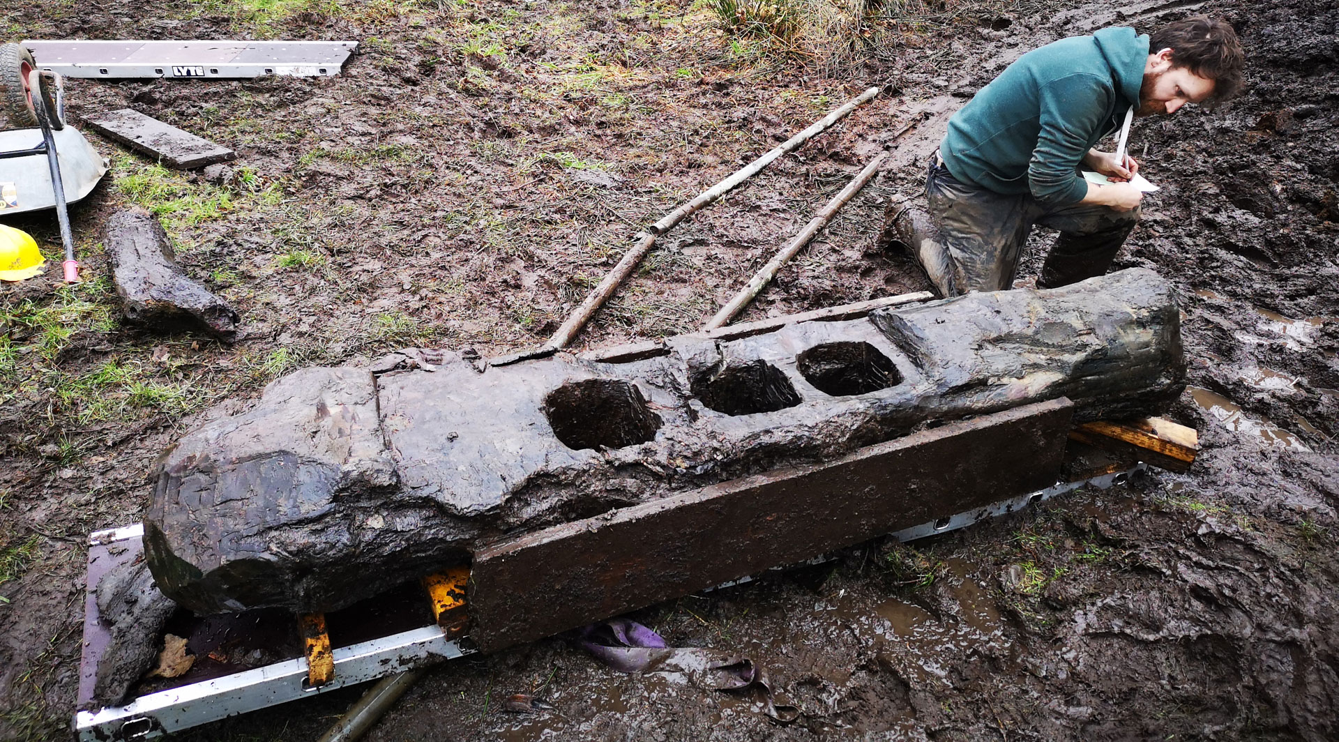
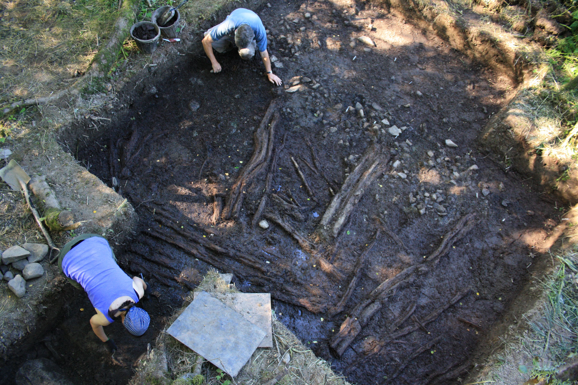
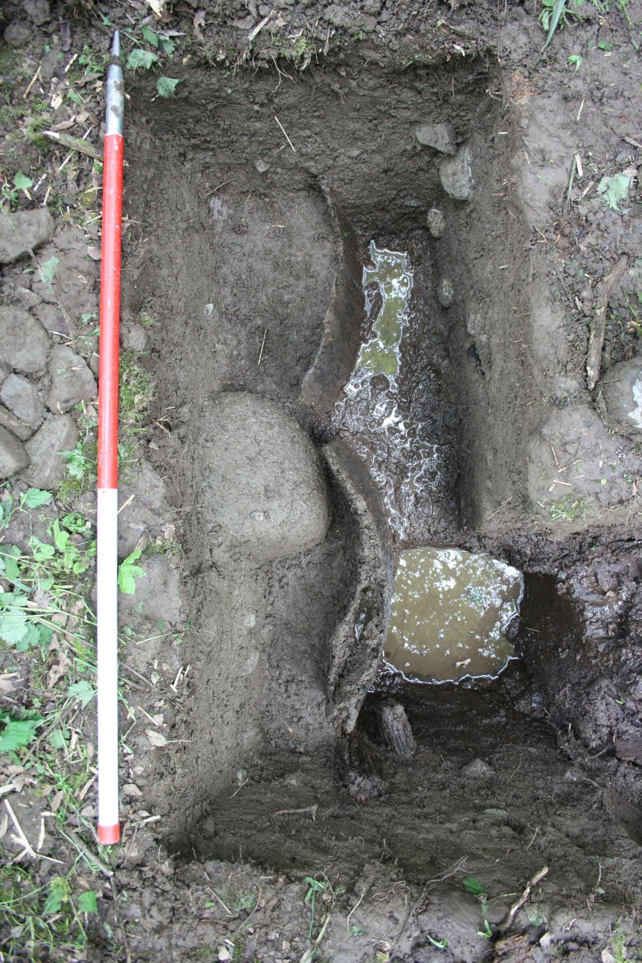
An archaeologist records a worked timber during the excavations
Woodworking
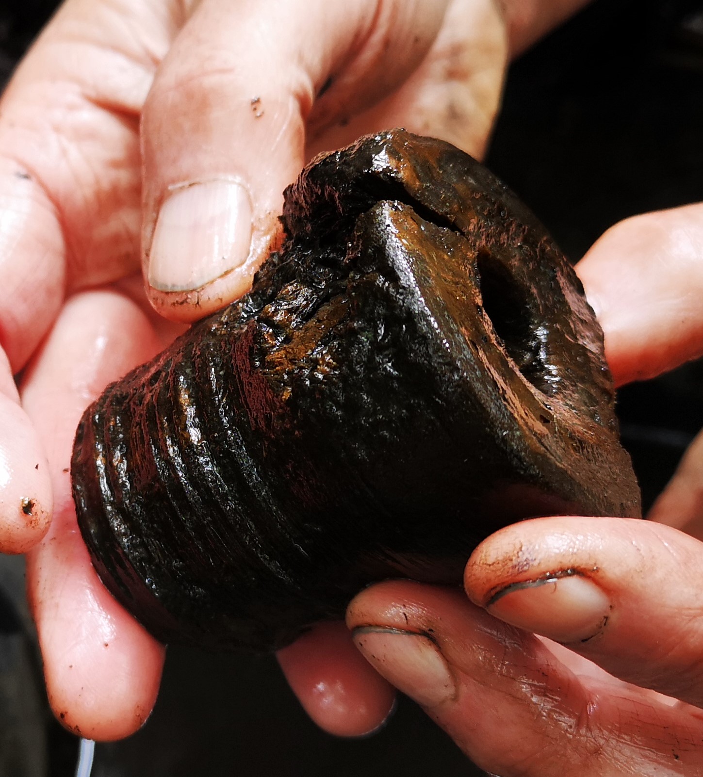
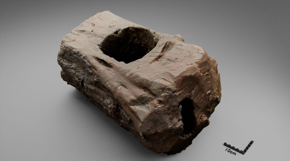
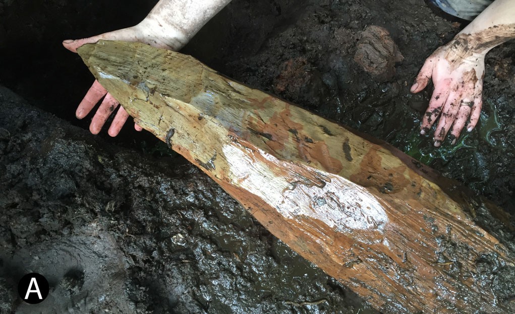
The conditions at Black Loch of Myrton meant that wooden structural features and artefacts were preserved across the site, providing a rare insight into Iron Age woodworking. The majority of timbers on site were used as undressed roundwood with the only shaping being at the tips of stakes or the ends of horizontal logs. Many oak logs were also tangentially cleaved to make planks. Evidence of joinery came from simple joints where a post was set into a square or open-ended notch in another timber. Some logs also featured tow-holes, which would have facilitated the movement of these large timbers around the site. The entrance to roundhouse ST2 had the most complex evidence of carpentry in the settlement – explore the 3D model below.
A square notch for a post
The shaped end of a post
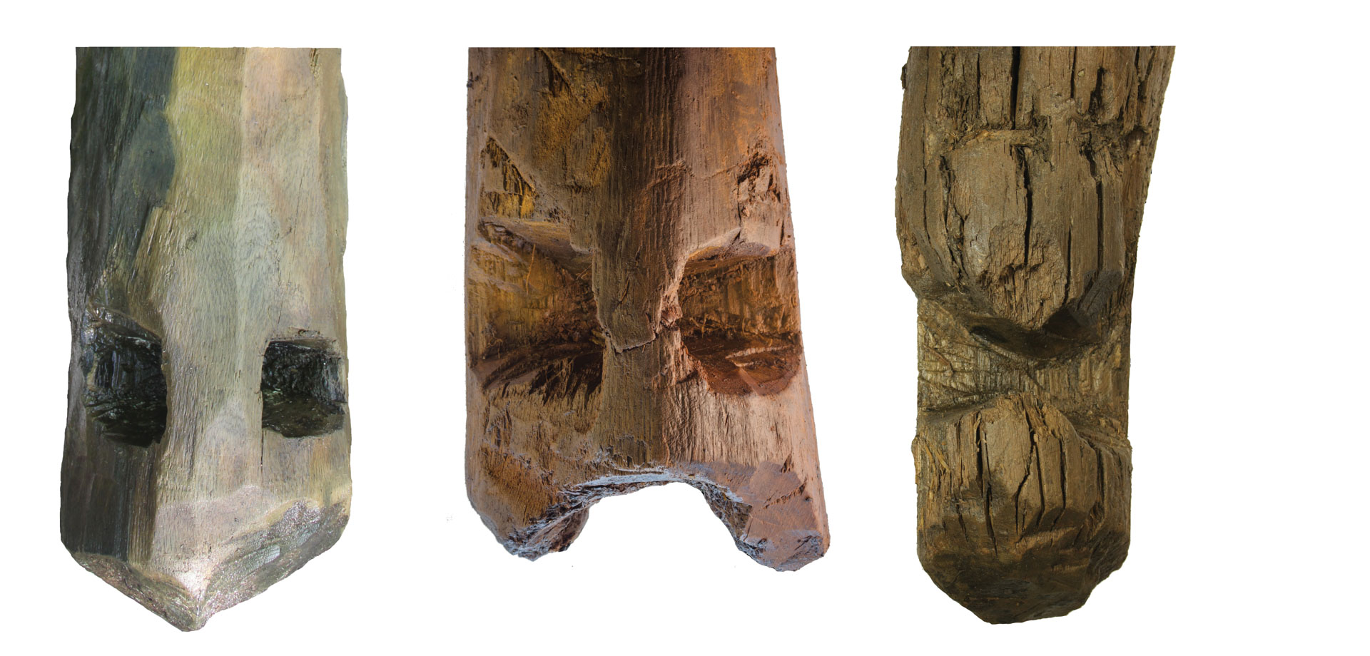
Tow holes found at the end of posts
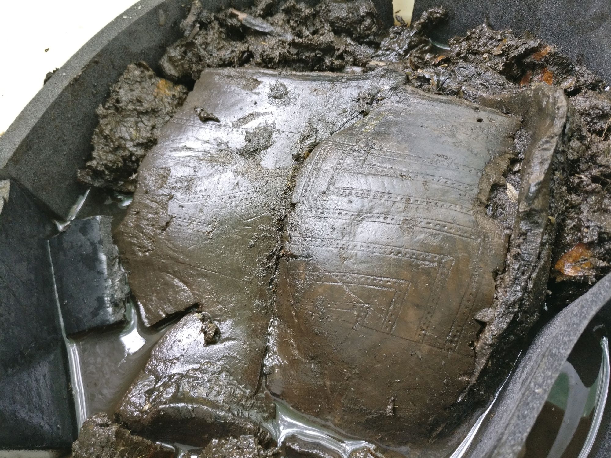
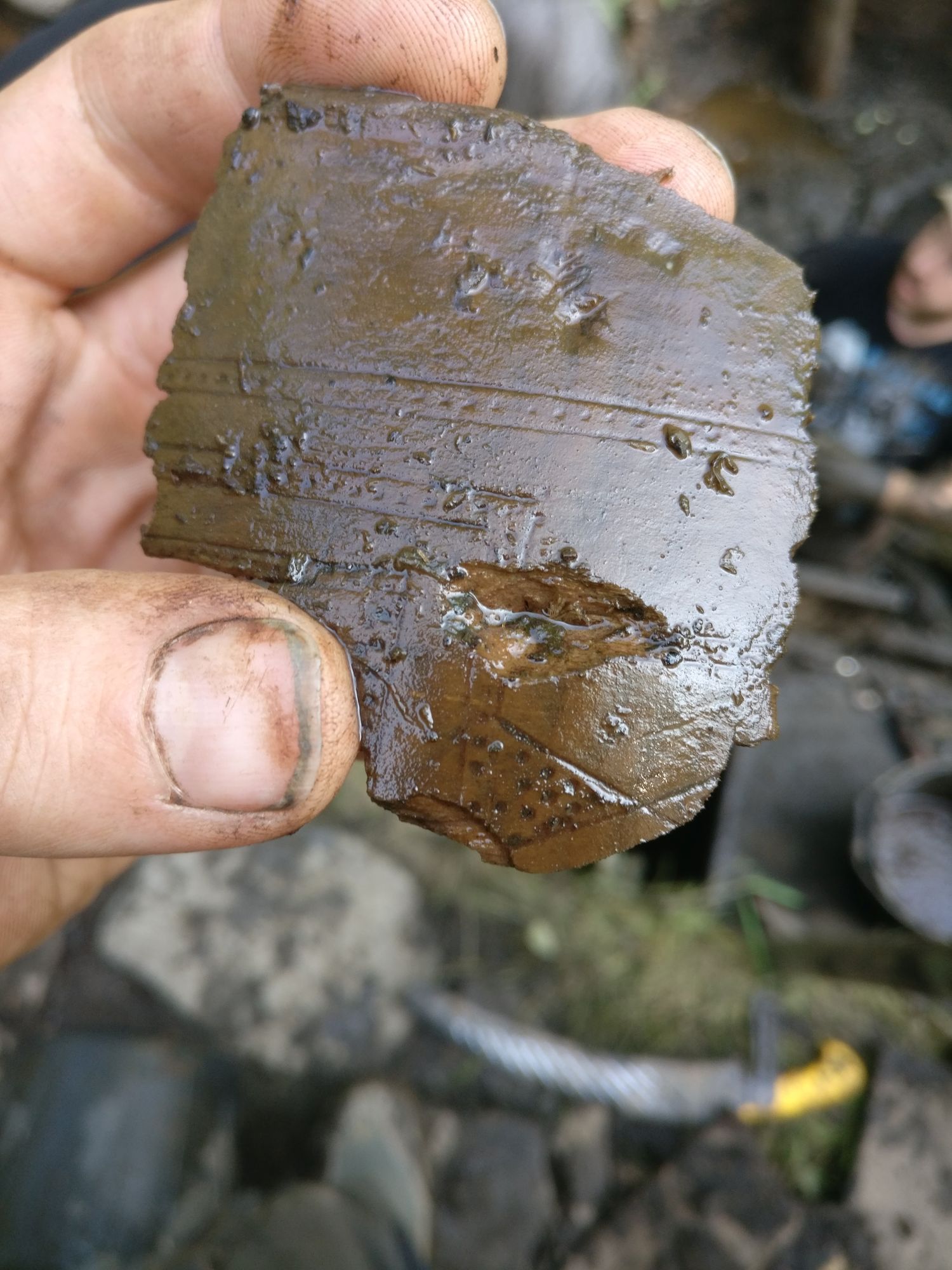
The Artefacts
Hover over each artefact to learn more about it.