Nestled within a bend in the River Clyde, archaeological monitoring works at a quarry uncovered a remarkable discovery: a prehistoric settlement concealed under 2.5m of peat.
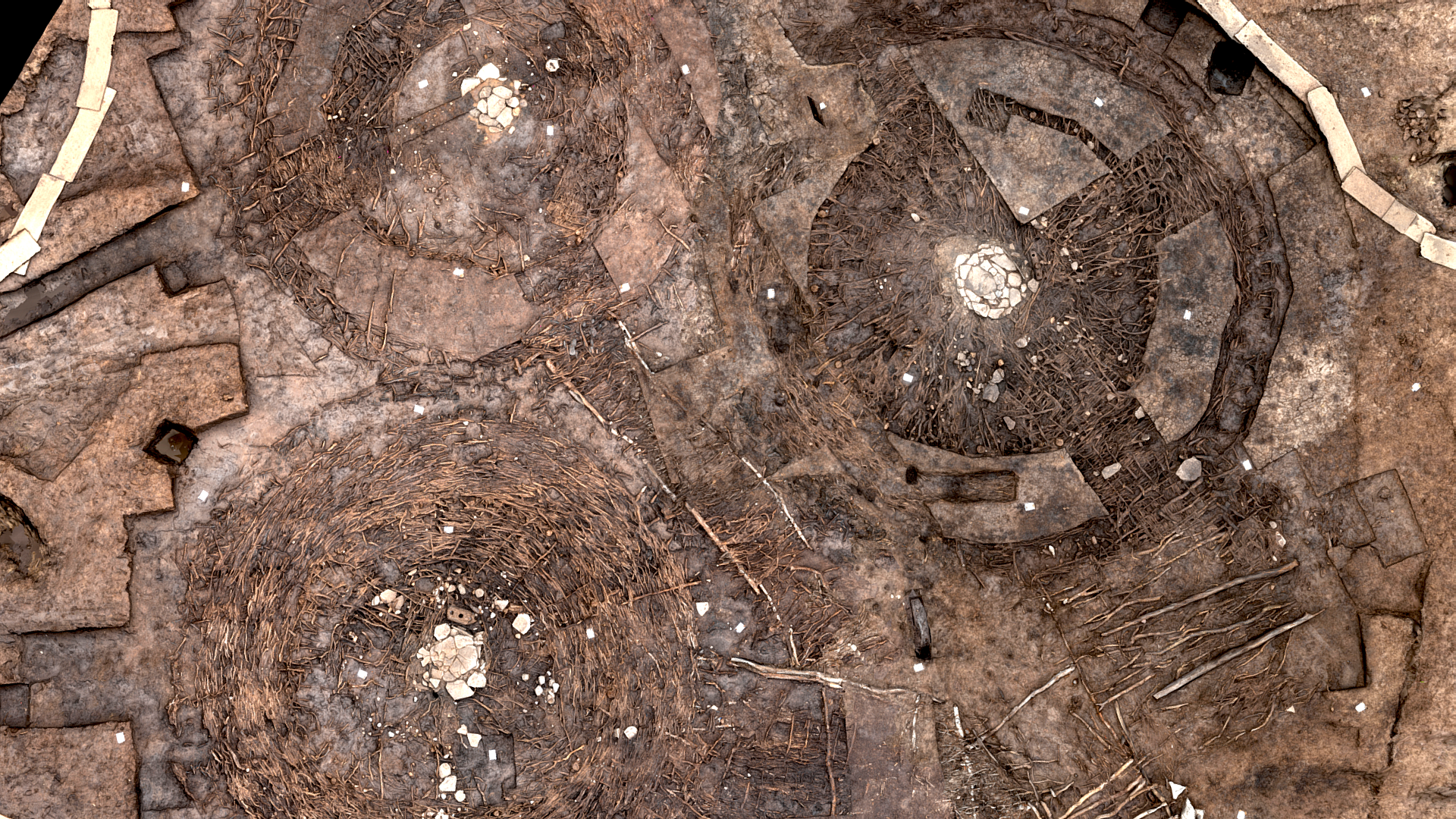
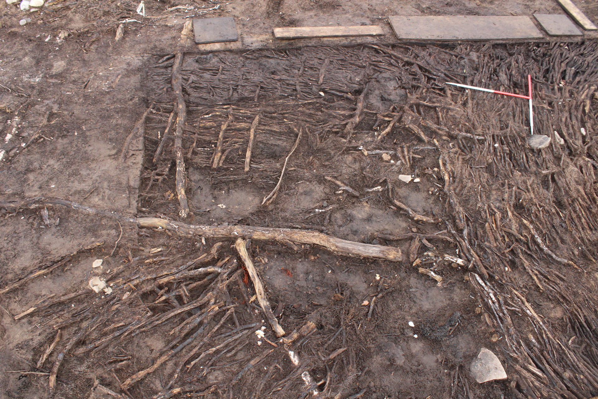
The settlement was a sub-circular fenced enclosure with brushwood pathways and surfaces linking three large timber roundhouses. Peat had preserved these structures in an astonishing condition, along with rare artefacts including shale and copper-alloy bracelets and two wooden wheels.
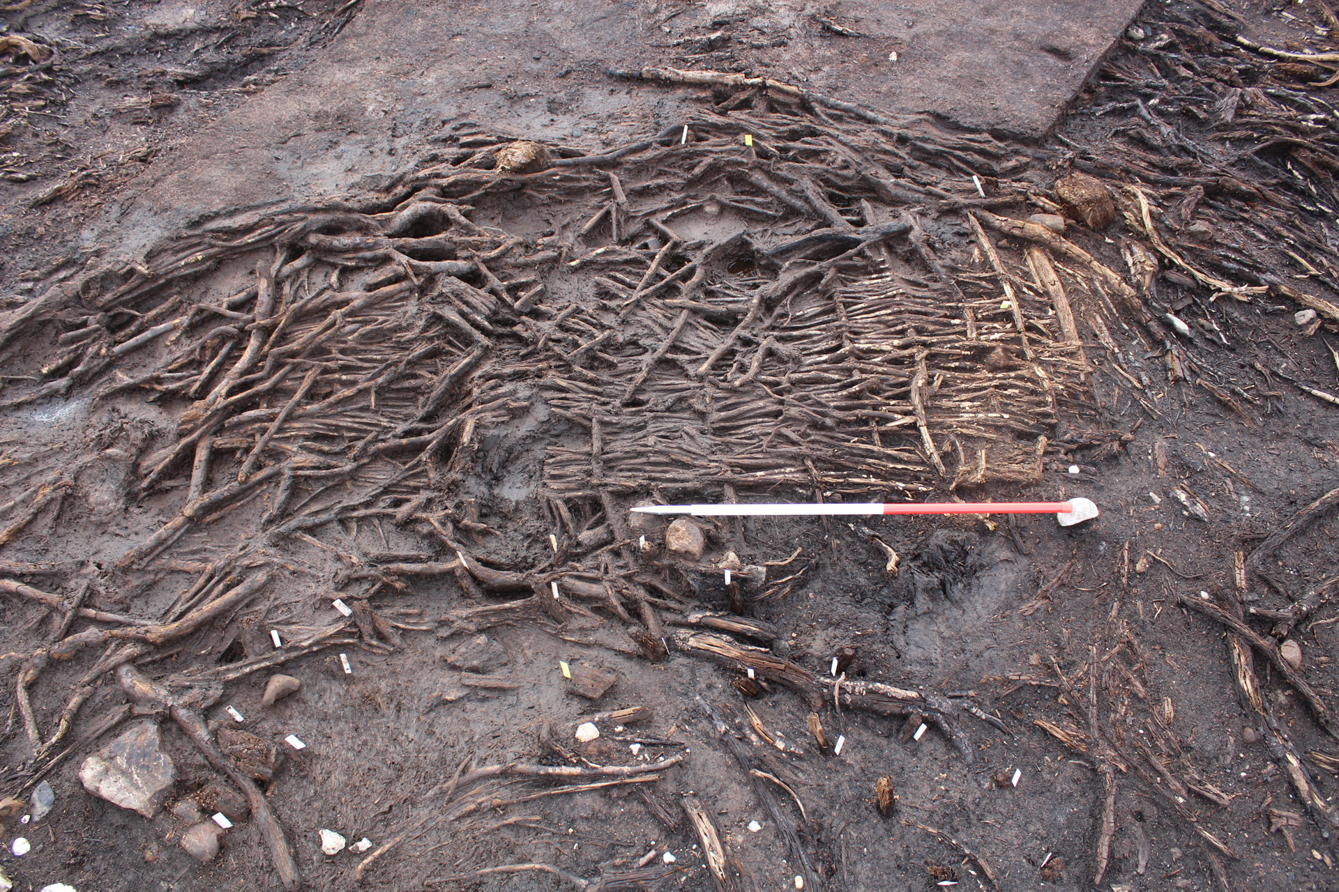
The settlement was constructed on a peat bog, though it’s possible that the ground was drier at the time. Unlike crannogs, which are built over open water, this site bore more similarities with a typical terrestrial roundhouse settlement except that it had been built in a wetland environment (a ‘wettlement’). The houses were built with wooden posts while bundles of brushwood made up the floors. Softer materials such as ferns, bracken, straw, and reeds were likely used as an upper floor covering, but this did not survive well. At some point, the site may have become inundated with rising water levels, leading to the growth of sphagnum moss which eventually became peat. Peat continued to form over the site for possibly 1500-1700 years before its discovery in 2020. The unique anoxic environment slowed the decay process and preserved the remarkable structures and artefacts.
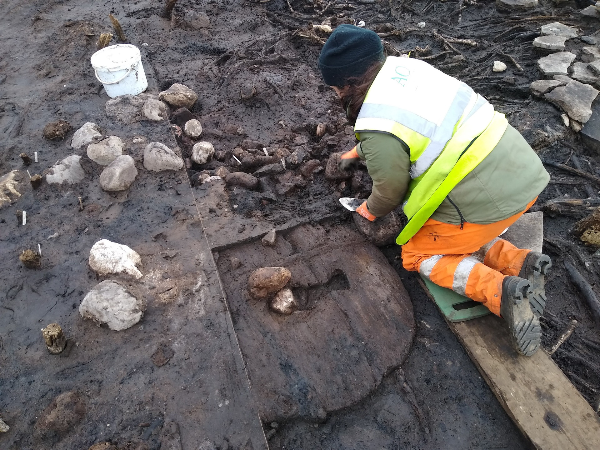
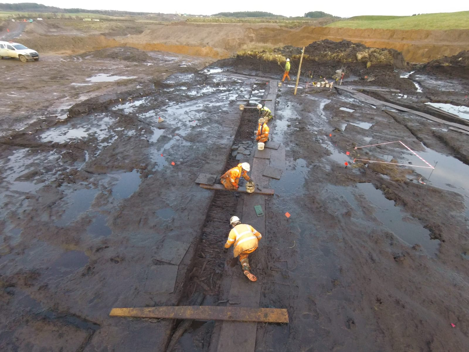
A Challenging Excavation
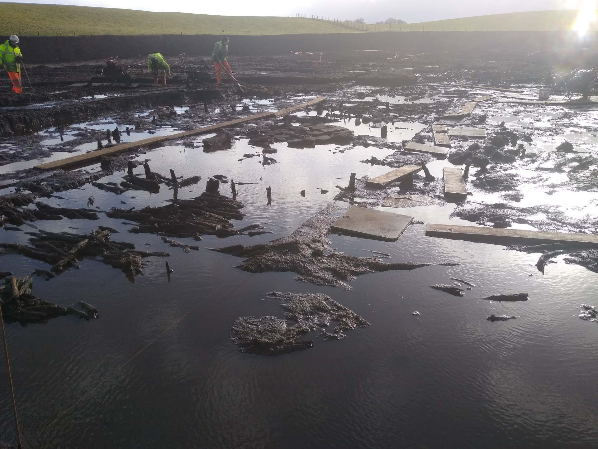
The site was discovered in October 2020 during archaeological monitoring of the removal of a peat bog. The delicate and complex nature of the site meant that all the structures were excavated by hand, a slow and methodical process that took several months to complete. The weather also presented challenging conditions with regular flooding from rain, snow, and the existing ground water. The archaeologists had to use wooden boards to create a network of walkways around the site. At other times, strong winds or sunlight started to dry out the site, threatening the carefully preserved deposits that needed to be kept damp.
The Roundhouses
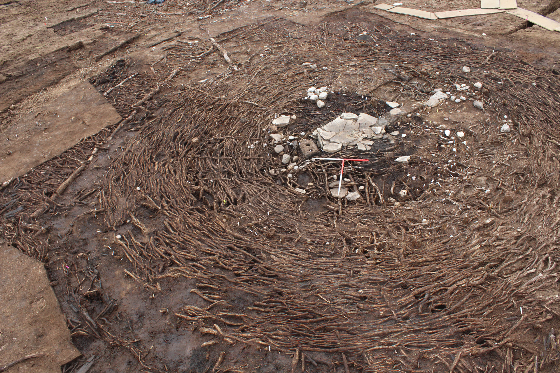
The three roundhouses were built less than 0.3m apart and were likely constructed at the same time. Logs and brushwood bundles were used to form paths and platforms around the houses, including a long path leading to Roundhouse 1.
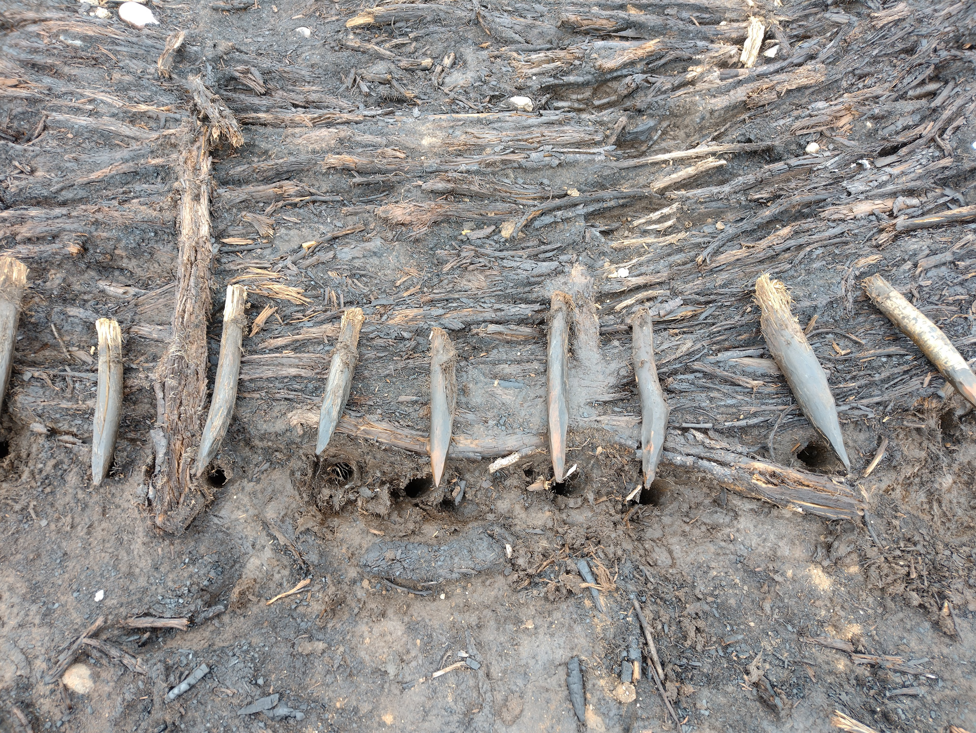
Each house had three rings of wooden posts: an outer double wall of small posts (less than 0.1m diameter); an inner ring of 11 posts (up to 0.2m diameter) which bore the structural load of the house; and a central ring of small stakes (less than 0.05m diameter) which would have enclosed the hearth. The walls were of woven wicker, which survived in places around the site.
The floors were made from brushwood bundles, which were best preserved around the edges of the houses. This may suggest that the inner area of the houses (around the hearth) was more frequently used. In some places woven mats were found, possibly at focal points where people were moving through more regularly. There were some differences in the construction and artefacts found in each house, indicating different activities that may have been happening.
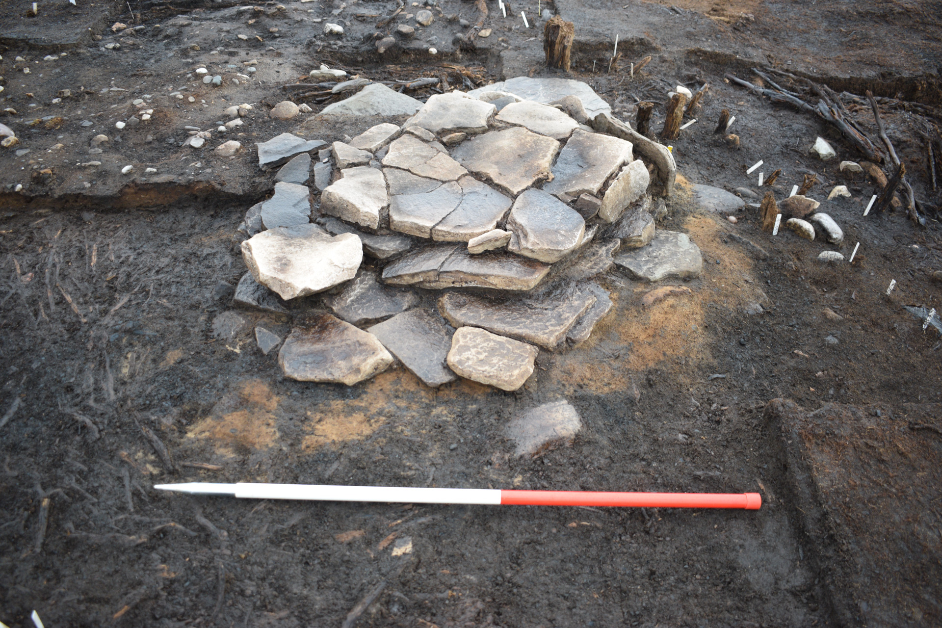
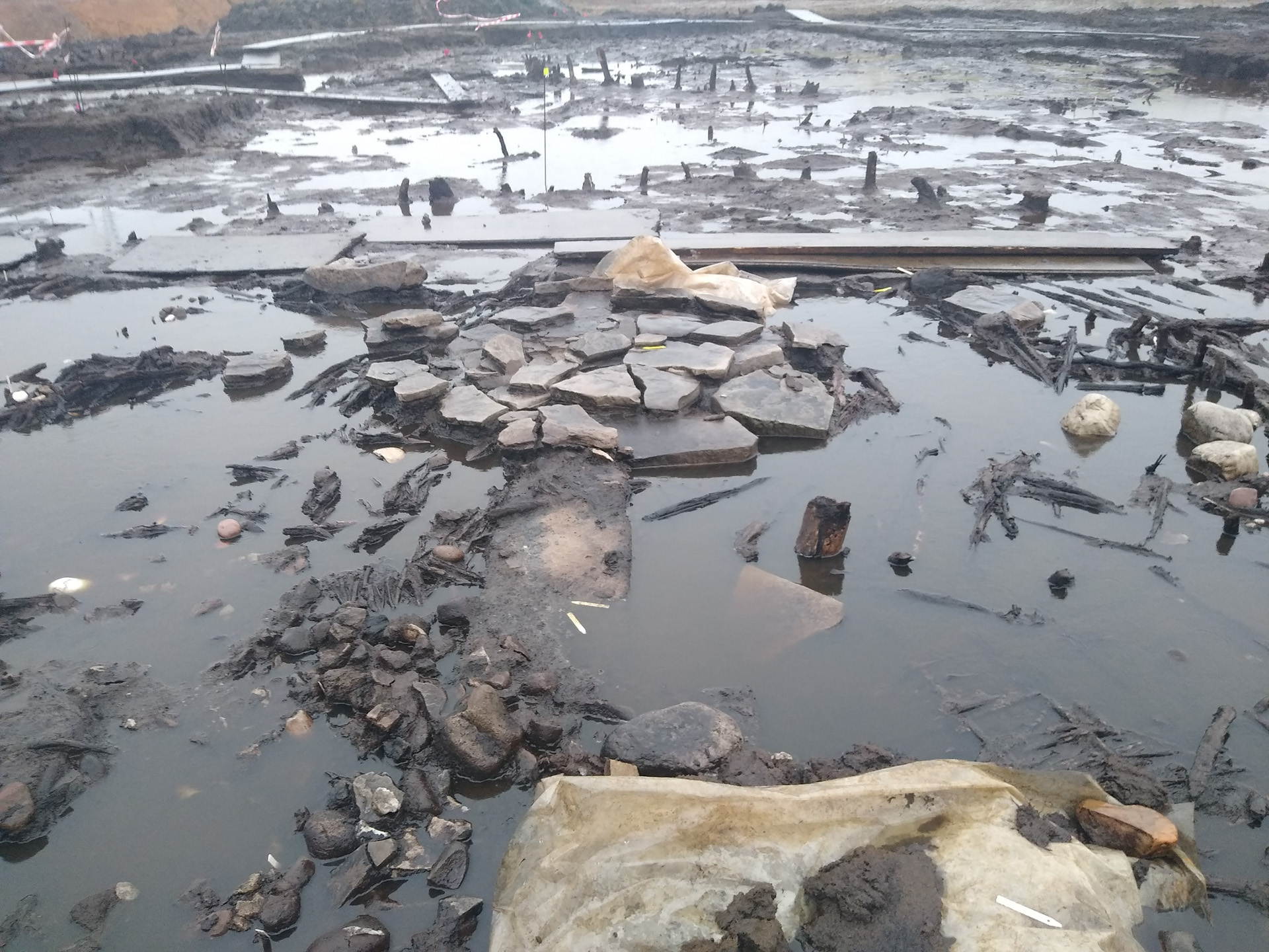
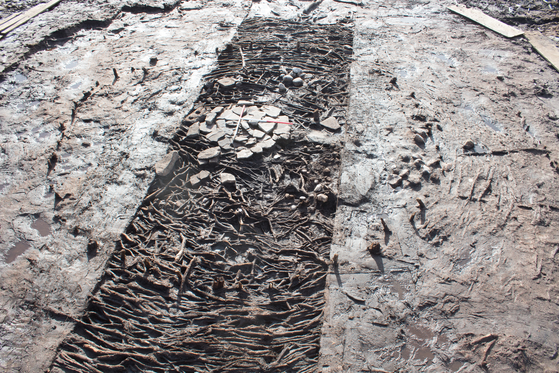
Heart of the House
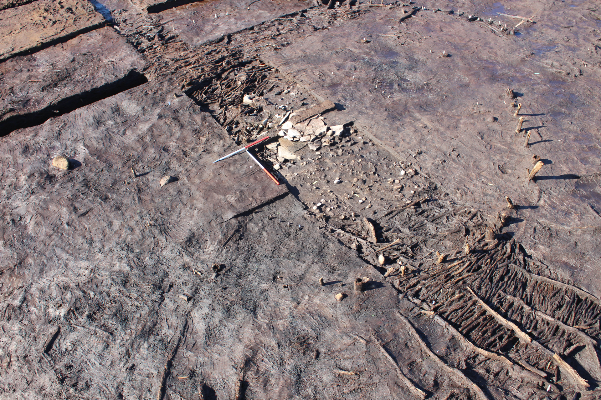
Each house featured a large central hearth built with flat stone slabs. The layers of stones indicate that the hearths had been replaced at least three times, sometimes with new layers of brushwood flooring woven around the edge of the new stones. The hearths in Roundhouses 2 and 3 had ‘post-shoes’ on their southern sides. These were logs with postholes cut into them, possibly to support a removable frame.
While the lower hearths and flooring had sunk somewhat into the peat below they were still in very good condition, hinting that the creation of a new hearth was not a purely functional activity. The hearth was an important element in the daily lives of inhabitants and the replacement of such a feature would have been significant. It may have taken place at specific times; perhaps representing ideas of renewal and rejuvenation.
Personal Adornment
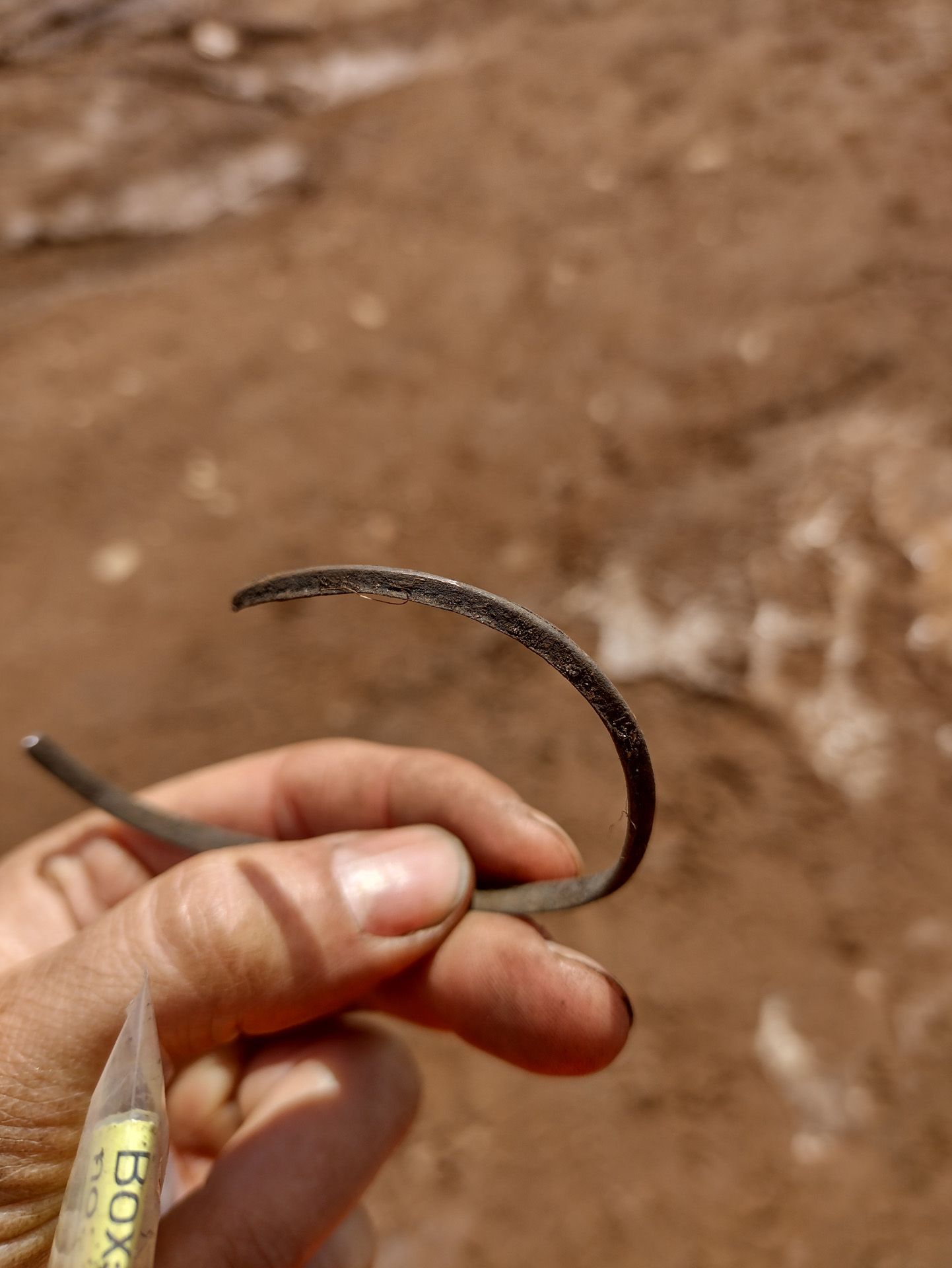
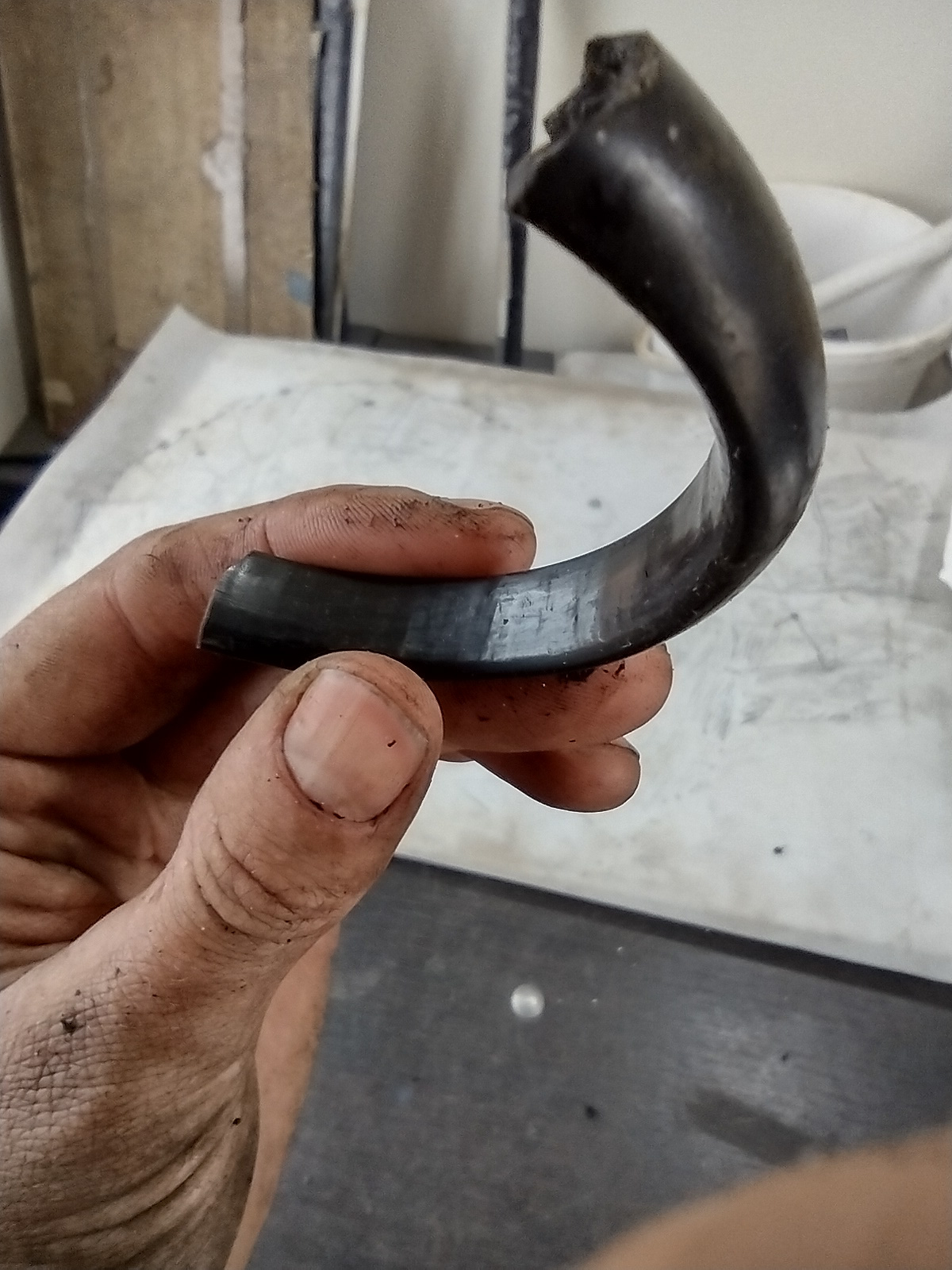
Three bracelets were found on the site, providing evidence for the personal adornment of the people living there. Fragments of shale bracelets were found in the floor surfaces of Roundhouses 1 and 3, and a complete copper-alloy bracelet was found in Roundhouse 1. Inside Roundhouse 1, several fragments of shale were also found, suggesting that such bracelets may have been made here. Intriguingly, a cup-marked stone was found alongside the shale fragments and may have been associated with bracelet-making. Bracelets were used throughout the Bronze Age and Iron Age and may have had a particular significance.
Tripartite wheel from Roundhouse 2
An example of a woven flooring mat
Roundhouse 2 during excavations
Roundhouse 2 during excavations
Decorated loom weight
Stacked hearth (Roundhouse 1)
Challenging conditions on site
Challenging conditions on site
Challenging conditions on site
Copper alloy bracelet
Tweezers
Shale bracelet
Roundhouse 1 during excavations
Post-shoe from Roundhouse 3
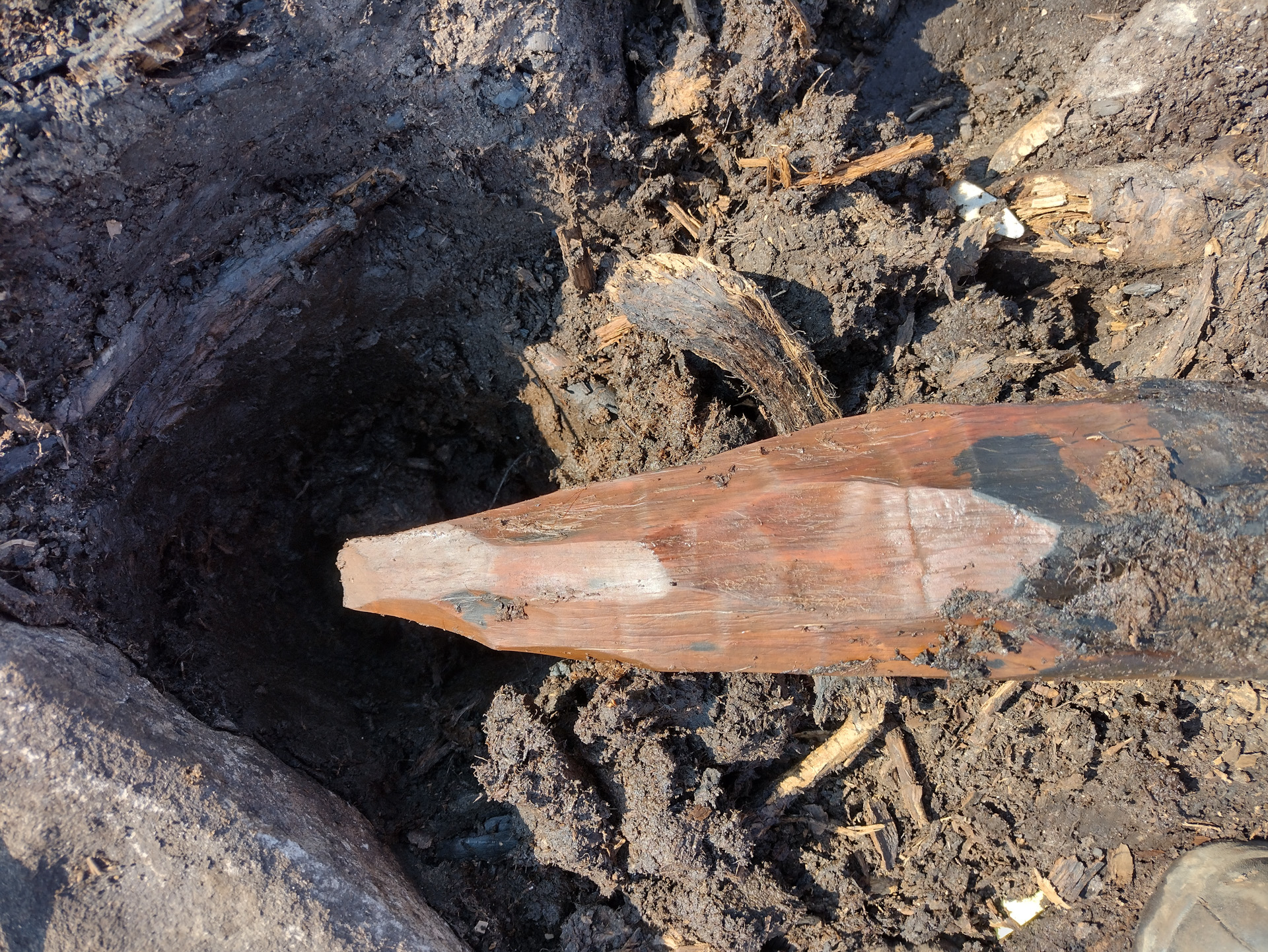
Worked end of post
Outer posts of roundhouse
Outer flooring (Roundhouse 2)
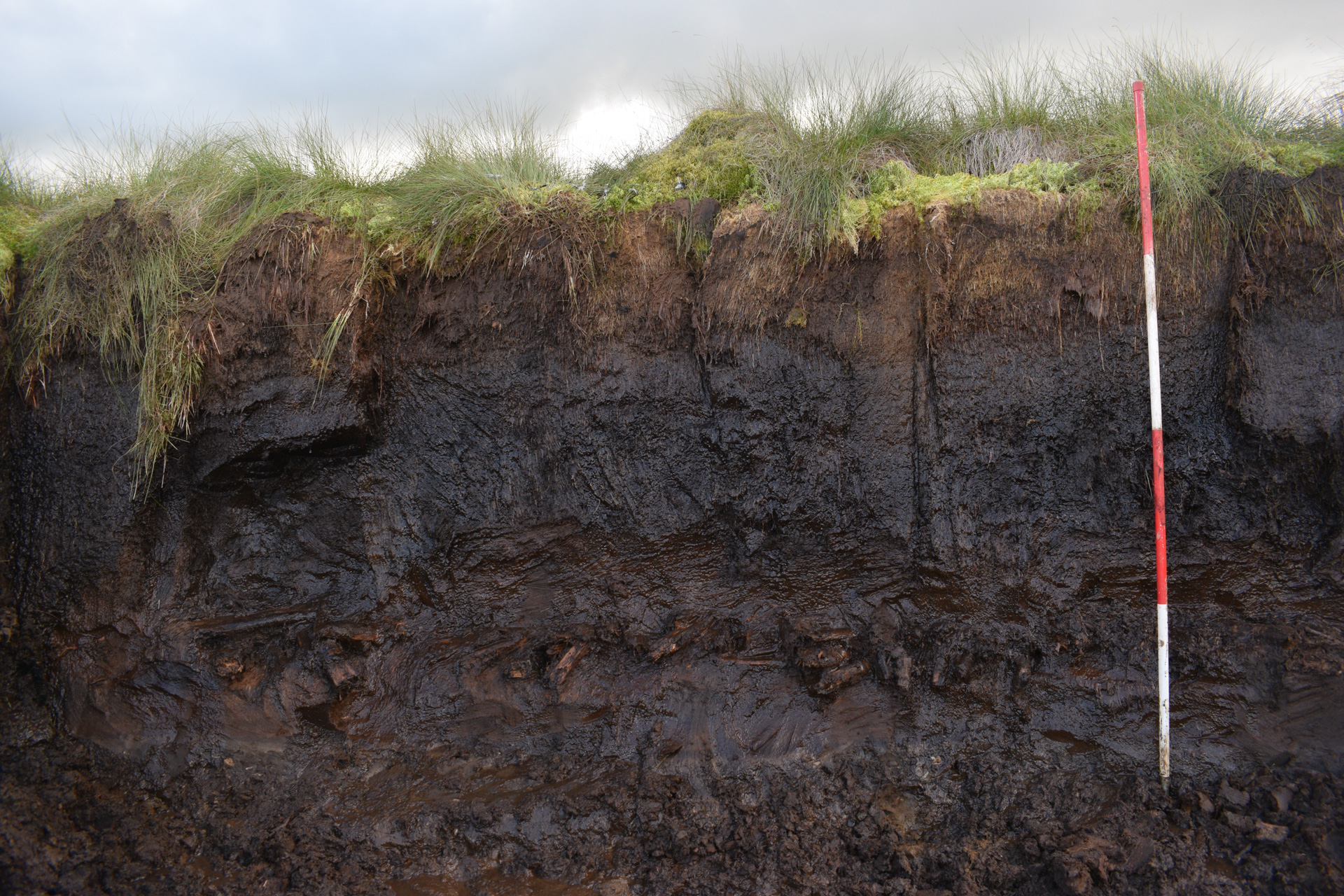
Initial peat face with wood visible
Entrance area to Roundhouse 2
Drawing the spoked wheel found just outside the main enclosure
Roundhouse 2 during excavations
Stone Tools
Cobble stone tools were found in all the roundhouses, scattered amongst the sub-floor surfaces. The tools, which would have originally been functional items for everyday tasks, appear to have been deliberately deposited. The reuse of stone tools within roundhouse structures has been seen on many sites across the country and hints at a significance beyond their mundane uses. One of these stone tools found near the hearth of Roundhouse 2 was a decorative loom weight.
Sampling Strategy
As part of the excavation, soil samples from different locations above, below, and within the roundhouses were taken. These samples contain a wealth of microscopic data that can help understand the houses and their local environment. Laboratory analyses of soil samples can reveal the materials used to construct the house floors and offer clues to the activities happening in different parts of the site. They can also give evidence for the ground conditions when the houses were built and suggest reasons for the site’s abandonment. Wood samples from the floors and posts can identify the trees species used and can be dated to discover when the houses wereconstructed and repaired.
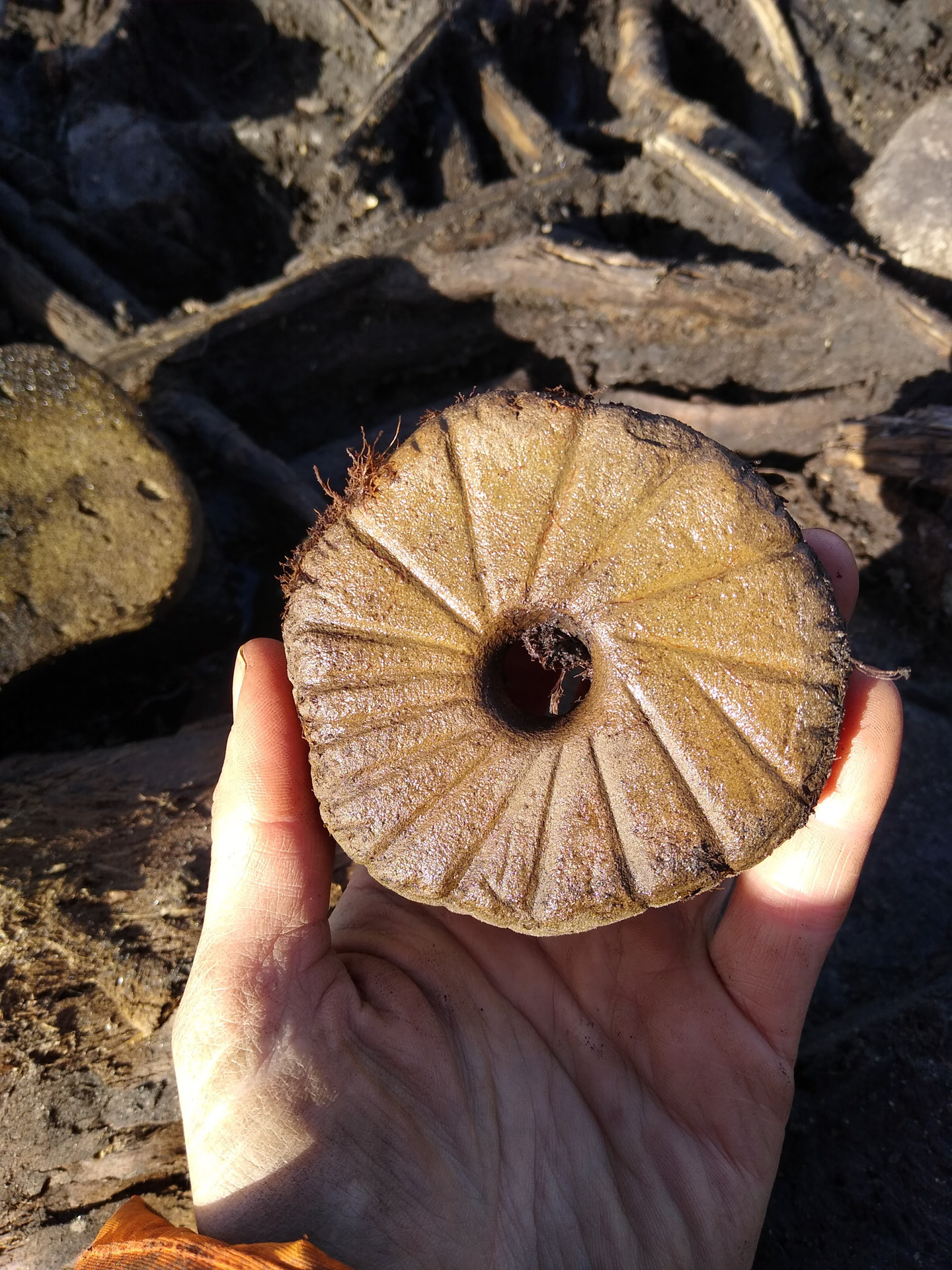
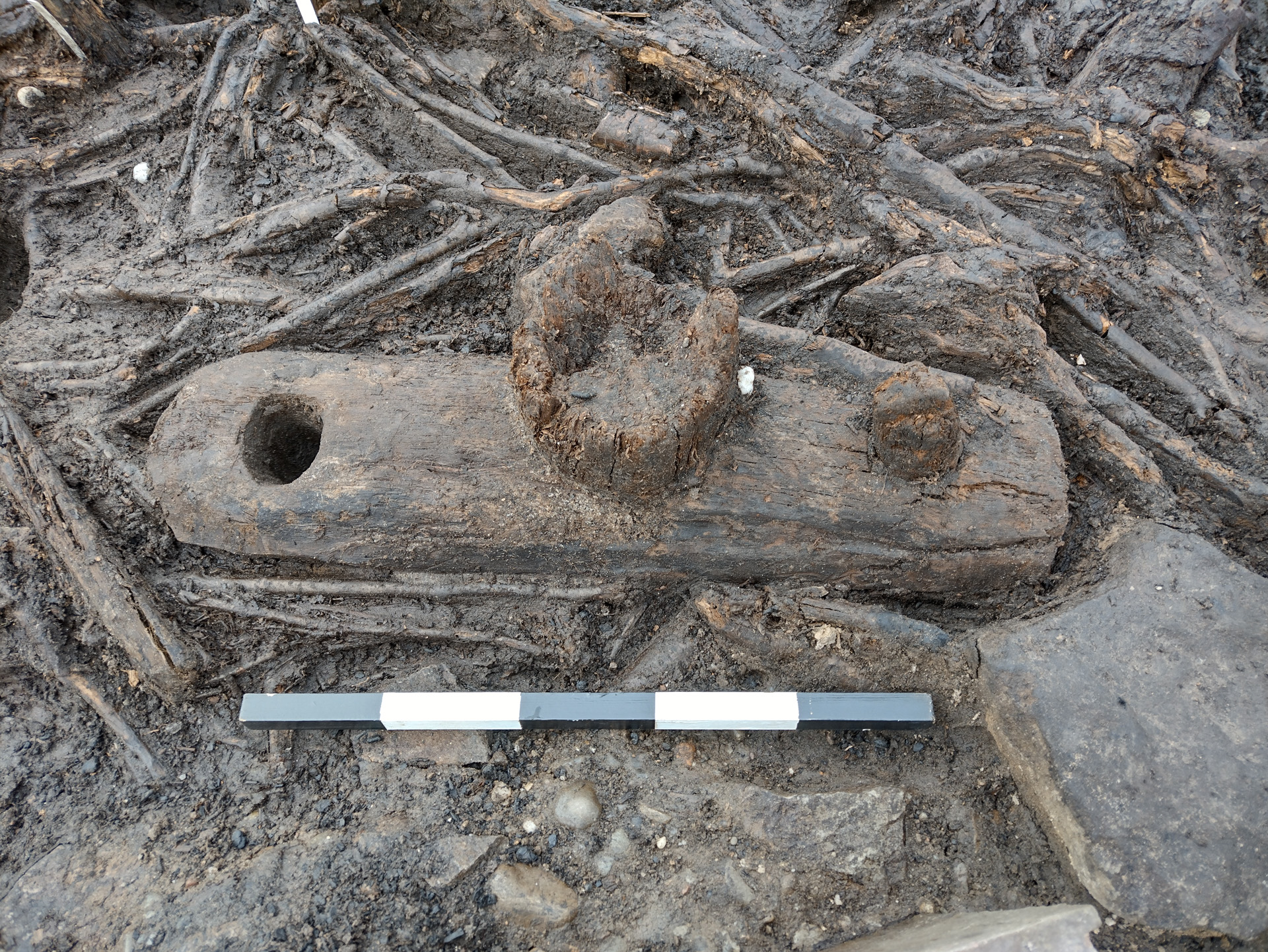
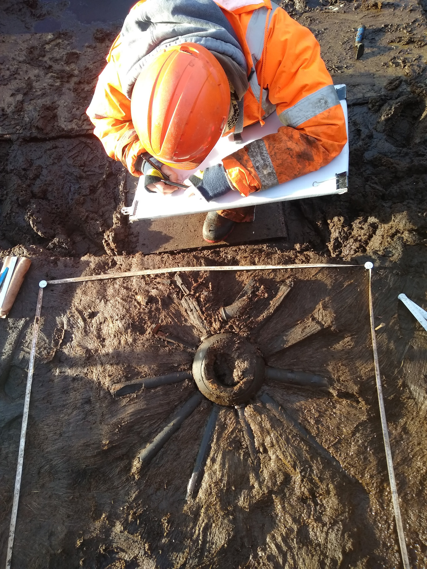
Two Wooden Wheels
Two of the most spectacular finds on the site were well-preserved wooden wheels. The first was a spoked wheel with finely turned and carved spokes and hub. It was discovered outside the main enclosure to the east and had been deposited in a fragmentary state, with only one spoke fully intact. It may have once been part of a chariot.
The second wheel was of a different type: a tripartite-plank wheel that may have been part of a cart. It had been integrated into the floor of Roundhouse 2 and might have been visible from just inside the entrance.
A photography-based 3D recording method using 2D images to extract 3D information. This is done by reading perspective variations and differences in lines of sight in multiple overlapping images.
Its adaptability, scalability and potential to create highly accurate 3D outputs, regardless of the size of the subject recorded, made photogrammetry a widely popular 3D recording technique.
Used in the heritage sector in a broad spectrum of applications: from creating a detailed record of archaeological sites and buildings to conservation monitoring and long-term preservation of fragile museum collections.
Laser Scanning
Terrestrial laser scanning is one of the primary techniques that enable the rapid and highly-accurate acquisition of 3D data.
The scanners measure the 3D geometry by sending a laser beam to the surface of the recorded structure. The beam hits the surface and returns to the scanner – based on those two events the scanners can calculate distances and angles, assigning each measured point a precise location in 3D space.
Capturing millions of measurements per second, laser scanning became one of the primary tools used in surveying due to its speed and ability to produce high-resolution data. Laser scanned point clouds can provide valuable metric data, giving cross sections through buildings, or accurate terrain models of slight topographic features. 3D data can be processed into highly accurate CAD models for visualisation, or used to extract detailed 2D elevations and plans.
Reflectance Transformation Imaging (RTI)
Reflectance Transformation Imaging ( RTI) balances between 2D and 3D imaging. Whilst it captures 2D images, it allows for the object recorded to be digitally re-lit, creating an illusion of 3D surface. RTI dataset is created by capturing a series of images from a fixed camera position with the artefact illuminated by a light source incrementally moved around on a hemispherical grid. It records the subject’s shape and colour and is particularly useful for enhancing fine surface detail invisible under regular illumination.
3D printing
Archaeological artefacts can provide a tangible link to people who lived centuries, or even millennia, before us. However, most are too fragile to be handled freely and are viewed behind glass or stored in archives. 3D prints of artefacts, made from highly accurate 3D models created from data gathered through digital recording methods, can provide an opportunity for a tactile experience, allowing a more personal connection. 3D printing technology is also making heritage more inclusive and accessible for people with visual impairments – dedicated handling kits are gaining more popularity across cultural institutions in the UK and beyond.
3D Reconstructions
Digital reconstructions allow us to visualise lost archaeological sites or piece together fragmented artefacts recovered during excavations. Particularly useful in the analysis and interpretation of fragile archaeological finds, 3D reconstructions allow specialists to examine objects in a non-invasive way and experiment with innovative methods of communicating the results of these analyses.
Based on photos, archival maps, LiDAR data or 3D scans, digital models of cultural assets can be created and experienced in the virtual world by the viewer. Those reconstructions provide a way for audiences to explore artefacts from afar and present a fascinating new opportunity for engagement with the past.
LIDAR analysis
LiDAR (Light Detection and Ranging) is a remote sensing technique, used for high-resolution survey of landscapes.
The technology is based on the use of a laser scanner, mounted on an aircraft. Laser scanners emit pulses of laser light at a rate of many hundreds of pulses per second,
and measure the time it takes for the reflection of that pulse to return to the instrument; a GPS is used to plot the coordinates of each measurement. Using this method, computers are able to process millions of measurements in a dataset called a ‘point cloud’. In turn, this point cloud is then used to make very detailed presentations of the ground surface, called ‘digital terrain models’, often referred to as ‘DTMs’.
UAV Survey
Drones in the heritage sector are used as a low-level aerial method of recording archaeological sites, historic buildings, tall monuments, and landscapes. Equipped with high-resolution cameras, drones can access high-level structures to facilitate the inspection of historic sites. Accurate 3D records are generated from gathered images and used for survey, conservation, and maintenance work.
360⁰ Virtual Tours
Immersive way of making remote heritage sites more accessible. By taking a series of 360⁰ images, or spherical panoramas, we can create virtual tours of archaeological sites and historic buildings.


")


")


