Craigievar Castle is one of Scotland’s best-preserved tower houses – built in the late 1500s and cared for by the National Trust for Scotland (NTS) since 1962. The Castle is an exquisite example of Scottish Baronial architecture and is believed as the inspiration for the famous Disney’s Cinderella Castle. The characteristic pink harling makes Craigievar recognisable worldwide.
In the summer of 2020, AOC’s Digital Heritage Team worked on 3D recording of one of the most picturesque tower houses in Scotland – Craigievar Castle in Aberdeenshire
Archaeological research has demonstrated how important Craigievar is in helping NTS understand how castles in Scotland were re-built and re-designed throughout their histories. When Craigievar was built in the late 1500s the castle was a simple four-storey tower with an enclosing wall attached. This enclosure, known in Scots as a barmkin, would probably have contained stables, smithy and brewhouse.
Today only the west side of the barmkin survives. The rest of the wall and the buildings inside the enclosure were removed in the 1800s, but Craigievar is still one of the only castles in Aberdeenshire to retain any part of its enclosure
In 1990 excavation led by Moira Greig, revealed the remains of the east wall and part of the south wall of the original barmkin, along with two contemporary stone drains and a few post-holes.
The excavation also recovered pottery, glass and coins. A silver sixpence dating from the reign of Elizabeth I in 1573 was discovered within the south wall of the barmkin during the excavation, suggesting the wall was built at the same time as the castle sometime in the late 1500s. To learn more, have a look at this article.
Craigievar Castle in 3D
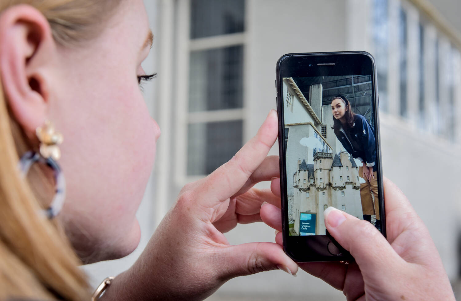
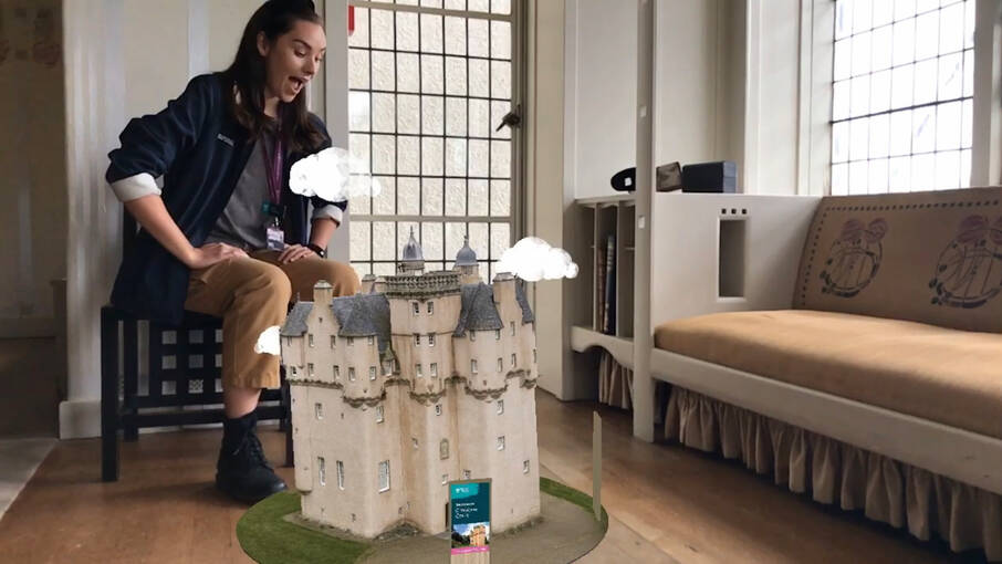
Augmented Reality App
In 2020 NTS teamed up with Lidl to release an augmented reality experience of Craigievar, a 3D model for which was created by AOC Archaeology in collaboration with Ulmus Media.
The 3D data was captured during the COVID-19 pandemic, to allow visitors to explore the castle online, as it remained closed for several months following the government’s guidance.
3D Recording and excavation
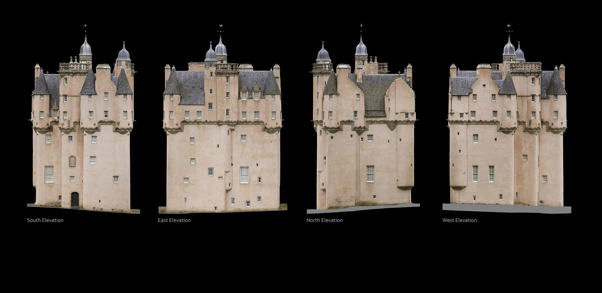
The entire exterior of the tower was recorded in 3D using photogrammetry and drones.
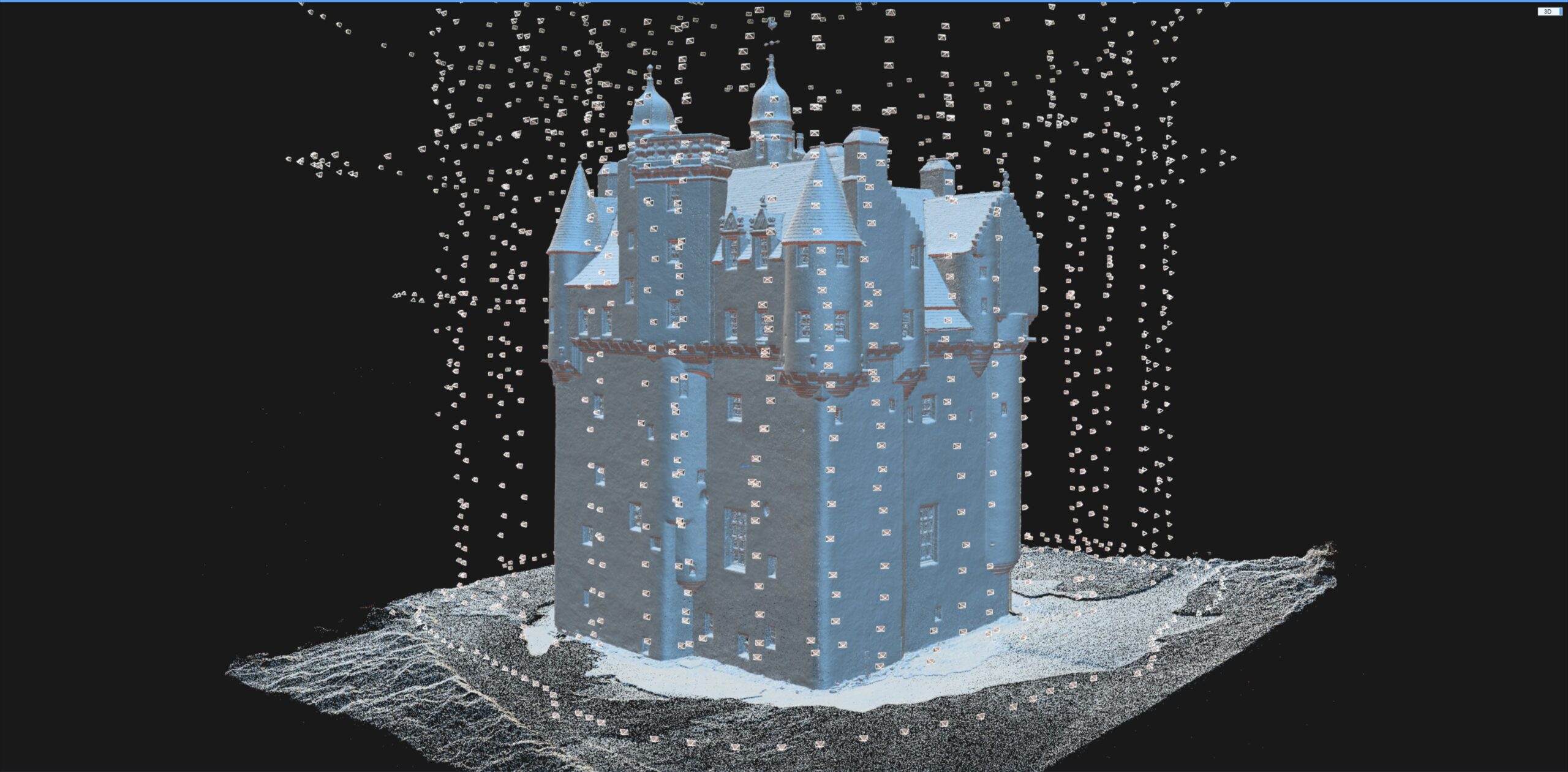
The principle of the photogrammetric process, in short, is fairly simple. It comes down to methodically taking hundreds of overlapping images (see the image – each one of these floating rectangles represents a camera position).Here, this involved flying a drone around the castle to get an even coverage of the entire structure
Once the 3D model was processed we blended it with the ecavation interpretation from archival materials to better show what archaeological work was done in the past and what is still left on site. Have a look at the final result below:
A photography-based 3D recording method using 2D images to extract 3D information. This is done by reading perspective variations and differences in lines of sight in multiple overlapping images.
Its adaptability, scalability and potential to create highly accurate 3D outputs, regardless of the size of the subject recorded, made photogrammetry a widely popular 3D recording technique.
Used in the heritage sector in a broad spectrum of applications: from creating a detailed record of archaeological sites and buildings to conservation monitoring and long-term preservation of fragile museum collections.
Laser Scanning
Terrestrial laser scanning is one of the primary techniques that enable the rapid and highly-accurate acquisition of 3D data.
The scanners measure the 3D geometry by sending a laser beam to the surface of the recorded structure. The beam hits the surface and returns to the scanner – based on those two events the scanners can calculate distances and angles, assigning each measured point a precise location in 3D space.
Capturing millions of measurements per second, laser scanning became one of the primary tools used in surveying due to its speed and ability to produce high-resolution data. Laser scanned point clouds can provide valuable metric data, giving cross sections through buildings, or accurate terrain models of slight topographic features. 3D data can be processed into highly accurate CAD models for visualisation, or used to extract detailed 2D elevations and plans.
Reflectance Transformation Imaging (RTI)
Reflectance Transformation Imaging ( RTI) balances between 2D and 3D imaging. Whilst it captures 2D images, it allows for the object recorded to be digitally re-lit, creating an illusion of 3D surface. RTI dataset is created by capturing a series of images from a fixed camera position with the artefact illuminated by a light source incrementally moved around on a hemispherical grid. It records the subject’s shape and colour and is particularly useful for enhancing fine surface detail invisible under regular illumination.
3D printing
Archaeological artefacts can provide a tangible link to people who lived centuries, or even millennia, before us. However, most are too fragile to be handled freely and are viewed behind glass or stored in archives. 3D prints of artefacts, made from highly accurate 3D models created from data gathered through digital recording methods, can provide an opportunity for a tactile experience, allowing a more personal connection. 3D printing technology is also making heritage more inclusive and accessible for people with visual impairments – dedicated handling kits are gaining more popularity across cultural institutions in the UK and beyond.
3D Reconstructions
Digital reconstructions allow us to visualise lost archaeological sites or piece together fragmented artefacts recovered during excavations. Particularly useful in the analysis and interpretation of fragile archaeological finds, 3D reconstructions allow specialists to examine objects in a non-invasive way and experiment with innovative methods of communicating the results of these analyses.
Based on photos, archival maps, LiDAR data or 3D scans, digital models of cultural assets can be created and experienced in the virtual world by the viewer. Those reconstructions provide a way for audiences to explore artefacts from afar and present a fascinating new opportunity for engagement with the past.
LIDAR analysis
LiDAR (Light Detection and Ranging) is a remote sensing technique, used for high-resolution survey of landscapes.
The technology is based on the use of a laser scanner, mounted on an aircraft. Laser scanners emit pulses of laser light at a rate of many hundreds of pulses per second,
and measure the time it takes for the reflection of that pulse to return to the instrument; a GPS is used to plot the coordinates of each measurement. Using this method, computers are able to process millions of measurements in a dataset called a ‘point cloud’. In turn, this point cloud is then used to make very detailed presentations of the ground surface, called ‘digital terrain models’, often referred to as ‘DTMs’.
UAV Survey
Drones in the heritage sector are used as a low-level aerial method of recording archaeological sites, historic buildings, tall monuments, and landscapes. Equipped with high-resolution cameras, drones can access high-level structures to facilitate the inspection of historic sites. Accurate 3D records are generated from gathered images and used for survey, conservation, and maintenance work.
360⁰ Virtual Tours
Immersive way of making remote heritage sites more accessible. By taking a series of 360⁰ images, or spherical panoramas, we can create virtual tours of archaeological sites and historic buildings.