On the outskirts of Rosemarkie, a coastal village on the Black Isle near Inverness, a new housing development has uncovered the remains of a much older settlement.
The settlement contained six roundhouses, one within a substantial palisade enclosure, extensive groups of prehistoric pits, and the surprise discovery of a Bronze Age hoard.
Archaeological work at Rosemarkie was commissioned byPat Munro Homes.
The Excavation
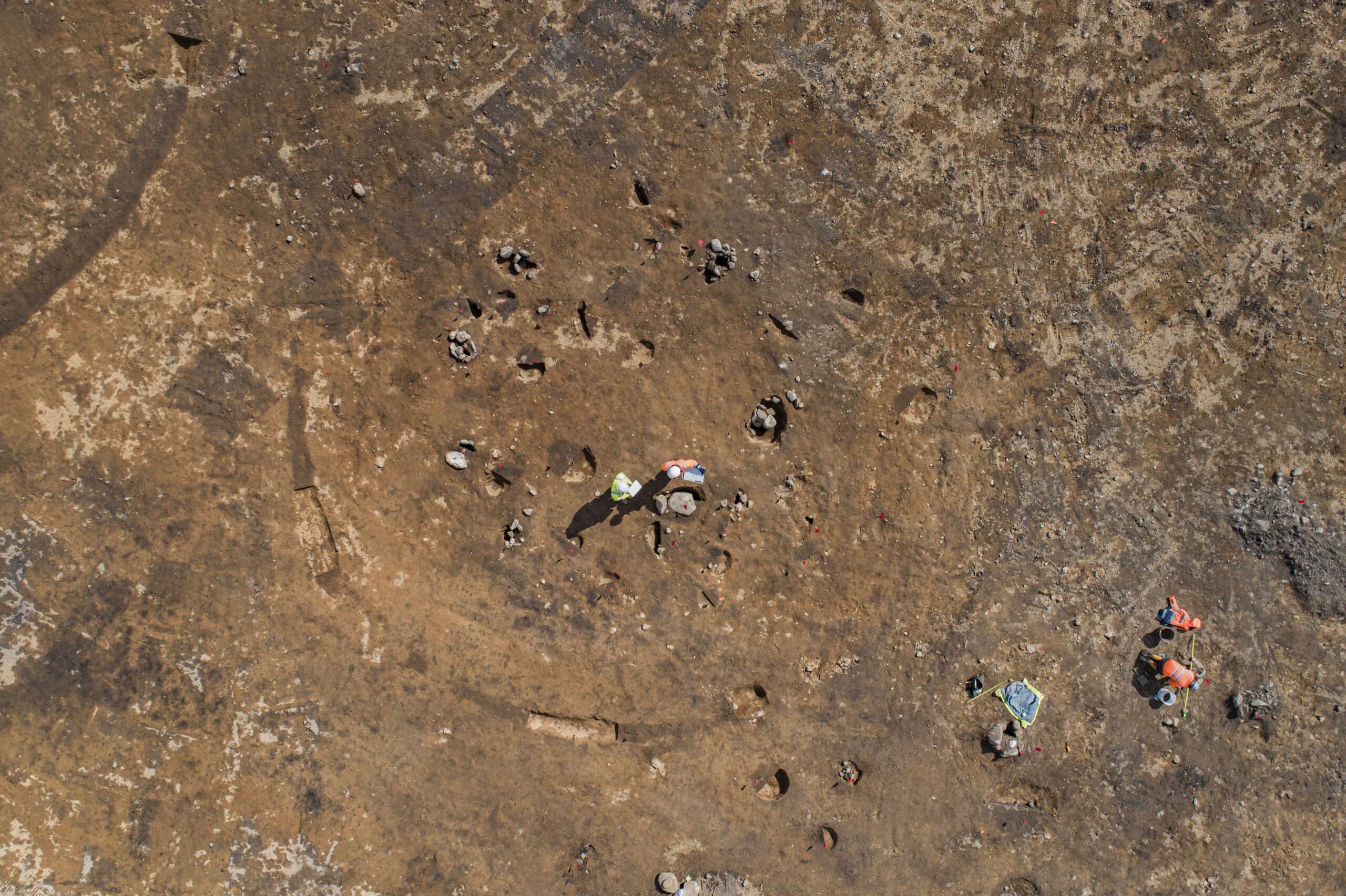
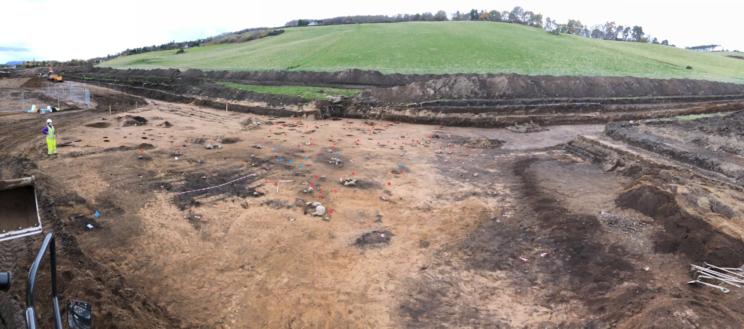
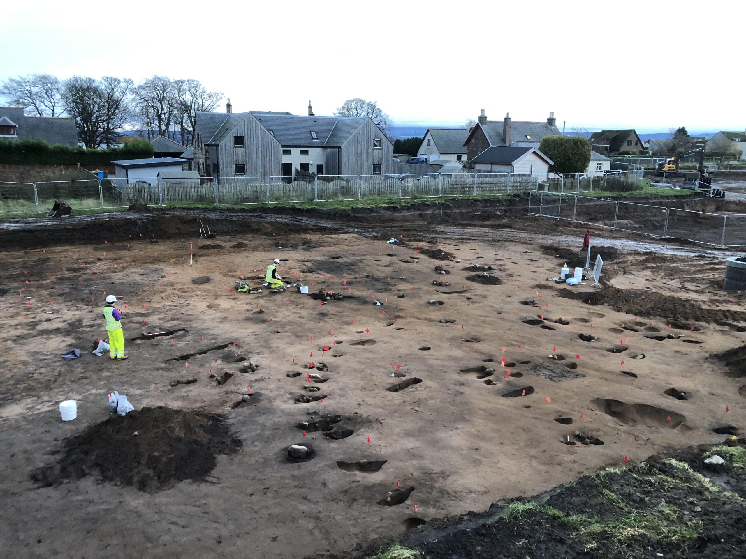
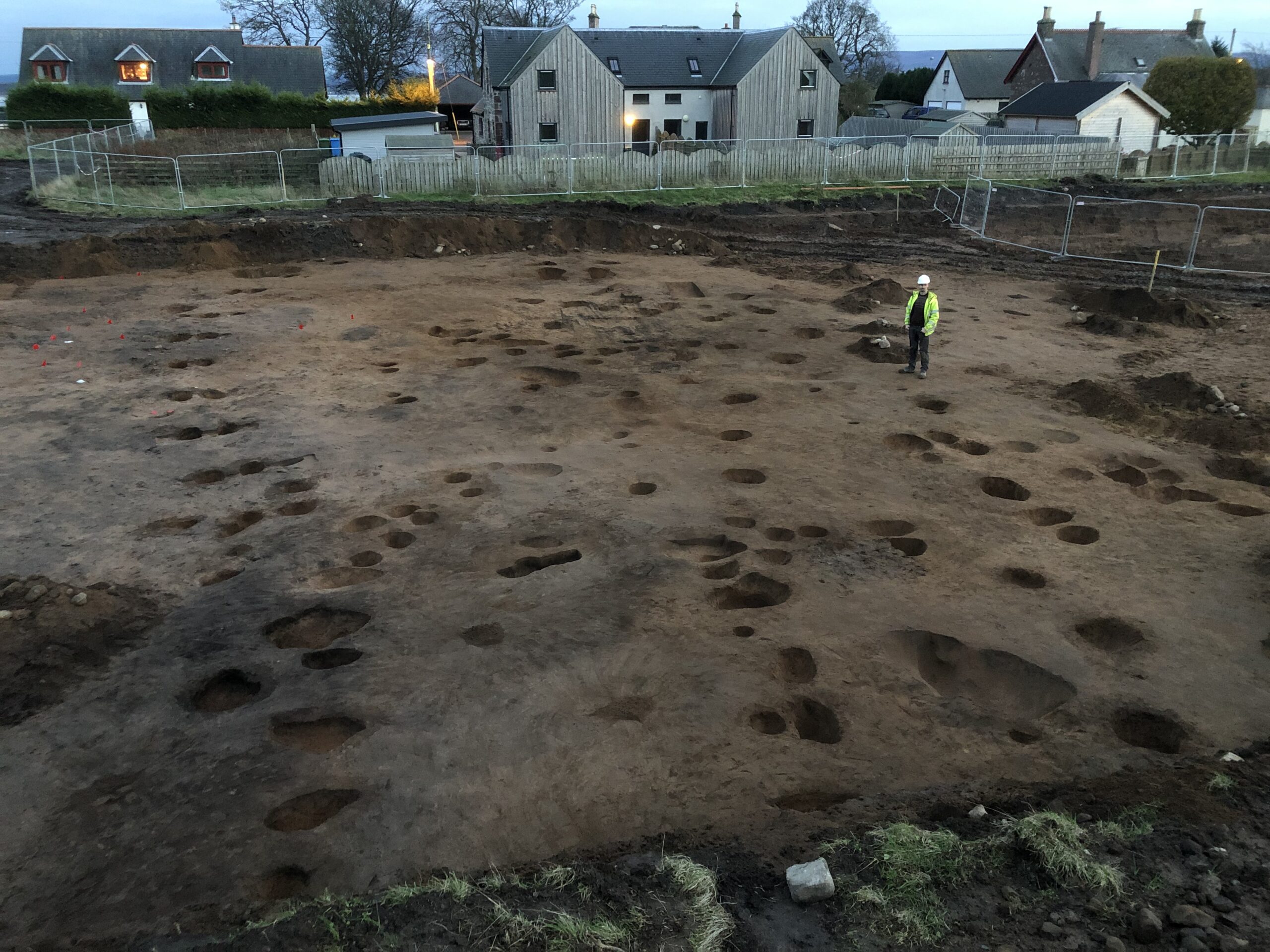
The excavations at Rosemarkie took almost a year to uncover and record the extensive spread of prehistoric settlement. While the bulk of the overlying soil was removed by a machine excavator, the entirety of the approximately 740 features were excavated by hand by a team of archaeologists. Recording of the site included written records, collection of soil samples, GPS survey, hand drawings, photographs, and a drone survey. The results presented here are preliminary only; the post-excavation analyses are still ongoing and will provide a much more detailed understanding of the site once complete.
Digging Deep
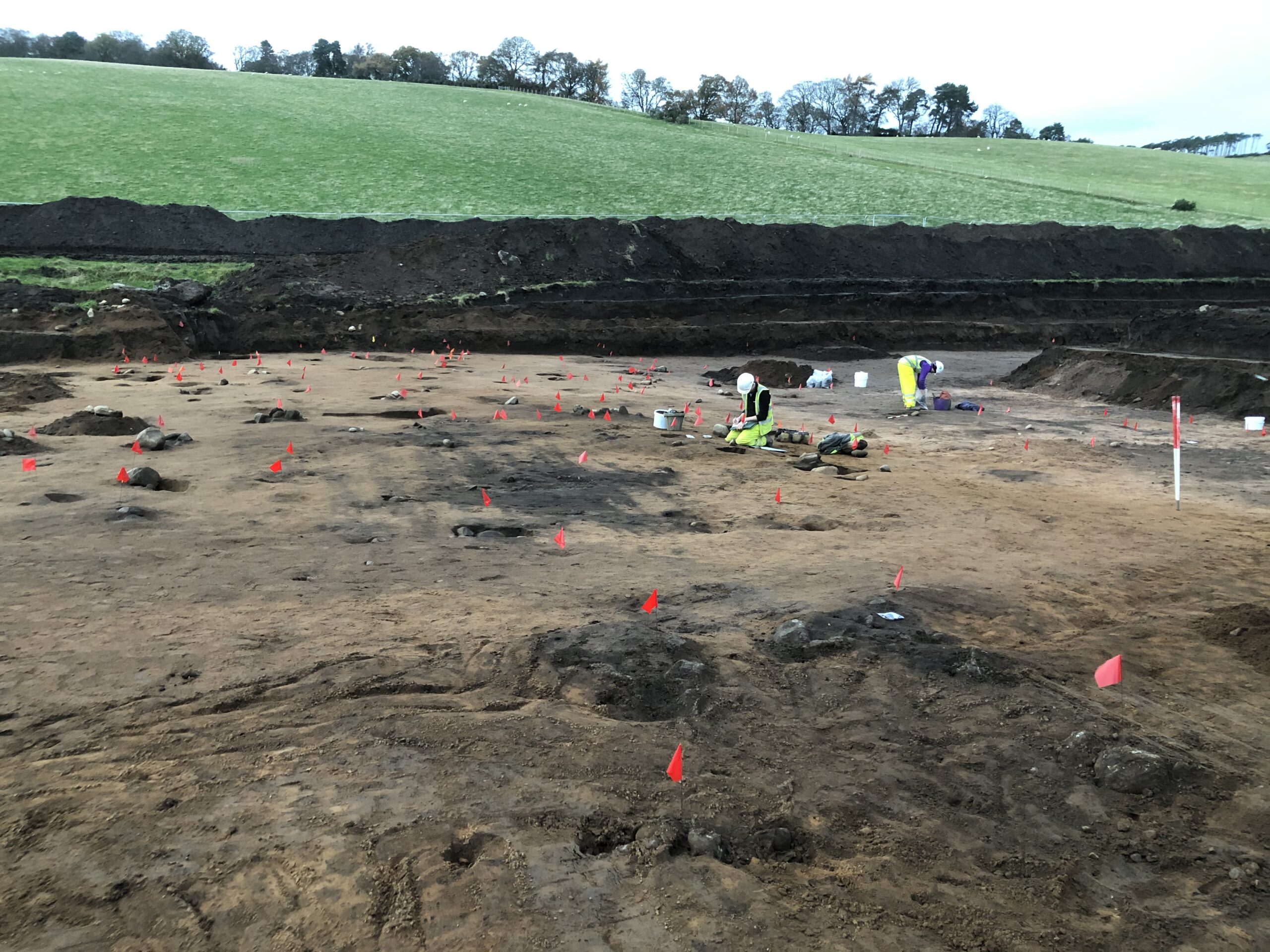
The archaeological remains at Rosemarkie lay near the base of Hill of Fortrose and were found buried under up to 2.6m of soil. Within this deep material were several distinct layers, one of which may be evidence of a fairly dramatic landslide, while others suggest gradual periods of natural soil accumulation. Most of the prehistoric remains survived below the landslide level, where there was also potential evidence for slash-and-burn, a prehistoric woodland clearance technique that may have had a part to play in causing the landslide.
Palisade Enclosure
Roundhouse 1 stood within a large palisade enclosure. The palisade was constructed with pairs of timber posts, which would have supported a substantial boundary fence. Such a fence may have had a defensive function, or it may have served to mark this area as special, limiting access to only certain people. Controlled access would have been important if this was a higher status building, either because of the elite standing of those who lived there or the specialist activities that were taking place. As well as the roundhouse, there were likely several other small post-built structures within the palisade. Finds of three possible metal-working mould fragments in the area may hint at the specialist activity taking place.
Prehistoric Recycling
There were six definite roundhouses identified at the site, and other potential, rectangular structures, all of which appear to have been post-built buildings. The evidence for these buildings survived mostly as negative features, such as postholes and ditches, which indicate where structural elements were dug into the ground. Generally, very little of the original construction materials survived as most would have been of an organic nature which has since degraded or ploughed away by subsequent farming. Despite that, the packing stones used to support the posts were still present in many of the buildings. Interestingly, many these stones were tools, such as quernstones, rubbing stones, and hammerstones, which had been reused within the construction of the house. Often the tools were broken, and it is not known if this was simply a form of prehistoric recycling, or if the practice had a deeper symbolic meaning.
A Place for the Living and the Dead
Although most of the discoveries at Rosemarkie were domestic in nature, representing the daily living of the people at the time, a single cist burial was identified in the area. The burial had been heavily disturbed but would have formed a sub-rectangular pit lined by rounded natural stones and capped by a large, flat slab. Within the pit were the remains of burnt bone, ceramic fragments, and a flint core. This is typical of many Bronze Age cist burials, where cremated remains would have been deposited within a ceramic urn along with small grave goods, such as flint objects.
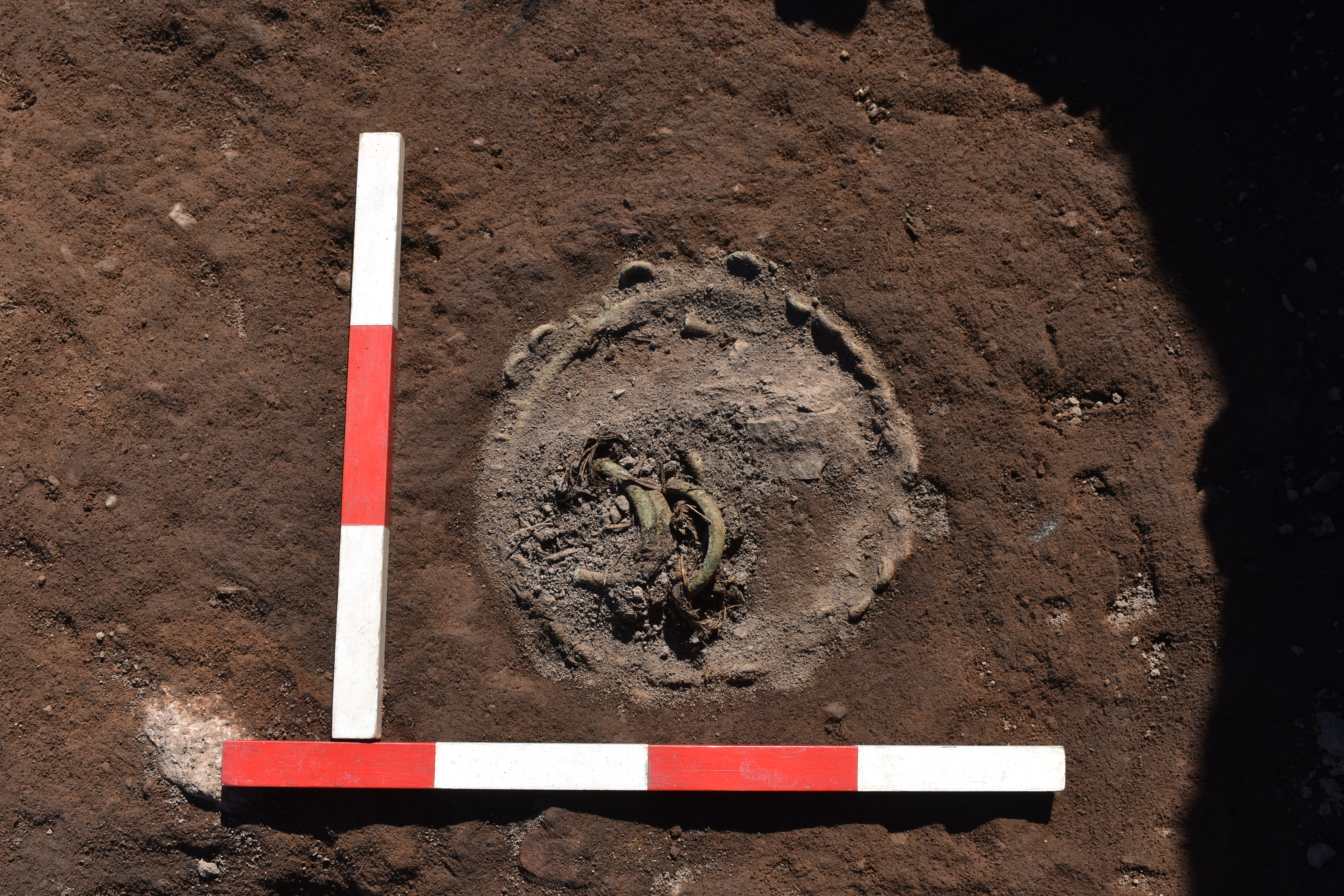
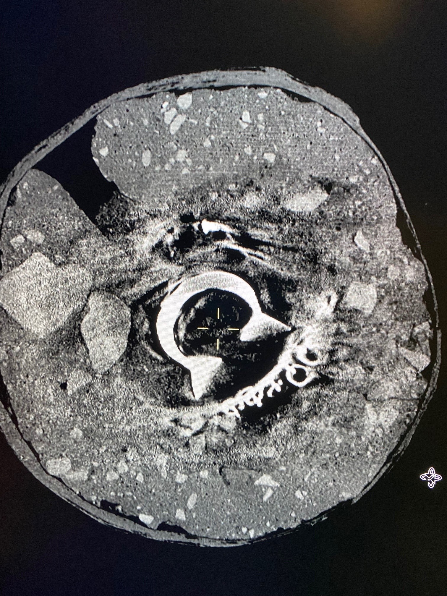
A Surprise Discovery
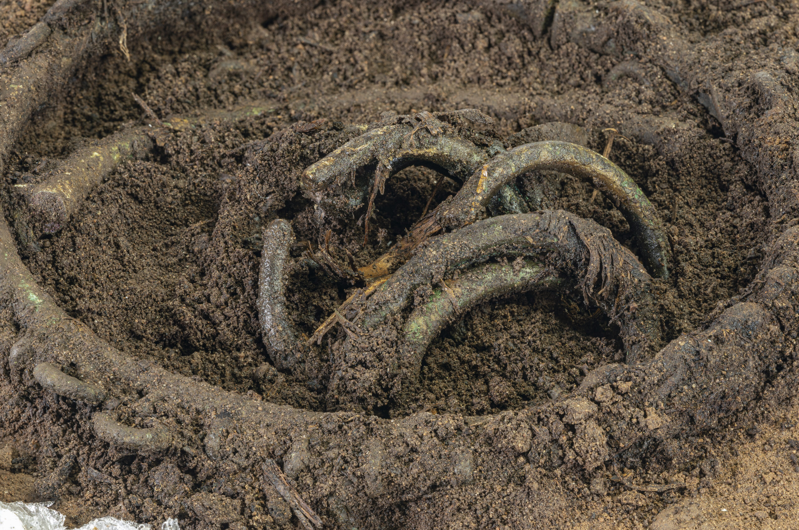
After several months of excavating on the site, the remains of a Bronze Age Hoard were uncovered within an area of pits and postholes forming a small, fenced structure.
From the surface, several bronze armlets could be seen within the circle of a larger ringed necklet. Organic material around the armlets appeared to be the remains of basket or woven bag.
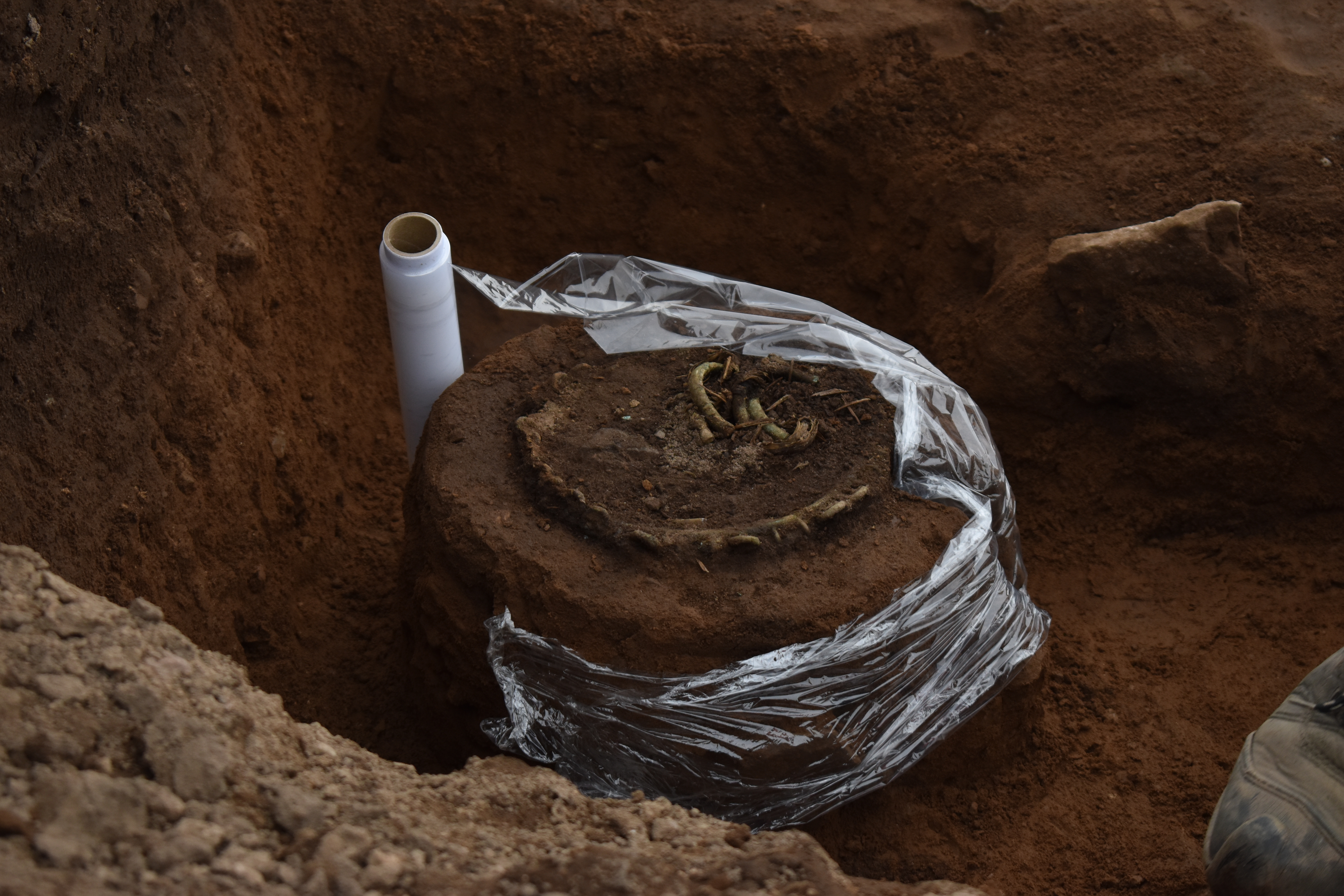
Due to the delicate nature of the discovery, the conservation team were called in on-site to block-lift the object and transport it safely to the lab, where initial micro-excavations were undertaken in a conrolled environment. The post-excavation work from this important, rare site will provide valuable information to understand a highly significant archaeological landscape.
Roundhouses during excavations
Rosemarkie hoard as discovered on site
Rosemarkie Hoard: excavation on site
Rosemarkie hoard: preparation for block-lifting
Rosemarkie hoard: close up
Rosemarkie Hoard: Xray image
Rosemarkie Hoard: micro-excavations in the lab
Further information
Williamson, S. 2021. Greenside Farm, Courthill Road, Rosemarkie: Archaeological Watching Brief and Excavation Data Structure Report.Unpublished AOC Archaeology report.
A photography-based 3D recording method using 2D images to extract 3D information. This is done by reading perspective variations and differences in lines of sight in multiple overlapping images.
Its adaptability, scalability and potential to create highly accurate 3D outputs, regardless of the size of the subject recorded, made photogrammetry a widely popular 3D recording technique.
Used in the heritage sector in a broad spectrum of applications: from creating a detailed record of archaeological sites and buildings to conservation monitoring and long-term preservation of fragile museum collections.
Laser Scanning
Terrestrial laser scanning is one of the primary techniques that enable the rapid and highly-accurate acquisition of 3D data.
The scanners measure the 3D geometry by sending a laser beam to the surface of the recorded structure. The beam hits the surface and returns to the scanner – based on those two events the scanners can calculate distances and angles, assigning each measured point a precise location in 3D space.
Capturing millions of measurements per second, laser scanning became one of the primary tools used in surveying due to its speed and ability to produce high-resolution data. Laser scanned point clouds can provide valuable metric data, giving cross sections through buildings, or accurate terrain models of slight topographic features. 3D data can be processed into highly accurate CAD models for visualisation, or used to extract detailed 2D elevations and plans.
Reflectance Transformation Imaging (RTI)
Reflectance Transformation Imaging ( RTI) balances between 2D and 3D imaging. Whilst it captures 2D images, it allows for the object recorded to be digitally re-lit, creating an illusion of 3D surface. RTI dataset is created by capturing a series of images from a fixed camera position with the artefact illuminated by a light source incrementally moved around on a hemispherical grid. It records the subject’s shape and colour and is particularly useful for enhancing fine surface detail invisible under regular illumination.
3D printing
Archaeological artefacts can provide a tangible link to people who lived centuries, or even millennia, before us. However, most are too fragile to be handled freely and are viewed behind glass or stored in archives. 3D prints of artefacts, made from highly accurate 3D models created from data gathered through digital recording methods, can provide an opportunity for a tactile experience, allowing a more personal connection. 3D printing technology is also making heritage more inclusive and accessible for people with visual impairments – dedicated handling kits are gaining more popularity across cultural institutions in the UK and beyond.
3D Reconstructions
Digital reconstructions allow us to visualise lost archaeological sites or piece together fragmented artefacts recovered during excavations. Particularly useful in the analysis and interpretation of fragile archaeological finds, 3D reconstructions allow specialists to examine objects in a non-invasive way and experiment with innovative methods of communicating the results of these analyses.
Based on photos, archival maps, LiDAR data or 3D scans, digital models of cultural assets can be created and experienced in the virtual world by the viewer. Those reconstructions provide a way for audiences to explore artefacts from afar and present a fascinating new opportunity for engagement with the past.
LIDAR analysis
LiDAR (Light Detection and Ranging) is a remote sensing technique, used for high-resolution survey of landscapes.
The technology is based on the use of a laser scanner, mounted on an aircraft. Laser scanners emit pulses of laser light at a rate of many hundreds of pulses per second,
and measure the time it takes for the reflection of that pulse to return to the instrument; a GPS is used to plot the coordinates of each measurement. Using this method, computers are able to process millions of measurements in a dataset called a ‘point cloud’. In turn, this point cloud is then used to make very detailed presentations of the ground surface, called ‘digital terrain models’, often referred to as ‘DTMs’.
UAV Survey
Drones in the heritage sector are used as a low-level aerial method of recording archaeological sites, historic buildings, tall monuments, and landscapes. Equipped with high-resolution cameras, drones can access high-level structures to facilitate the inspection of historic sites. Accurate 3D records are generated from gathered images and used for survey, conservation, and maintenance work.
360⁰ Virtual Tours
Immersive way of making remote heritage sites more accessible. By taking a series of 360⁰ images, or spherical panoramas, we can create virtual tours of archaeological sites and historic buildings.