


The 18th century military road network in the Highlands was constructed by General George Wade between 1725 and 1733 and comprised over 400 km of road and about 40 bridges, linking the four barracks at Fort William, Fort Augustus, Inverness and Ruthven. The barracks were built in order to counter the feared Jacobite threat. The road network was greatly extended by Major William Caulfield between 1740 and 1767, eventually crossing some of the most rugged terrain in Scotland.
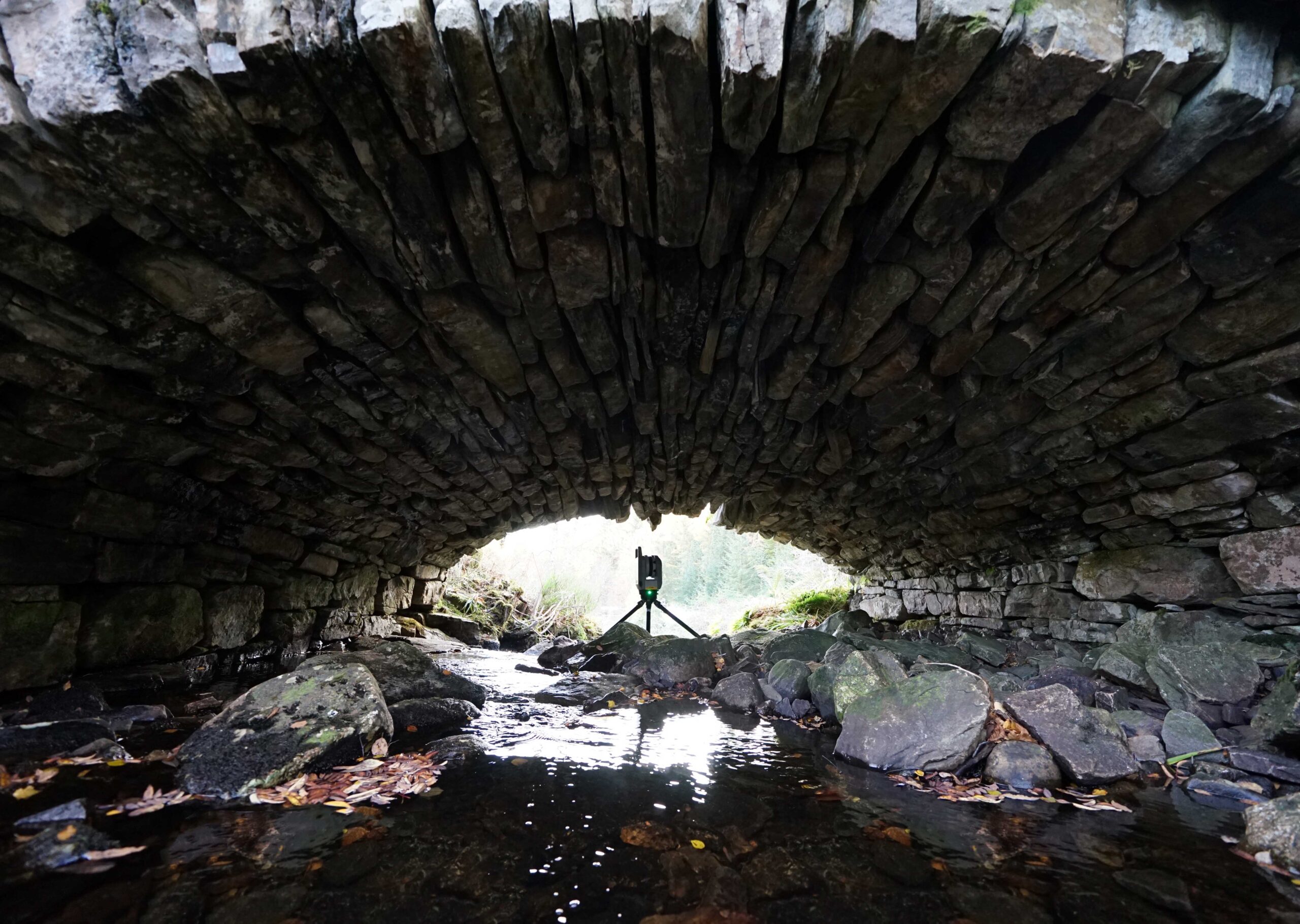
In recent years, five of the bridges along the Inchnacardoch Road have been cleared of scrub and laser scanned by AOC Archaeology on behalf of Forestry and Land Scotland. This archaeological recording has enhanced the Highland Historic Environment Record and informs ongoing condition monitoring.

The military road helped to confirm and extend the power of the crown during the 18th century, but once it had outlived its military purpose, it began to enhance and encourage communications, trade and development throughout the region. Unfortunately, much of the road network has now been lost or destroyed by modern roads, and only short stretches of the original 18th century road survives, such as the route through Inchnacardoch Forest.
Inchnacardoch Forest
Running from Jenkin’s Park at Fort Augustus in the east over the hills to Achlain in Glen Moriston in the west, the route through Inchnacardoch Forest includes short surviving stretches of road and several well-preserved bridges and culverts. Built by Major Caulfield between 1748 and 1753, the road links the garrison at Fort Augustus with Bernera Barracks in Glenelg, about 70 km to the west.
The road follows a former drove route from Skye which was metalled to make it suitable for troops, carts and artillery. It fell into disrepair after 1784, when maintenance ceased with the end of the Jacobite threat. Some sections were upgraded by Thomas Telford during the Parliamentary Road building programme in 1808 to 1811 and these form part of the modern road network.
Constructing the Road
Much of the construction of the military road network was undertaken by troops stationed at the various garrisons spread across the Highlands. These troops undertook the straightforward elements of the construction programme, such as the building of the roads themselves. The more complicated structures, such as the bridges and culverts, were contracted out to experienced civilian engineers and builders.
Much of the road network was made to a standard design with a foundation trench being filled with increasingly fine grades of stone from broken boulders at the base to fine gravels forming a top surface to the road. The road was typically flanked by drains on the uphill and downhill sides with open cross drains in the early days of the construction programme; these were later replaced with buried culverts.
Explore the Road
Scroll through the interactive map below to discover the 18th century military bridges in Inchnacardoch Forest and investigate the 3D models. Toggle the orange buttons to view extra content.
For the full experience, make sure to view the interactive map on a larger screen.